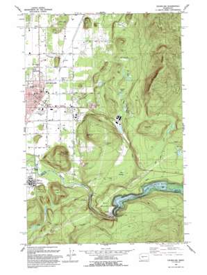
Enumclaw Topo Map Washington
To zoom in, hover over the map of Enumclaw
USGS Topo Quad 47121b8 - 1:24,000 scale
| Topo Map Name: | Enumclaw |
| USGS Topo Quad ID: | 47121b8 |
| Print Size: | ca. 21 1/4" wide x 27" high |
| Southeast Coordinates: | 47.125° N latitude / 121.875° W longitude |
| Map Center Coordinates: | 47.1875° N latitude / 121.9375° W longitude |
| U.S. State: | WA |
| Filename: | o47121b8.jpg |
| Download Map JPG Image: | Enumclaw topo map 1:24,000 scale |
| Map Type: | Topographic |
| Topo Series: | 7.5´ |
| Map Scale: | 1:24,000 |
| Source of Map Images: | United States Geological Survey (USGS) |
| Alternate Map Versions: |
Enumclaw WA 1956, updated 1958 Download PDF Buy paper map Enumclaw WA 1956, updated 1967 Download PDF Buy paper map Enumclaw WA 1956, updated 1969 Download PDF Buy paper map Enumclaw WA 1956, updated 1976 Download PDF Buy paper map Enumclaw WA 1956, updated 1991 Download PDF Buy paper map Enumclaw WA 1993, updated 1993 Download PDF Buy paper map Enumclaw WA 1997, updated 2003 Download PDF Buy paper map Enumclaw WA 2011 Download PDF Buy paper map Enumclaw WA 2014 Download PDF Buy paper map |
1:24,000 Topo Quads surrounding Enumclaw
> Back to 47121a1 at 1:100,000 scale
> Back to 47120a1 at 1:250,000 scale
> Back to U.S. Topo Maps home
Enumclaw topo map: Gazetteer
Enumclaw: Airports
Bergseth Field elevation 327m 1072′Enumclaw: Dams
Mud Mountain Dam elevation 369m 1210′White River Mill Pond Dam elevation 309m 1013′
Enumclaw: Lakes
First Lake elevation 335m 1099′Rock Quarry Lake elevation 305m 1000′
Second Lake elevation 333m 1092′
Third Lake elevation 341m 1118′
Enumclaw: Parks
King County Enumclaw Park elevation 253m 830′Enumclaw: Populated Places
Birch elevation 222m 728′Enumclaw elevation 232m 761′
Krain elevation 209m 685′
Upper Mill elevation 333m 1092′
Veazie elevation 228m 748′
Enumclaw: Reservoirs
Boise Lake elevation 309m 1013′Mud Mountain Lake elevation 369m 1210′
White River Mill Pond elevation 309m 1013′
Enumclaw: Ridges
Boise Ridge elevation 936m 3070′Enumclaw: Streams
Old Pond Creek elevation 300m 984′Red Creek elevation 242m 793′
Scatter Creek elevation 369m 1210′
Enumclaw: Summits
Baldy Hill elevation 506m 1660′Baldy Hill elevation 250m 820′
Fell Hill elevation 312m 1023′
Haystack elevation 236m 774′
Long Hill elevation 456m 1496′
Mud Mountain elevation 395m 1295′
Pinnacle Peak elevation 536m 1758′
Radio Hill elevation 589m 1932′
Stanridge Hill elevation 292m 958′
Enumclaw: Swamps
Bear Swamp elevation 310m 1017′Enumclaw digital topo map on disk
Buy this Enumclaw topo map showing relief, roads, GPS coordinates and other geographical features, as a high-resolution digital map file on DVD:


