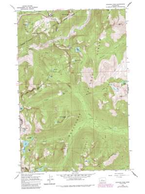
Stevens Pass Topo Map Washington
To zoom in, hover over the map of Stevens Pass
USGS Topo Quad 47121f1 - 1:24,000 scale
| Topo Map Name: | Stevens Pass |
| USGS Topo Quad ID: | 47121f1 |
| Print Size: | ca. 21 1/4" wide x 27" high |
| Southeast Coordinates: | 47.625° N latitude / 121° W longitude |
| Map Center Coordinates: | 47.6875° N latitude / 121.0625° W longitude |
| U.S. State: | WA |
| Filename: | o47121f1.jpg |
| Download Map JPG Image: | Stevens Pass topo map 1:24,000 scale |
| Map Type: | Topographic |
| Topo Series: | 7.5´ |
| Map Scale: | 1:24,000 |
| Source of Map Images: | United States Geological Survey (USGS) |
| Alternate Map Versions: |
Stevens Pass WA 1965, updated 1967 Download PDF Buy paper map Stevens Pass WA 1965, updated 1972 Download PDF Buy paper map Stevens Pass WA 1965, updated 1981 Download PDF Buy paper map Stevens Pass WA 1965, updated 1987 Download PDF Buy paper map Stevens Pass WA 1965, updated 1987 Download PDF Buy paper map Stevens Pass WA 2011 Download PDF Buy paper map Stevens Pass WA 2014 Download PDF Buy paper map |
| FStopo: | US Forest Service topo Stevens Pass is available: Download FStopo PDF Download FStopo TIF |
1:24,000 Topo Quads surrounding Stevens Pass
> Back to 47121e1 at 1:100,000 scale
> Back to 47120a1 at 1:250,000 scale
> Back to U.S. Topo Maps home
Stevens Pass topo map: Gazetteer
Stevens Pass: Capes
Lake Lorraine Point elevation 1575m 5167′Stevens Pass: Dams
Square Lake Dam elevation 1522m 4993′Stevens Pass: Gaps
Stevens Pass elevation 1254m 4114′Stevens Pass: Lakes
Chain Lakes elevation 1762m 5780′Doelle Lakes elevation 1740m 5708′
Grace Lakes elevation 1472m 4829′
Grass Lake elevation 1109m 3638′
Hope Lake elevation 1326m 4350′
Josephine Lake elevation 1442m 4730′
Lake Cuitin elevation 1754m 5754′
Lake Lorraine elevation 1557m 5108′
Lake Susan Jane elevation 1555m 5101′
Lake Wolverine elevation 1538m 5045′
Mig Lake elevation 1396m 4580′
Milk Lake elevation 1570m 5150′
Summit Lake elevation 1447m 4747′
Swallow Lakes elevation 1544m 5065′
Swimming Deer Lake elevation 1433m 4701′
Trap Lake elevation 1518m 4980′
Stevens Pass: Reservoirs
Square Lake elevation 1522m 4993′Stevens Pass: Ridges
French Ridge elevation 1737m 5698′The Barrier elevation 1504m 4934′
Stevens Pass: Streams
Basin Creek elevation 1026m 3366′Chain Creek elevation 1013m 3323′
Cuitin Creek elevation 980m 3215′
Doughgod Creek elevation 937m 3074′
Leland Creek elevation 980m 3215′
Mule Creek elevation 1200m 3937′
Prospect Creek elevation 1023m 3356′
Trapper Creek elevation 1013m 3323′
Stevens Pass: Summits
Big Chief Mountain elevation 1571m 5154′Bulls Tooth elevation 2006m 6581′
Cowboy Mountain elevation 1653m 5423′
Jim Hill Mountain elevation 1946m 6384′
Mac Peak elevation 2078m 6817′
Thunder Mountain elevation 1954m 6410′
Stevens Pass: Tunnels
Cascade Tunnel elevation 1604m 5262′New Cascade Tunnel elevation 1479m 4852′
Stevens Pass digital topo map on disk
Buy this Stevens Pass topo map showing relief, roads, GPS coordinates and other geographical features, as a high-resolution digital map file on DVD:


