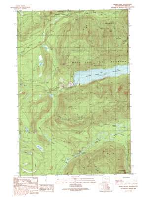
Tolt Reservoir Topo Map Washington
To zoom in, hover over the map of Tolt Reservoir
USGS Topo Quad 47121f6 - 1:24,000 scale
| Topo Map Name: | Tolt Reservoir |
| USGS Topo Quad ID: | 47121f6 |
| Print Size: | ca. 21 1/4" wide x 27" high |
| Southeast Coordinates: | 47.625° N latitude / 121.625° W longitude |
| Map Center Coordinates: | 47.6875° N latitude / 121.6875° W longitude |
| U.S. State: | WA |
| Filename: | o47121f6.jpg |
| Download Map JPG Image: | Tolt Reservoir topo map 1:24,000 scale |
| Map Type: | Topographic |
| Topo Series: | 7.5´ |
| Map Scale: | 1:24,000 |
| Source of Map Images: | United States Geological Survey (USGS) |
| Alternate Map Versions: |
Devils Slide WA 1989, updated 1989 Download PDF Buy paper map Devils Slide WA 2011 Download PDF Buy paper map Devils Slide WA 2014 Download PDF Buy paper map |
| FStopo: | US Forest Service topo Devils Slide is available: Download FStopo PDF Download FStopo TIF |
1:24,000 Topo Quads surrounding Tolt Reservoir
> Back to 47121e1 at 1:100,000 scale
> Back to 47120a1 at 1:250,000 scale
> Back to U.S. Topo Maps home
Tolt Reservoir topo map: Gazetteer
Tolt Reservoir: Areas
North Fork Tolt Watershed elevation 516m 1692′Tolt Reservoir: Capes
Devils Slide elevation 1042m 3418′Tolt Reservoir: Dams
Tolt River Dam elevation 524m 1719′Tolt Reservoir: Lakes
Black Lake elevation 371m 1217′Fitchener Slough elevation 450m 1476′
Lake Titicaca elevation 1163m 3815′
Lynch Lake elevation 404m 1325′
Mud Lake elevation 388m 1272′
Tolt Reservoir: Reservoirs
South Fork Tolt Reservoir elevation 524m 1719′Tolt Reservoir: Streams
Big Creek elevation 405m 1328′Deep Creek elevation 377m 1236′
Dry Creek elevation 422m 1384′
Philippa Creek elevation 459m 1505′
Sunday Creek elevation 452m 1482′
Titicaca Creek elevation 474m 1555′
Tolt Reservoir digital topo map on disk
Buy this Tolt Reservoir topo map showing relief, roads, GPS coordinates and other geographical features, as a high-resolution digital map file on DVD:


