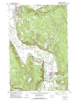
Carnation Topo Map Washington
To zoom in, hover over the map of Carnation
USGS Topo Quad 47121f8 - 1:24,000 scale
| Topo Map Name: | Carnation |
| USGS Topo Quad ID: | 47121f8 |
| Print Size: | ca. 21 1/4" wide x 27" high |
| Southeast Coordinates: | 47.625° N latitude / 121.875° W longitude |
| Map Center Coordinates: | 47.6875° N latitude / 121.9375° W longitude |
| U.S. State: | WA |
| Filename: | o47121f8.jpg |
| Download Map JPG Image: | Carnation topo map 1:24,000 scale |
| Map Type: | Topographic |
| Topo Series: | 7.5´ |
| Map Scale: | 1:24,000 |
| Source of Map Images: | United States Geological Survey (USGS) |
| Alternate Map Versions: |
Carnation WA 1953, updated 1963 Download PDF Buy paper map Carnation WA 1953, updated 1970 Download PDF Buy paper map Carnation WA 1953, updated 1976 Download PDF Buy paper map Carnation WA 1953, updated 1986 Download PDF Buy paper map Carnation WA 1979, updated 1980 Download PDF Buy paper map Carnation WA 1993, updated 1993 Download PDF Buy paper map Carnation WA 2011 Download PDF Buy paper map Carnation WA 2014 Download PDF Buy paper map |
1:24,000 Topo Quads surrounding Carnation
> Back to 47121e1 at 1:100,000 scale
> Back to 47120a1 at 1:250,000 scale
> Back to U.S. Topo Maps home
Carnation topo map: Gazetteer
Carnation: Dams
Lake Marcel Dam elevation 90m 295′Loutsis Dam elevation 48m 157′
Carnation: Flats
Tolt Hill Flat elevation 19m 62′Carnation: Lakes
Ames Lake elevation 73m 239′Ames Lake Pothole elevation 97m 318′
Horseshoe Lake elevation 15m 49′
Lake Marcel elevation 90m 295′
Langlois Lake elevation 42m 137′
Rasmussen Lake elevation 79m 259′
Sikes Lake elevation 14m 45′
Carnation: Parks
Duvall Park elevation 13m 42′John MacDonald Tolt River Park elevation 20m 65′
Loutsis Park elevation 25m 82′
MacDonald Memorial Park elevation 21m 68′
Taylor Park elevation 50m 164′
Taylor Park elevation 48m 157′
Valley Memorial Park elevation 26m 85′
Carnation: Populated Places
Ames Lake elevation 98m 321′Carnation elevation 24m 78′
Duvall elevation 27m 88′
Lake Marcel elevation 96m 314′
Novelty elevation 17m 55′
Stillwater elevation 24m 78′
Stuart elevation 11m 36′
Carnation: Reservoirs
Lake Marcel elevation 90m 295′Carnation: Streams
Essency Creek elevation 17m 55′Harris Creek elevation 13m 42′
Langlois Creek elevation 26m 85′
Margaret Creek elevation 76m 249′
North Fork Cherry Creek elevation 11m 36′
Tolt River elevation 19m 62′
Tuck Creek elevation 9m 29′
Weiss Creek elevation 112m 367′
Carnation: Summits
Novelty Hill elevation 149m 488′Tolt Hill elevation 146m 479′
Union Hill elevation 204m 669′
Union Hill elevation 195m 639′
Carnation digital topo map on disk
Buy this Carnation topo map showing relief, roads, GPS coordinates and other geographical features, as a high-resolution digital map file on DVD:


