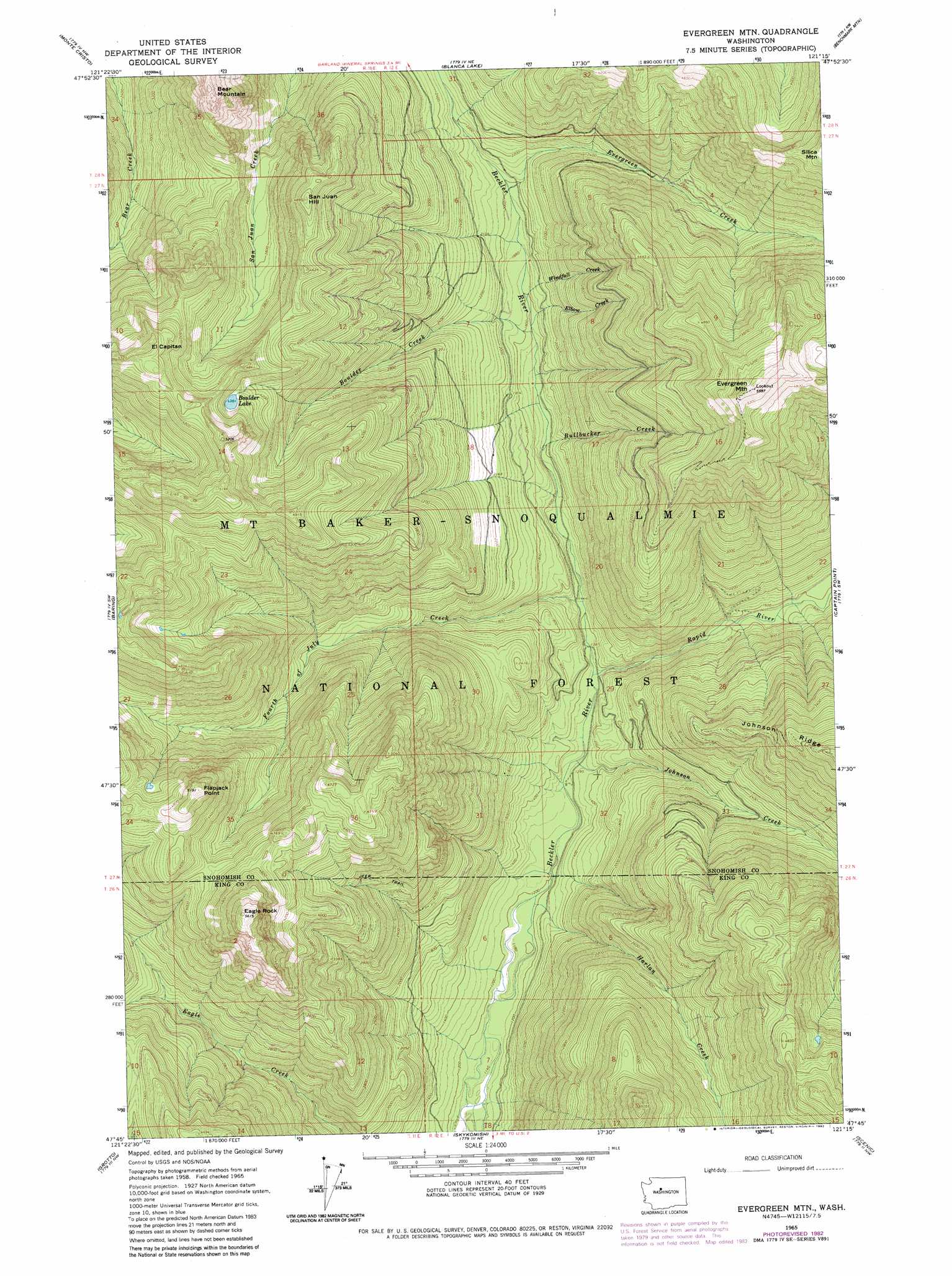
Evergreen Mountain Topo Map Washington
To zoom in, hover over the map of Evergreen Mountain
USGS Topo Quad 47121g3 - 1:24,000 scale
| Topo Map Name: | Evergreen Mountain |
| USGS Topo Quad ID: | 47121g3 |
| Print Size: | ca. 21 1/4" wide x 27" high |
| Southeast Coordinates: | 47.75° N latitude / 121.25° W longitude |
| Map Center Coordinates: | 47.8125° N latitude / 121.3125° W longitude |
| U.S. State: | WA |
| Filename: | o47121g3.jpg |
| Download Map JPG Image: | Evergreen Mountain topo map 1:24,000 scale |
| Map Type: | Topographic |
| Topo Series: | 7.5´ |
| Map Scale: | 1:24,000 |
| Source of Map Images: | United States Geological Survey (USGS) |
| Alternate Map Versions: |
Evergreen Mtn WA 1965, updated 1967 Download PDF Buy paper map Evergreen Mtn WA 1965, updated 1982 Download PDF Buy paper map Evergreen Mountain WA 2011 Download PDF Buy paper map Evergreen Mountain WA 2014 Download PDF Buy paper map |
| FStopo: | US Forest Service topo Evergreen Mountain is available: Download FStopo PDF Download FStopo TIF |
1:24,000 Topo Quads surrounding Evergreen Mountain
Silverton |
Bedal |
Sloan Peak |
Glacier Peak West |
Glacier Peak East |
Mount Stickney |
Monte Cristo |
Blanca Lake |
Benchmark Mountain |
Poe Mountain |
Index |
Baring |
Evergreen Mountain |
Captain Point |
Labyrinth Mountain |
Mount Phelps |
Grotto |
Skykomish |
Scenic |
Stevens Pass |
Lake Philippa |
Snoqualmie Lake |
Big Snow Mountain |
Mount Daniel |
The Cradle |
> Back to 47121e1 at 1:100,000 scale
> Back to 47120a1 at 1:250,000 scale
> Back to U.S. Topo Maps home
Evergreen Mountain topo map: Gazetteer
Evergreen Mountain: Cliffs
Flapjack Point elevation 1580m 5183′Evergreen Mountain: Forests
Skykomish Ranger District elevation 1196m 3923′Evergreen Mountain: Lakes
Boulder Lake elevation 1338m 4389′Evergreen Mountain: Streams
Boulder Creek elevation 538m 1765′Bullbucker Creek elevation 488m 1601′
Elbow Creek elevation 544m 1784′
Evergreen Creek elevation 606m 1988′
Fourth of July Creek elevation 445m 1459′
Harlan Creek elevation 364m 1194′
Johnson Creek elevation 392m 1286′
Rapid River elevation 409m 1341′
Windfall Creek elevation 559m 1833′
Evergreen Mountain: Summits
Bear Mountain elevation 1628m 5341′Eagle Rock elevation 1710m 5610′
Evergreen Mountain elevation 1700m 5577′
San Juan Hill elevation 1472m 4829′
Silica Mountain elevation 1643m 5390′
Evergreen Mountain digital topo map on disk
Buy this Evergreen Mountain topo map showing relief, roads, GPS coordinates and other geographical features, as a high-resolution digital map file on DVD: