Index Topo Map Washington
To zoom in, hover over the map of Index
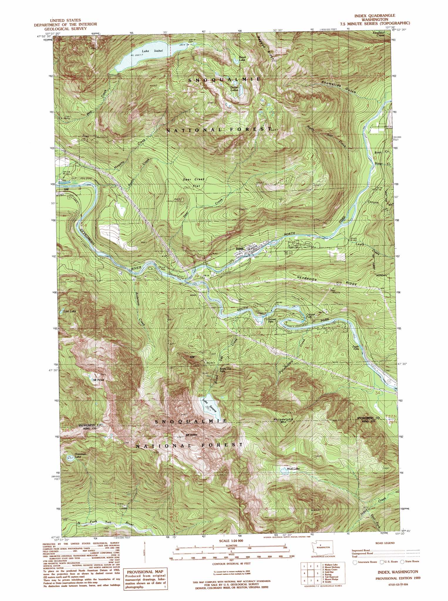
USGS Topo Quad 47121g5 - 1:24,000 scale
| Topo Map Name: | Index |
| USGS Topo Quad ID: | 47121g5 |
| Print Size: | ca. 21 1/4" wide x 27" high |
| Southeast Coordinates: | 47.75° N latitude / 121.5° W longitude |
| Map Center Coordinates: | 47.8125° N latitude / 121.5625° W longitude |
| U.S. State: | WA |
| Filename: | o47121g5.jpg |
| Download Map JPG Image: | Index topo map 1:24,000 scale |
| Map Type: | Topographic |
| Topo Series: | 7.5´ |
| Map Scale: | 1:24,000 |
| Source of Map Images: | United States Geological Survey (USGS) |
| Alternate Map Versions: |
Index WA 1989, updated 1989 Download PDF Buy paper map Index WA 1989, updated 1989 Download PDF Buy paper map Index WA 1989, updated 1989 Download PDF Buy paper map Index WA 2011 Download PDF Buy paper map Index WA 2014 Download PDF Buy paper map |
| FStopo: | US Forest Service topo Index is available: Download FStopo PDF Download FStopo TIF |
1:24,000 Topo Quads surrounding Index
Verlot |
Mallardy Ridge |
Silverton |
Bedal |
Sloan Peak |
Lake Chaplain |
Wallace Lake |
Mount Stickney |
Monte Cristo |
Blanca Lake |
Sultan |
Gold Bar |
Index |
Baring |
Evergreen Mountain |
Lake Joy |
Tolt Reservoir |
Mount Phelps |
Grotto |
Skykomish |
Snoqualmie |
Mount Si |
Lake Philippa |
Snoqualmie Lake |
Big Snow Mountain |
> Back to 47121e1 at 1:100,000 scale
> Back to 47120a1 at 1:250,000 scale
> Back to U.S. Topo Maps home
Index topo map: Gazetteer
Index: Dams
Reiter-Skykomish Rearing Ponds Dam elevation 95m 311′Index: Falls
Bridal Veil Falls elevation 497m 1630′Canyon Falls elevation 196m 643′
Eagle Falls elevation 216m 708′
Sunset Falls elevation 185m 606′
Index: Flats
Deer Creek Flat elevation 546m 1791′Index: Lakes
Lake Isabel elevation 869m 2851′Lake Serene elevation 770m 2526′
Index: Mines
Copperbelt Mine elevation 357m 1171′Honeymoon Mine elevation 383m 1256′
Index: Populated Places
Halford elevation 229m 751′Index elevation 176m 577′
Index: Reservoirs
Reiter-Skykomish Rearing Ponds elevation 95m 311′Index: Streams
Anderson Creek elevation 130m 426′Austin Creek elevation 124m 406′
Barclay Creek elevation 223m 731′
Bitter Creek elevation 217m 711′
Boss Creek elevation 223m 731′
Bridal Veil Creek elevation 154m 505′
Canyon Creek elevation 203m 666′
Deer Creek elevation 145m 475′
East Fork Index Creek elevation 518m 1699′
Hogarty Creek elevation 99m 324′
Lewis Creek elevation 188m 616′
Noname Creek elevation 118m 387′
North Fork Skykomish River elevation 142m 465′
North Star Creek elevation 219m 718′
Philadelphia Creek elevation 220m 721′
South Fork Skykomish River elevation 143m 469′
Index: Summits
Heybrook Mountain elevation 555m 1820′Mount Index elevation 1815m 5954′
Mount Persis elevation 1657m 5436′
Philadelphia Mountain elevation 1297m 4255′
Index: Valleys
Snowslide Gulch elevation 231m 757′Index digital topo map on disk
Buy this Index topo map showing relief, roads, GPS coordinates and other geographical features, as a high-resolution digital map file on DVD: