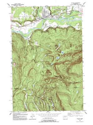
Sultan Topo Map Washington
To zoom in, hover over the map of Sultan
USGS Topo Quad 47121g7 - 1:24,000 scale
| Topo Map Name: | Sultan |
| USGS Topo Quad ID: | 47121g7 |
| Print Size: | ca. 21 1/4" wide x 27" high |
| Southeast Coordinates: | 47.75° N latitude / 121.75° W longitude |
| Map Center Coordinates: | 47.8125° N latitude / 121.8125° W longitude |
| U.S. State: | WA |
| Filename: | o47121g7.jpg |
| Download Map JPG Image: | Sultan topo map 1:24,000 scale |
| Map Type: | Topographic |
| Topo Series: | 7.5´ |
| Map Scale: | 1:24,000 |
| Source of Map Images: | United States Geological Survey (USGS) |
| Alternate Map Versions: |
Sultan WA 1953, updated 1955 Download PDF Buy paper map Sultan WA 1953, updated 1964 Download PDF Buy paper map Sultan WA 1953, updated 1969 Download PDF Buy paper map Sultan WA 1953, updated 1976 Download PDF Buy paper map Sultan WA 1993, updated 1993 Download PDF Buy paper map Sultan WA 1997, updated 2003 Download PDF Buy paper map Sultan WA 2011 Download PDF Buy paper map Sultan WA 2014 Download PDF Buy paper map |
1:24,000 Topo Quads surrounding Sultan
> Back to 47121e1 at 1:100,000 scale
> Back to 47120a1 at 1:250,000 scale
> Back to U.S. Topo Maps home
Sultan topo map: Gazetteer
Sultan: Airports
Roesler Timber Company Heliport elevation 44m 144′Sky Harbor Airport elevation 76m 249′
Sultan: Dams
Dagger Lake Dam elevation 205m 672′McCoy Creek Dam elevation 101m 331′
Sultan Mill Pond Dam elevation 42m 137′
Sultan: Lakes
Cedar Ponds Lake elevation 213m 698′Cherry Lake elevation 299m 980′
Drunken Charlie Lake elevation 419m 1374′
Lake Dorothy elevation 151m 495′
Lake Elsie elevation 175m 574′
Tomtit Lake elevation 187m 613′
Sultan: Parks
Centennial Park elevation 36m 118′Rudolf Reese Park elevation 38m 124′
Sultan: Populated Places
Sultan elevation 33m 108′Sultan: Reservoirs
Dagger Lake elevation 205m 672′Sultan Mill Pond elevation 42m 137′
Sultan: Streams
Crandall Creek elevation 162m 531′Elwell Creek elevation 25m 82′
McCoy Creek elevation 31m 101′
Sultan River elevation 31m 101′
Wagleys Creek elevation 36m 118′
Wallace River elevation 35m 114′
Youngs Creek elevation 67m 219′
Sultan digital topo map on disk
Buy this Sultan topo map showing relief, roads, GPS coordinates and other geographical features, as a high-resolution digital map file on DVD:


