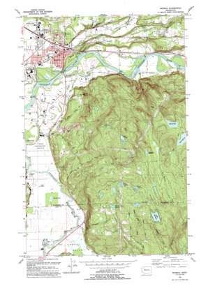
Monroe Topo Map Washington
To zoom in, hover over the map of Monroe
USGS Topo Quad 47121g8 - 1:24,000 scale
| Topo Map Name: | Monroe |
| USGS Topo Quad ID: | 47121g8 |
| Print Size: | ca. 21 1/4" wide x 27" high |
| Southeast Coordinates: | 47.75° N latitude / 121.875° W longitude |
| Map Center Coordinates: | 47.8125° N latitude / 121.9375° W longitude |
| U.S. State: | WA |
| Filename: | o47121g8.jpg |
| Download Map JPG Image: | Monroe topo map 1:24,000 scale |
| Map Type: | Topographic |
| Topo Series: | 7.5´ |
| Map Scale: | 1:24,000 |
| Source of Map Images: | United States Geological Survey (USGS) |
| Alternate Map Versions: |
Monroe WA 1953, updated 1955 Download PDF Buy paper map Monroe WA 1953, updated 1966 Download PDF Buy paper map Monroe WA 1953, updated 1969 Download PDF Buy paper map Monroe WA 1953, updated 1976 Download PDF Buy paper map Monroe WA 1993, updated 1993 Download PDF Buy paper map Monroe WA 2011 Download PDF Buy paper map Monroe WA 2014 Download PDF Buy paper map |
1:24,000 Topo Quads surrounding Monroe
> Back to 47121e1 at 1:100,000 scale
> Back to 47120a1 at 1:250,000 scale
> Back to U.S. Topo Maps home
Monroe topo map: Gazetteer
Monroe: Airports
B and M Ranch Airport elevation 91m 298′Firstair Field elevation 13m 42′
Van De Plasch Airport elevation 32m 104′
Monroe: Basins
Tualco Valley elevation 15m 49′Monroe: Bends
Big Bend elevation 12m 39′Monroe: Dams
Lake Margaret Dam elevation 245m 803′Lakes Unlimited Dam elevation 267m 875′
Monroe: Falls
McCauley Falls elevation 104m 341′Monroe: Lakes
King Lake elevation 414m 1358′Lake Fontal elevation 333m 1092′
Lake Hannan elevation 333m 1092′
Long Lake elevation 10m 32′
Round Lake elevation 10m 32′
Soup Hole elevation 255m 836′
Treen Lake elevation 9m 29′
Wellin Lake elevation 26m 85′
Monroe: Parks
Al Borlin Park elevation 17m 55′Skykomish River Centennial Park elevation 12m 39′
Monroe: Populated Places
High Rock elevation 18m 59′Monroe elevation 22m 72′
Monroe Junction elevation 19m 62′
Pearson Eddy elevation 6m 19′
Monroe: Reservoirs
Lake Margaret elevation 245m 803′Lake Margaret elevation 240m 787′
Monroe Reservoir elevation 75m 246′
Monroe: Streams
Barr Creek elevation 22m 72′Cherry Creek elevation 7m 22′
Foye Creek elevation 14m 45′
Hannan Creek elevation 100m 328′
Hanstead Creek elevation 10m 32′
Haskel Slough elevation 14m 45′
High Rock Creek elevation 13m 42′
Isakson Creek elevation 189m 620′
Peoples Creek elevation 7m 22′
Richardson Creek elevation 23m 75′
West Fork Woods Creek elevation 31m 101′
Woods Creek elevation 12m 39′
Monroe: Summits
High Rock elevation 122m 400′Monroe: Swamps
Harts Swamp elevation 237m 777′Johnsons Swamp elevation 322m 1056′
Roths Swamp elevation 267m 875′
Trestle Swamp elevation 273m 895′
Monroe: Valleys
Cherry Valley elevation 7m 22′Monroe digital topo map on disk
Buy this Monroe topo map showing relief, roads, GPS coordinates and other geographical features, as a high-resolution digital map file on DVD:


