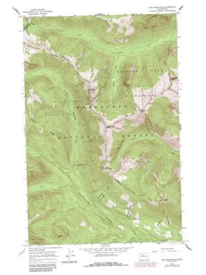
Poe Mountain Topo Map Washington
To zoom in, hover over the map of Poe Mountain
USGS Topo Quad 47121h1 - 1:24,000 scale
| Topo Map Name: | Poe Mountain |
| USGS Topo Quad ID: | 47121h1 |
| Print Size: | ca. 21 1/4" wide x 27" high |
| Southeast Coordinates: | 47.875° N latitude / 121° W longitude |
| Map Center Coordinates: | 47.9375° N latitude / 121.0625° W longitude |
| U.S. State: | WA |
| Filename: | o47121h1.jpg |
| Download Map JPG Image: | Poe Mountain topo map 1:24,000 scale |
| Map Type: | Topographic |
| Topo Series: | 7.5´ |
| Map Scale: | 1:24,000 |
| Source of Map Images: | United States Geological Survey (USGS) |
| Alternate Map Versions: |
Poe Mountain WA 1965, updated 1967 Download PDF Buy paper map Poe Mountain WA 1965, updated 1970 Download PDF Buy paper map Poe Mountain WA 1965, updated 1987 Download PDF Buy paper map Poe Mountain WA 2004, updated 2008 Download PDF Buy paper map Poe Mountain WA 2011 Download PDF Buy paper map Poe Mountain WA 2014 Download PDF Buy paper map |
| FStopo: | US Forest Service topo Poe Mountain is available: Download FStopo PDF Download FStopo TIF |
1:24,000 Topo Quads surrounding Poe Mountain
> Back to 47121e1 at 1:100,000 scale
> Back to 47120a1 at 1:250,000 scale
> Back to U.S. Topo Maps home
Poe Mountain topo map: Gazetteer
Poe Mountain: Flats
Meander Meadow elevation 1507m 4944′Poe Mountain: Gaps
Indian Pass elevation 1517m 4977′Poe Mountain: Ridges
Cady Ridge elevation 1626m 5334′Poe Mountain: Streams
Cady Creek elevation 826m 2709′Cockeye Creek elevation 1010m 3313′
Cougar Creek elevation 1010m 3313′
Fall Creek elevation 781m 2562′
Fish Creek elevation 804m 2637′
Fourteenmile Creek elevation 795m 2608′
Lake Creek elevation 705m 2312′
Papoose Creek elevation 1004m 3293′
Pheasant Creek elevation 730m 2395′
Thirteenmile Creek elevation 741m 2431′
Twelvemile Creek elevation 696m 2283′
Vine Maple Creek elevation 782m 2565′
Poe Mountain: Summits
Bryant Peak elevation 1915m 6282′Irving Peak elevation 1780m 5839′
Longfellow Mountain elevation 1991m 6532′
Mount Jonathan elevation 2174m 7132′
Poe Mountain elevation 1812m 5944′
Shoofly Mountain elevation 1647m 5403′
Whittier Peak elevation 2207m 7240′
Poe Mountain digital topo map on disk
Buy this Poe Mountain topo map showing relief, roads, GPS coordinates and other geographical features, as a high-resolution digital map file on DVD:


