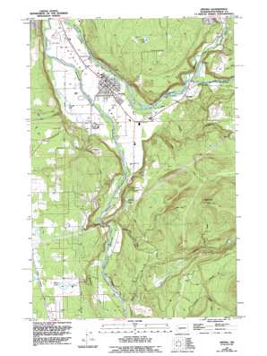
Orting Topo Map Washington
To zoom in, hover over the map of Orting
USGS Topo Quad 47122a2 - 1:24,000 scale
| Topo Map Name: | Orting |
| USGS Topo Quad ID: | 47122a2 |
| Print Size: | ca. 21 1/4" wide x 27" high |
| Southeast Coordinates: | 47° N latitude / 122.125° W longitude |
| Map Center Coordinates: | 47.0625° N latitude / 122.1875° W longitude |
| U.S. State: | WA |
| Filename: | o47122a2.jpg |
| Download Map JPG Image: | Orting topo map 1:24,000 scale |
| Map Type: | Topographic |
| Topo Series: | 7.5´ |
| Map Scale: | 1:24,000 |
| Source of Map Images: | United States Geological Survey (USGS) |
| Alternate Map Versions: |
Orting WA 1956, updated 1957 Download PDF Buy paper map Orting WA 1956, updated 1968 Download PDF Buy paper map Orting WA 1956, updated 1969 Download PDF Buy paper map Orting WA 1956, updated 1981 Download PDF Buy paper map Orting WA 1956, updated 1994 Download PDF Buy paper map Orting WA 1997, updated 2003 Download PDF Buy paper map Orting WA 2011 Download PDF Buy paper map Orting WA 2014 Download PDF Buy paper map |
1:24,000 Topo Quads surrounding Orting
> Back to 47122a1 at 1:100,000 scale
> Back to 47122a1 at 1:250,000 scale
> Back to U.S. Topo Maps home
Orting topo map: Gazetteer
Orting: Airports
Kapowsin Field elevation 218m 715′Orting: Lakes
Forest Lake elevation 161m 528′Morgan Lake elevation 211m 692′
Orting Lake elevation 226m 741′
Soldiers Pond elevation 68m 223′
Orting: Populated Places
Croker elevation 87m 285′Orting elevation 58m 190′
Puyallup River Junction elevation 167m 547′
Tanwax elevation 214m 702′
Orting: Streams
Beane Creek elevation 263m 862′Coplar Creek elevation 72m 236′
Fiske Creek elevation 113m 370′
Fox Creek elevation 160m 524′
Kapowsin Creek elevation 122m 400′
South Fork Kings Creek elevation 347m 1138′
South Prairie Creek elevation 91m 298′
Voight Creek elevation 66m 216′
Orting: Summits
Spar Pole Hill elevation 581m 1906′Orting digital topo map on disk
Buy this Orting topo map showing relief, roads, GPS coordinates and other geographical features, as a high-resolution digital map file on DVD:


