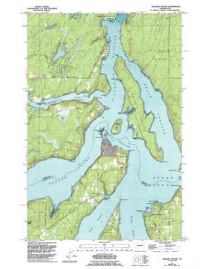
Squaxin Island Topo Map Washington
To zoom in, hover over the map of Squaxin Island
USGS Topo Quad 47122b8 - 1:24,000 scale
| Topo Map Name: | Squaxin Island |
| USGS Topo Quad ID: | 47122b8 |
| Print Size: | ca. 21 1/4" wide x 27" high |
| Southeast Coordinates: | 47.125° N latitude / 122.875° W longitude |
| Map Center Coordinates: | 47.1875° N latitude / 122.9375° W longitude |
| U.S. State: | WA |
| Filename: | o47122b8.jpg |
| Download Map JPG Image: | Squaxin Island topo map 1:24,000 scale |
| Map Type: | Topographic |
| Topo Series: | 7.5´ |
| Map Scale: | 1:24,000 |
| Source of Map Images: | United States Geological Survey (USGS) |
| Alternate Map Versions: |
Squaxin Island WA 1959, updated 1966 Download PDF Buy paper map Squaxin Island WA 1959, updated 1970 Download PDF Buy paper map Squaxin Island WA 1959, updated 1991 Download PDF Buy paper map Squaxin Island WA 1959, updated 1994 Download PDF Buy paper map Squaxin Island WA 1997, updated 2003 Download PDF Buy paper map Squaxin Island WA 2011 Download PDF Buy paper map Squaxin Island WA 2014 Download PDF Buy paper map |
1:24,000 Topo Quads surrounding Squaxin Island
> Back to 47122a1 at 1:100,000 scale
> Back to 47122a1 at 1:250,000 scale
> Back to U.S. Topo Maps home
Squaxin Island topo map: Gazetteer
Squaxin Island: Bays
Boston Harbor elevation 4m 13′Gallagher Cove elevation 0m 0′
Little Fish Trap elevation 2m 6′
Little Fishtrap elevation 2m 6′
Palela Bay elevation 0m 0′
Seafarm Cove elevation 0m 0′
Totten Inlet elevation 1m 3′
Zangle Cove elevation 3m 9′
Squaxin Island: Capes
Arcadia Point elevation 1m 3′Belspeox Point elevation 1m 3′
Brisco Point elevation 2m 6′
Cape Cod elevation 0m 0′
Cape Horn elevation 7m 22′
Cooper Point elevation 0m 0′
Dofflemyer Point elevation 4m 13′
Dover Point elevation 1m 3′
Hungerford Point elevation 9m 29′
Hunter Point elevation 7m 22′
Jeal Point elevation 10m 32′
Libby Point elevation 6m 19′
Potlatch Point elevation 10m 32′
Salmon Point elevation 9m 29′
Sandy Point elevation 1m 3′
Tuckapahwox Point elevation 1m 3′
Tucksel Point elevation 3m 9′
Windy Point elevation 21m 68′
Squaxin Island: Channels
Peale Passage elevation 0m 0′Squaxin Passage elevation 2m 6′
Squaxin Island: Dams
Littletwin Lakes Dam elevation 52m 170′Timberlakes Dam elevation 56m 183′
Squaxin Island: Islands
Harstine Island elevation 60m 196′Hope Island elevation 23m 75′
Squaxin Island elevation 13m 42′
Steamboat Island elevation 5m 16′
Squaxin Island: Lakes
Forbes Lake elevation 30m 98′Timber Lake elevation 53m 173′
Squaxin Island: Parks
Squaxin Island State Park (historical) elevation 9m 29′Squaxin Island: Populated Places
Arcadia elevation 10m 32′Boston Harbor elevation 12m 39′
Carlyon Beach elevation 10m 32′
Edgewater Beach elevation 18m 59′
Graham Point elevation 8m 26′
Rignall elevation 30m 98′
Squaxin Island: Reservoirs
Big Twin Lake elevation 56m 183′Little Twin Lake elevation 52m 170′
Squaxin Island: Streams
Mill Creek elevation 0m 0′Squaxin Island digital topo map on disk
Buy this Squaxin Island topo map showing relief, roads, GPS coordinates and other geographical features, as a high-resolution digital map file on DVD:


