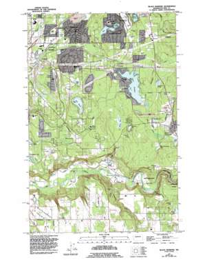
Black Diamond Topo Map Washington
To zoom in, hover over the map of Black Diamond
USGS Topo Quad 47122c1 - 1:24,000 scale
| Topo Map Name: | Black Diamond |
| USGS Topo Quad ID: | 47122c1 |
| Print Size: | ca. 21 1/4" wide x 27" high |
| Southeast Coordinates: | 47.25° N latitude / 122° W longitude |
| Map Center Coordinates: | 47.3125° N latitude / 122.0625° W longitude |
| U.S. State: | WA |
| Filename: | o47122c1.jpg |
| Download Map JPG Image: | Black Diamond topo map 1:24,000 scale |
| Map Type: | Topographic |
| Topo Series: | 7.5´ |
| Map Scale: | 1:24,000 |
| Source of Map Images: | United States Geological Survey (USGS) |
| Alternate Map Versions: |
Black Diamond WA 1949, updated 1956 Download PDF Buy paper map Black Diamond WA 1949, updated 1964 Download PDF Buy paper map Black Diamond WA 1949, updated 1969 Download PDF Buy paper map Black Diamond WA 1949, updated 1976 Download PDF Buy paper map Black Diamond WA 1949, updated 1976 Download PDF Buy paper map Black Diamond WA 1949, updated 1995 Download PDF Buy paper map Black Diamond WA 2011 Download PDF Buy paper map Black Diamond WA 2014 Download PDF Buy paper map |
1:24,000 Topo Quads surrounding Black Diamond
> Back to 47122a1 at 1:100,000 scale
> Back to 47122a1 at 1:250,000 scale
> Back to U.S. Topo Maps home
Black Diamond topo map: Gazetteer
Black Diamond: Airports
Black Diamond Airport elevation 176m 577′Crest Airpark elevation 141m 462′
Evergreen Sky Ranch Airport elevation 178m 583′
Washington Air Museum Heliport elevation 161m 528′
Black Diamond: Areas
Kent Watershed elevation 173m 567′Morgan Slope elevation 183m 600′
Black Diamond: Bridges
Kummer Bridge elevation 58m 190′Whitney Bridge elevation 56m 183′
Black Diamond: Dams
Sawyer Lake Outlet Structure Dam elevation 152m 498′Black Diamond: Lakes
Beaver Lake elevation 213m 698′Black Diamond Lake elevation 166m 544′
Grass Lake elevation 143m 469′
Horseshoe Lake elevation 152m 498′
Jones Lake elevation 163m 534′
Keevie Lake elevation 158m 518′
Lake Lucerne elevation 164m 538′
Lake Morton elevation 160m 524′
Oak Lake elevation 149m 488′
Pipe Lake elevation 164m 538′
Sinkhole Lake elevation 197m 646′
Straight Ponds elevation 61m 200′
Black Diamond: Parks
Black Diamond Bridge Site State Park elevation 138m 452′Black Diamond Bridge State Park elevation 160m 524′
East Green River Park elevation 58m 190′
Fernwood Park elevation 156m 511′
Flaming Geyser State Park elevation 69m 226′
Black Diamond: Populated Places
Black Diamond elevation 199m 652′Cherokee Bay Park elevation 181m 593′
Covington elevation 116m 380′
Danville elevation 162m 531′
Green River elevation 53m 173′
Henrys elevation 166m 544′
Kummer elevation 185m 606′
Lake Morton elevation 161m 528′
Morganville elevation 169m 554′
Newaukum elevation 161m 528′
One Hundred One Pines elevation 169m 554′
Summit elevation 166m 544′
Timberlane elevation 133m 436′
Black Diamond: Reservoirs
Lake Sawyer elevation 152m 498′Black Diamond: Springs
Diamond Springs elevation 120m 393′Black Diamond: Streams
Burns Creek elevation 39m 127′Cranmar Creek elevation 112m 367′
Crisp Creek elevation 61m 200′
Cristy Creek elevation 63m 206′
Newaukum Creek elevation 54m 177′
Ravensdale Creek elevation 153m 501′
Rock Creek elevation 157m 515′
Black Diamond: Swamps
Mooney Swamp elevation 122m 400′Black Diamond digital topo map on disk
Buy this Black Diamond topo map showing relief, roads, GPS coordinates and other geographical features, as a high-resolution digital map file on DVD:


