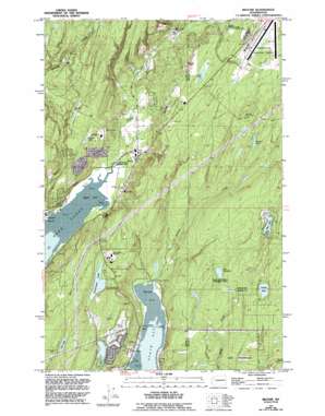
Belfair Topo Map Washington
To zoom in, hover over the map of Belfair
USGS Topo Quad 47122d7 - 1:24,000 scale
| Topo Map Name: | Belfair |
| USGS Topo Quad ID: | 47122d7 |
| Print Size: | ca. 21 1/4" wide x 27" high |
| Southeast Coordinates: | 47.375° N latitude / 122.75° W longitude |
| Map Center Coordinates: | 47.4375° N latitude / 122.8125° W longitude |
| U.S. State: | WA |
| Filename: | o47122d7.jpg |
| Download Map JPG Image: | Belfair topo map 1:24,000 scale |
| Map Type: | Topographic |
| Topo Series: | 7.5´ |
| Map Scale: | 1:24,000 |
| Source of Map Images: | United States Geological Survey (USGS) |
| Alternate Map Versions: |
Belfair WA 1953, updated 1955 Download PDF Buy paper map Belfair WA 1953, updated 1969 Download PDF Buy paper map Belfair WA 1953, updated 1981 Download PDF Buy paper map Belfair WA 1953, updated 1994 Download PDF Buy paper map Belfair WA 1999, updated 2003 Download PDF Buy paper map Belfair WA 2011 Download PDF Buy paper map Belfair WA 2014 Download PDF Buy paper map |
1:24,000 Topo Quads surrounding Belfair
> Back to 47122a1 at 1:100,000 scale
> Back to 47122a1 at 1:250,000 scale
> Back to U.S. Topo Maps home
Belfair topo map: Gazetteer
Belfair: Airports
Bremerton National Airport elevation 135m 442′Belfair: Bays
Lynch Cove elevation 2m 6′North Bay elevation 1m 3′
Belfair: Capes
Plum Point elevation 1m 3′Point Victor elevation 4m 13′
Belfair: Dams
Lake Anderson Dam elevation 50m 164′Belfair: Isthmuses
Kellums Lake Isthmus elevation 100m 328′Belfair: Lakes
Carney Lake elevation 108m 354′Coon Lake elevation 101m 331′
Devereaux Lake elevation 65m 213′
Kriegler Lake elevation 97m 318′
Lake Koeneman elevation 66m 216′
Larson Lake elevation 83m 272′
Lider Lake elevation 94m 308′
Wye Lake elevation 93m 305′
Belfair: Populated Places
Allyn elevation 8m 26′Belfair elevation 14m 45′
Rose Point elevation 3m 9′
Victor elevation 10m 32′
Belfair: Reservoirs
Lake Anderson elevation 50m 164′Belfair: Streams
Bear Creek elevation 38m 124′Coulter Creek elevation 3m 9′
Irene Creek elevation 7m 22′
Miggie Creek elevation 22m 72′
Mission Creek elevation 3m 9′
North East Fork Union River elevation 40m 131′
Sherwood Creek elevation 1m 3′
Sweetwater Creek elevation 4m 13′
Union River elevation 2m 6′
Viola Creek elevation 12m 39′
Belfair digital topo map on disk
Buy this Belfair topo map showing relief, roads, GPS coordinates and other geographical features, as a high-resolution digital map file on DVD:


