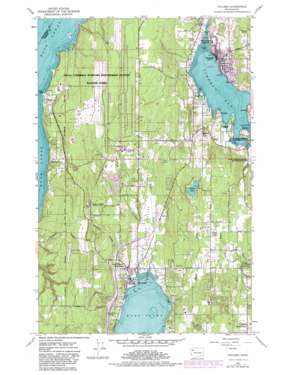
Poulsbo Topo Map Washington
To zoom in, hover over the map of Poulsbo
USGS Topo Quad 47122f6 - 1:24,000 scale
| Topo Map Name: | Poulsbo |
| USGS Topo Quad ID: | 47122f6 |
| Print Size: | ca. 21 1/4" wide x 27" high |
| Southeast Coordinates: | 47.625° N latitude / 122.625° W longitude |
| Map Center Coordinates: | 47.6875° N latitude / 122.6875° W longitude |
| U.S. State: | WA |
| Filename: | o47122f6.jpg |
| Download Map JPG Image: | Poulsbo topo map 1:24,000 scale |
| Map Type: | Topographic |
| Topo Series: | 7.5´ |
| Map Scale: | 1:24,000 |
| Source of Map Images: | United States Geological Survey (USGS) |
| Alternate Map Versions: |
Poulsbo WA 1953, updated 1954 Download PDF Buy paper map Poulsbo WA 1953, updated 1969 Download PDF Buy paper map Poulsbo WA 1953, updated 1975 Download PDF Buy paper map Poulsbo WA 1953, updated 1981 Download PDF Buy paper map Poulsbo WA 2011 Download PDF Buy paper map Poulsbo WA 2014 Download PDF Buy paper map |
1:24,000 Topo Quads surrounding Poulsbo
> Back to 47122e1 at 1:100,000 scale
> Back to 47122a1 at 1:250,000 scale
> Back to U.S. Topo Maps home
Poulsbo topo map: Gazetteer
Poulsbo: Airports
Apex Airpark elevation 161m 528′Port of Poulsbo Marina Moorage Seaplane Base elevation 3m 9′
Poulsbo: Bars
King Spit elevation 2m 6′Poulsbo: Bays
Liberty Bay elevation 0m 0′Poulsbo: Crossings
Clear Creek Interchange elevation 26m 85′Newberry Hill Interchange elevation 30m 98′
Poulsbo: Dams
Devils Hole Dam elevation 2m 6′Glud Pond Dam elevation 19m 62′
Temporary Sewage Lagoon Dam elevation 125m 410′
Poulsbo: Lakes
Bangor Lake elevation 1m 3′Glad Ponds elevation 12m 39′
Island Lake elevation 67m 219′
Poulsbo: Populated Places
Bangor elevation 15m 49′Central Valley elevation 57m 187′
Huckle Ridge elevation 31m 101′
Johansons Corner elevation 70m 229′
Meadowdale elevation 58m 190′
Olympic View elevation 65m 213′
Parkwood East elevation 79m 259′
Pearson elevation 9m 29′
Poulsbo elevation 10m 32′
Scandia elevation 19m 62′
Silverdale elevation 3m 9′
Sunset Farm elevation 59m 193′
Virginia elevation 13m 42′
Poulsbo: Reservoirs
Devils Hole elevation 2m 6′Temporary Sewage Lagoon elevation 125m 410′
Poulsbo: Streams
Barker Creek elevation 0m 0′Clear Creek elevation 3m 9′
Crouch Creek elevation 6m 19′
Hoot Creek elevation 22m 72′
Pinsch Creek elevation 9m 29′
Royal Valley Creek elevation 8m 26′
Poulsbo: Summits
Bucklin Hill elevation 70m 229′Poulsbo: Valleys
Clear Creek Valley elevation 8m 26′Poulsbo digital topo map on disk
Buy this Poulsbo topo map showing relief, roads, GPS coordinates and other geographical features, as a high-resolution digital map file on DVD:


