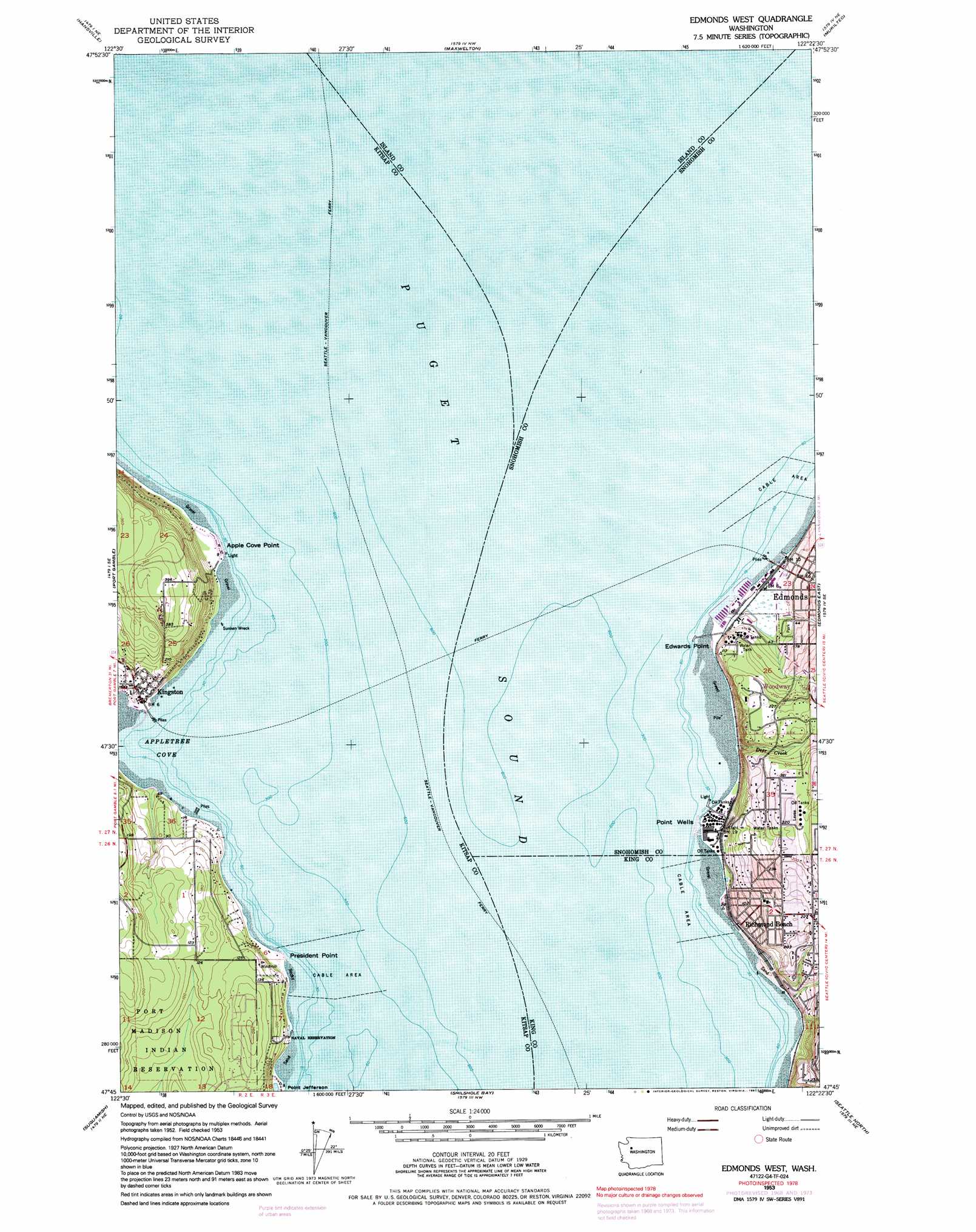
Edmonds West Topo Map Washington
To zoom in, hover over the map of Edmonds West
USGS Topo Quad 47122g4 - 1:24,000 scale
| Topo Map Name: | Edmonds West |
| USGS Topo Quad ID: | 47122g4 |
| Print Size: | ca. 21 1/4" wide x 27" high |
| Southeast Coordinates: | 47.75° N latitude / 122.375° W longitude |
| Map Center Coordinates: | 47.8125° N latitude / 122.4375° W longitude |
| U.S. State: | WA |
| Filename: | o47122g4.jpg |
| Download Map JPG Image: | Edmonds West topo map 1:24,000 scale |
| Map Type: | Topographic |
| Topo Series: | 7.5´ |
| Map Scale: | 1:24,000 |
| Source of Map Images: | United States Geological Survey (USGS) |
| Alternate Map Versions: |
Edmonds West WA 1953, updated 1955 Download PDF Buy paper map Edmonds West WA 1953, updated 1965 Download PDF Buy paper map Edmonds West WA 1953, updated 1969 Download PDF Buy paper map Edmonds West WA 1953, updated 1976 Download PDF Buy paper map Edmonds West WA 1953, updated 1991 Download PDF Buy paper map Edmonds West WA 1997, updated 2003 Download PDF Buy paper map Edmonds West WA 2011 Download PDF Buy paper map Edmonds West WA 2014 Download PDF Buy paper map |
1:24,000 Topo Quads surrounding Edmonds West
Nordland |
Freeland |
Langley |
Tulalip |
Marysville |
Port Ludlow |
Hansville |
Maxwelton |
Mukilteo |
Everett |
Lofall |
Port Gamble |
Edmonds West |
Edmonds East |
Bothell |
Poulsbo |
Suquamish |
Seattle North |
||
Bremerton West |
Bremerton East |
Seattle South |
> Back to 47122e1 at 1:100,000 scale
> Back to 47122a1 at 1:250,000 scale
> Back to U.S. Topo Maps home
Edmonds West topo map: Gazetteer
Edmonds West: Bays
Appletree Cove elevation 0m 0′Puget Sound elevation 0m 0′
Edmonds West: Beaches
Sunset Beach elevation 0m 0′Edmonds West: Capes
Apple Cove Point elevation 2m 6′Edwards Point elevation 1m 3′
Point Wells elevation -1m -4′
President Point elevation 2m 6′
Edmonds West: Parks
Edmonds Underwater Park elevation 0m 0′Edmonds West: Populated Places
Edmonds elevation 20m 65′Kingston elevation 20m 65′
Richmond Beach elevation 7m 22′
Woodway elevation 68m 223′
Edmonds West: Post Offices
Edmonds Post Office elevation 10m 32′Edmonds West: Streams
Deer Creek elevation 0m 0′Newellhurst Creek elevation 2m 6′
Osier Creek elevation 2m 6′
Shelleberger Creek elevation 6m 19′
Whisper Creek elevation 1m 3′
Edmonds West digital topo map on disk
Buy this Edmonds West topo map showing relief, roads, GPS coordinates and other geographical features, as a high-resolution digital map file on DVD: