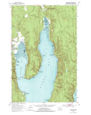
Quilcene Topo Map Washington
To zoom in, hover over the map of Quilcene
USGS Topo Quad 47122g7 - 1:24,000 scale
| Topo Map Name: | Quilcene |
| USGS Topo Quad ID: | 47122g7 |
| Print Size: | ca. 21 1/4" wide x 27" high |
| Southeast Coordinates: | 47.75° N latitude / 122.75° W longitude |
| Map Center Coordinates: | 47.8125° N latitude / 122.8125° W longitude |
| U.S. State: | WA |
| Filename: | o47122g7.jpg |
| Download Map JPG Image: | Quilcene topo map 1:24,000 scale |
| Map Type: | Topographic |
| Topo Series: | 7.5´ |
| Map Scale: | 1:24,000 |
| Source of Map Images: | United States Geological Survey (USGS) |
| Alternate Map Versions: |
Quilcene WA 1953, updated 1954 Download PDF Buy paper map Quilcene WA 1953, updated 1967 Download PDF Buy paper map Quilcene WA 1953, updated 1977 Download PDF Buy paper map Quilcene WA 1953, updated 1977 Download PDF Buy paper map Quilcene WA 2011 Download PDF Buy paper map Quilcene WA 2014 Download PDF Buy paper map |
1:24,000 Topo Quads surrounding Quilcene
> Back to 47122e1 at 1:100,000 scale
> Back to 47122a1 at 1:250,000 scale
> Back to U.S. Topo Maps home
Quilcene topo map: Gazetteer
Quilcene: Airports
Kimshan Ranch Airport elevation 18m 59′Quilcene: Bars
Broad Spit elevation 2m 6′Long Spit elevation 3m 9′
Quilcene: Bays
Dabob Bay elevation 1m 3′Quilcene Bay elevation 2m 6′
Tarboo Bay elevation 1m 3′
Quilcene: Capes
Bolton Peninsula elevation 122m 400′Brown Point elevation 0m 0′
Fishermans Point elevation 2m 6′
Frenchmans Point elevation 2m 6′
Toandos Peninsula elevation 156m 511′
Whitney Point elevation 18m 59′
Quilcene: Cliffs
Red Bluff elevation 49m 160′Quilcene: Dams
Scalzo Dam elevation 122m 400′Quilcene: Harbors
Quilcene Boat Haven elevation 4m 13′Quilcene: Lakes
Silent Lake elevation 167m 547′Quilcene: Populated Places
Bees Mill elevation 7m 22′Camp Discovery elevation 14m 45′
Dabob elevation 16m 52′
East Quilcene elevation 12m 39′
Quilcene: Streams
Big Quilcene River elevation 4m 13′Donovan Creek elevation 2m 6′
Indian George Creek elevation 6m 19′
Little Quilcene River elevation 4m 13′
Tarboo Creek elevation 4m 13′
Quilcene digital topo map on disk
Buy this Quilcene topo map showing relief, roads, GPS coordinates and other geographical features, as a high-resolution digital map file on DVD:


