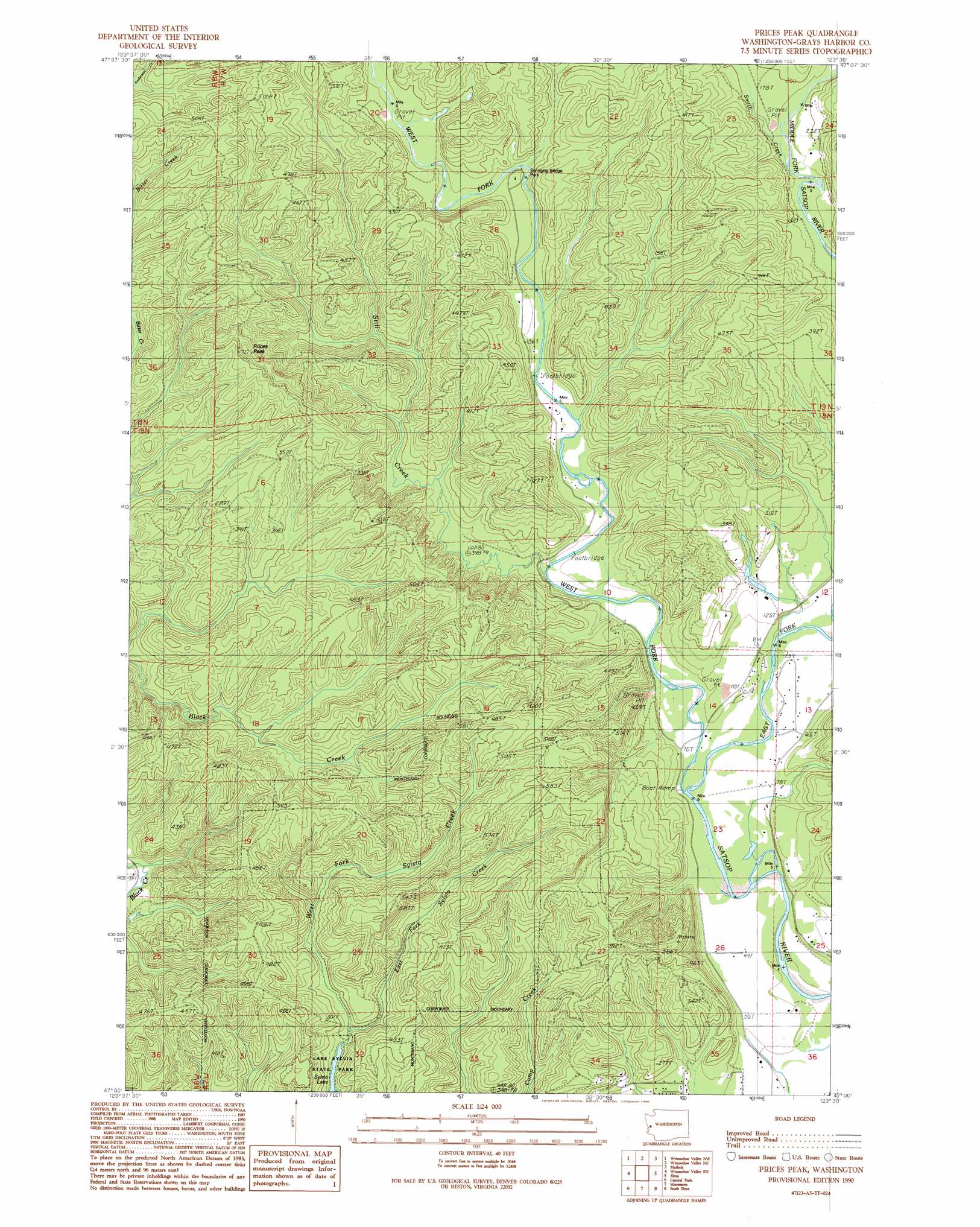
Prices Peak Topo Map Washington
To zoom in, hover over the map of Prices Peak
USGS Topo Quad 47123a5 - 1:24,000 scale
| Topo Map Name: | Prices Peak |
| USGS Topo Quad ID: | 47123a5 |
| Print Size: | ca. 21 1/4" wide x 27" high |
| Southeast Coordinates: | 47° N latitude / 123.5° W longitude |
| Map Center Coordinates: | 47.0625° N latitude / 123.5625° W longitude |
| U.S. State: | WA |
| Filename: | o47123a5.jpg |
| Download Map JPG Image: | Prices Peak topo map 1:24,000 scale |
| Map Type: | Topographic |
| Topo Series: | 7.5´ |
| Map Scale: | 1:24,000 |
| Source of Map Images: | United States Geological Survey (USGS) |
| Alternate Map Versions: |
Prices Peak WA 1990, updated 1990 Download PDF Buy paper map Prices Peak WA 2011 Download PDF Buy paper map Prices Peak WA 2014 Download PDF Buy paper map |
1:24,000 Topo Quads surrounding Prices Peak
Burnt Hill |
Larsen Creek |
Grisdale |
Dry Bed Lakes |
Vance Creek |
Railroad Camp |
Wynoochee Valley Nw |
Wynoochee Valley Ne |
Matlock |
Nahwatzel Lake |
Aberdeen Gardens |
Wynoochee Valley Sw |
Prices Peak |
Elma |
Mccleary |
Aberdeen |
Central Park |
Montesano |
South Elma |
Malone |
Aberdeen Se |
Elkhorn Creek |
Brooklyn |
Blue Mountain |
Cedarville |
> Back to 47123a1 at 1:100,000 scale
> Back to 47122a1 at 1:250,000 scale
> Back to U.S. Topo Maps home
Prices Peak topo map: Gazetteer
Prices Peak: Parks
Lake Sylvia State Park elevation 50m 164′Swinging Bridge Park elevation 40m 131′
Prices Peak: Streams
East Fork Satsop River elevation 25m 82′East Fork Sylvia Creek elevation 50m 164′
Smith Creek elevation 45m 147′
Still Creek elevation 25m 82′
West Fork Satsop River elevation 24m 78′
West Fork Sylvia Creek elevation 50m 164′
Prices Peak: Summits
Prices Peak elevation 215m 705′Prices Peak digital topo map on disk
Buy this Prices Peak topo map showing relief, roads, GPS coordinates and other geographical features, as a high-resolution digital map file on DVD: