Dry Bed Lakes Topo Map Washington
To zoom in, hover over the map of Dry Bed Lakes
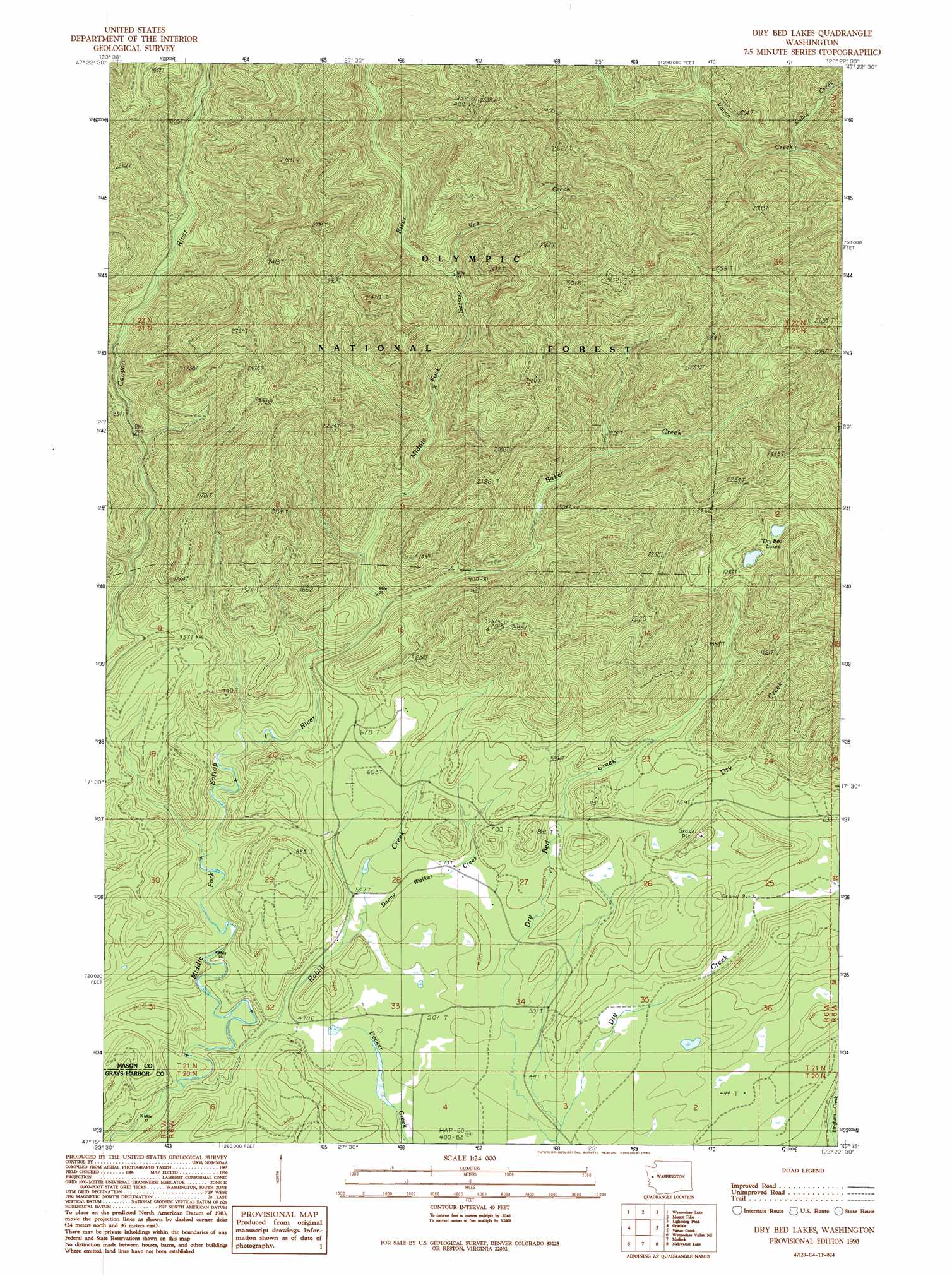
USGS Topo Quad 47123c4 - 1:24,000 scale
| Topo Map Name: | Dry Bed Lakes |
| USGS Topo Quad ID: | 47123c4 |
| Print Size: | ca. 21 1/4" wide x 27" high |
| Southeast Coordinates: | 47.25° N latitude / 123.375° W longitude |
| Map Center Coordinates: | 47.3125° N latitude / 123.4375° W longitude |
| U.S. State: | WA |
| Filename: | o47123c4.jpg |
| Download Map JPG Image: | Dry Bed Lakes topo map 1:24,000 scale |
| Map Type: | Topographic |
| Topo Series: | 7.5´ |
| Map Scale: | 1:24,000 |
| Source of Map Images: | United States Geological Survey (USGS) |
| Alternate Map Versions: |
Dry Bed Lakes WA 1990, updated 1990 Download PDF Buy paper map Dry Bed Lakes WA 2011 Download PDF Buy paper map Dry Bed Lakes WA 2014 Download PDF Buy paper map |
| FStopo: | US Forest Service topo Dry Bed Lakes is available: Download FStopo PDF Download FStopo TIF |
1:24,000 Topo Quads surrounding Dry Bed Lakes
Bunch Lake |
Mount Hoquiam |
Mount Olsen |
Mount Skokomish |
Mount Washington |
Colonel Bob |
Wynoochee Lake |
Mount Tebo |
Lightning Peak |
Hoodsport |
Larsen Creek |
Grisdale |
Dry Bed Lakes |
Vance Creek |
Skokomish Valley |
Wynoochee Valley Nw |
Wynoochee Valley Ne |
Matlock |
Nahwatzel Lake |
Shelton Valley |
Wynoochee Valley Sw |
Prices Peak |
Elma |
Mccleary |
Kamilche Valley |
> Back to 47123a1 at 1:100,000 scale
> Back to 47122a1 at 1:250,000 scale
> Back to U.S. Topo Maps home
Dry Bed Lakes topo map: Gazetteer
Dry Bed Lakes: Lakes
Dry Bed Lakes elevation 367m 1204′Dry Bed Lakes: Streams
Baker Creek elevation 188m 616′Cabin Creek elevation 265m 869′
Danny Walker Creek elevation 160m 524′
Dry Creek elevation 142m 465′
Rabbit Creek elevation 134m 439′
Vee Creek elevation 254m 833′
Dry Bed Lakes digital topo map on disk
Buy this Dry Bed Lakes topo map showing relief, roads, GPS coordinates and other geographical features, as a high-resolution digital map file on DVD: