Stevens Creek Topo Map Washington
To zoom in, hover over the map of Stevens Creek
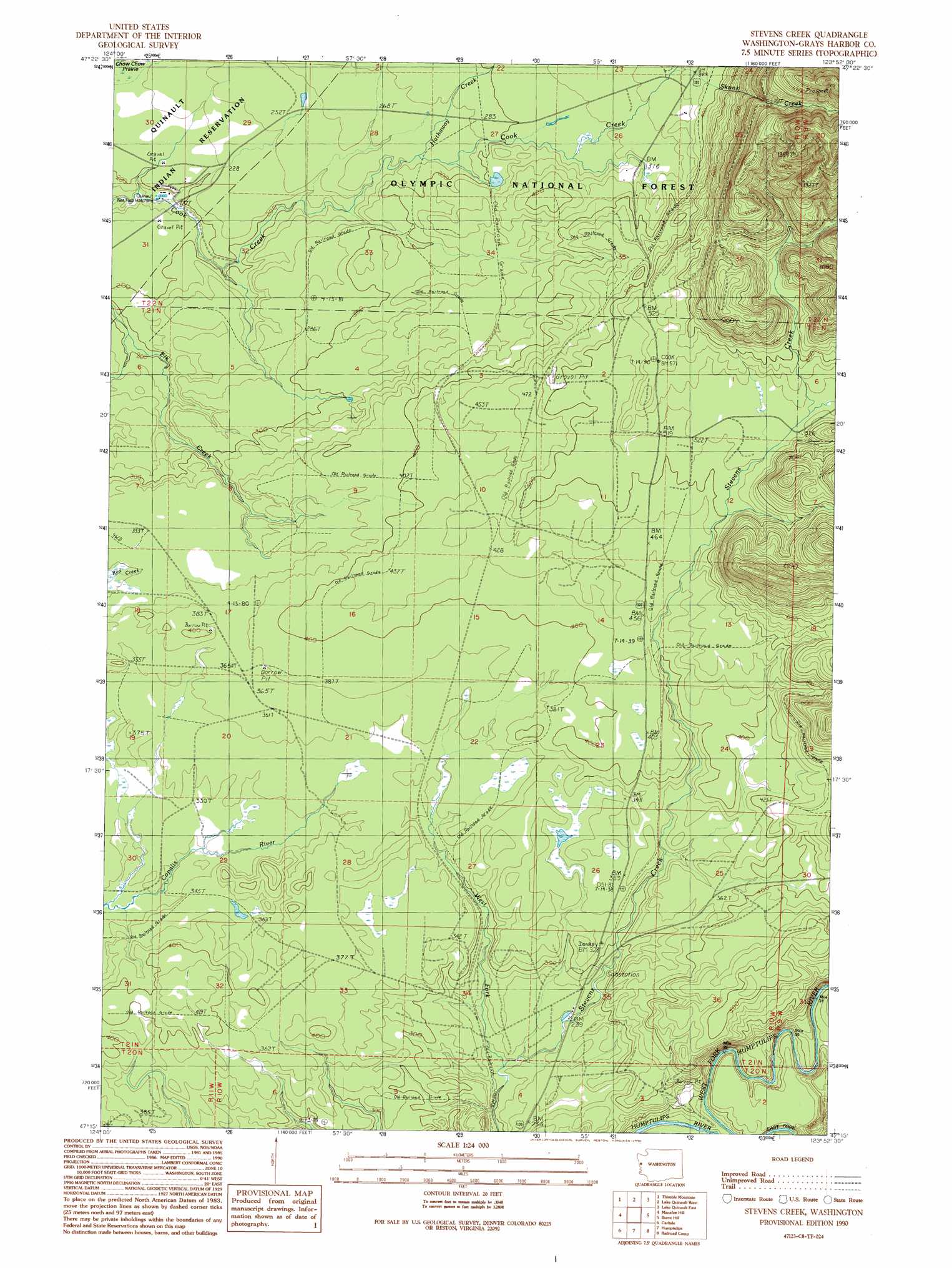
USGS Topo Quad 47123c8 - 1:24,000 scale
| Topo Map Name: | Stevens Creek |
| USGS Topo Quad ID: | 47123c8 |
| Print Size: | ca. 21 1/4" wide x 27" high |
| Southeast Coordinates: | 47.25° N latitude / 123.875° W longitude |
| Map Center Coordinates: | 47.3125° N latitude / 123.9375° W longitude |
| U.S. State: | WA |
| Filename: | o47123c8.jpg |
| Download Map JPG Image: | Stevens Creek topo map 1:24,000 scale |
| Map Type: | Topographic |
| Topo Series: | 7.5´ |
| Map Scale: | 1:24,000 |
| Source of Map Images: | United States Geological Survey (USGS) |
| Alternate Map Versions: |
Stevens Creek WA 1990, updated 1990 Download PDF Buy paper map Stevens Creek WA 2011 Download PDF Buy paper map Stevens Creek WA 2014 Download PDF Buy paper map |
| FStopo: | US Forest Service topo Stevens Creek is available: Download FStopo PDF Download FStopo TIF |
1:24,000 Topo Quads surrounding Stevens Creek
Salmon River West |
Salmon River East |
Matheny Ridge |
Finley Creek |
Bunch Lake |
O'Took Prairie |
Thimble Mountain |
Quinault Lake West |
Quinault Lake East |
Colonel Bob |
Shale Slough |
Macafee Hill |
Stevens Creek |
Burnt Hill |
Larsen Creek |
Moclips |
Carlisle |
Humptulips |
Railroad Camp |
Wynoochee Valley Nw |
Copalis Beach |
Copalis Crossing |
New London |
Aberdeen Gardens |
Wynoochee Valley Sw |
> Back to 47123a1 at 1:100,000 scale
> Back to 47122a1 at 1:250,000 scale
> Back to U.S. Topo Maps home
Stevens Creek topo map: Gazetteer
Stevens Creek: Parks
Promised Land Recreation Area elevation 74m 242′Stevens Creek: Streams
Skunk Creek elevation 112m 367′West Fork Stevens Creek elevation 67m 219′
Stevens Creek digital topo map on disk
Buy this Stevens Creek topo map showing relief, roads, GPS coordinates and other geographical features, as a high-resolution digital map file on DVD: