Mount Tebo Topo Map Washington
To zoom in, hover over the map of Mount Tebo
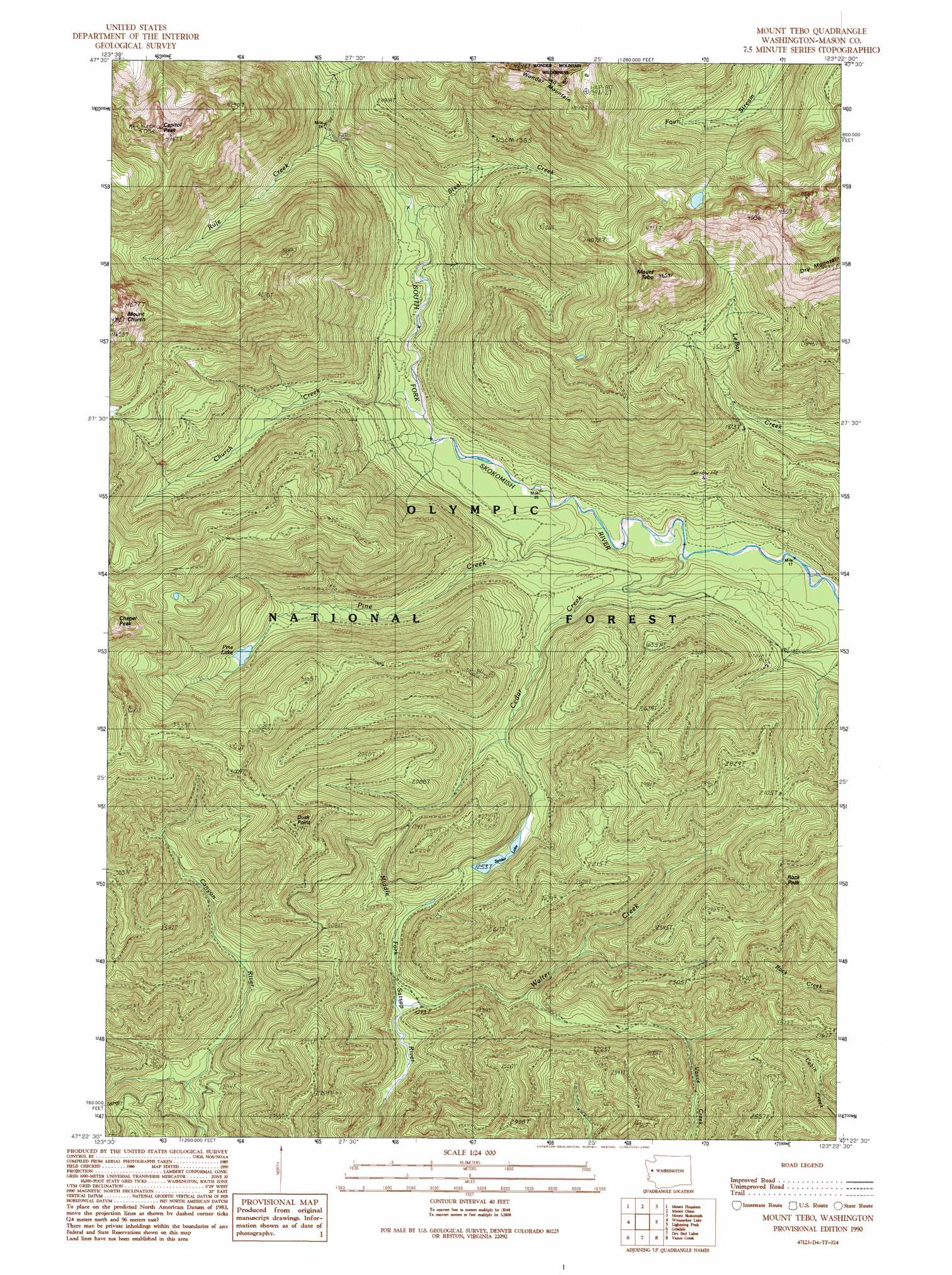
USGS Topo Quad 47123d4 - 1:24,000 scale
| Topo Map Name: | Mount Tebo |
| USGS Topo Quad ID: | 47123d4 |
| Print Size: | ca. 21 1/4" wide x 27" high |
| Southeast Coordinates: | 47.375° N latitude / 123.375° W longitude |
| Map Center Coordinates: | 47.4375° N latitude / 123.4375° W longitude |
| U.S. State: | WA |
| Filename: | o47123d4.jpg |
| Download Map JPG Image: | Mount Tebo topo map 1:24,000 scale |
| Map Type: | Topographic |
| Topo Series: | 7.5´ |
| Map Scale: | 1:24,000 |
| Source of Map Images: | United States Geological Survey (USGS) |
| Alternate Map Versions: |
Mount Tebo WA 1990, updated 1990 Download PDF Buy paper map Mount Tebo WA 2011 Download PDF Buy paper map Mount Tebo WA 2014 Download PDF Buy paper map |
| FStopo: | US Forest Service topo Mount Tebo is available: Download FStopo PDF Download FStopo TIF |
1:24,000 Topo Quads surrounding Mount Tebo
Kimta Peak |
Mount Christie |
Chimney Peak |
Mount Steel |
The Brothers |
Bunch Lake |
Mount Hoquiam |
Mount Olsen |
Mount Skokomish |
Mount Washington |
Colonel Bob |
Wynoochee Lake |
Mount Tebo |
Lightning Peak |
Hoodsport |
Larsen Creek |
Grisdale |
Dry Bed Lakes |
Vance Creek |
Skokomish Valley |
Wynoochee Valley Nw |
Wynoochee Valley Ne |
Matlock |
Nahwatzel Lake |
Shelton Valley |
> Back to 47123a1 at 1:100,000 scale
> Back to 47122a1 at 1:250,000 scale
> Back to U.S. Topo Maps home
Mount Tebo topo map: Gazetteer
Mount Tebo: Lakes
Pine Lake elevation 532m 1745′Spider Lake elevation 426m 1397′
Mount Tebo: Streams
Cedar Creek elevation 216m 708′Church Creek elevation 268m 879′
Pine Creek elevation 235m 770′
Rule Creek elevation 422m 1384′
Steel Creek elevation 329m 1079′
Walter Creek elevation 334m 1095′
Walter Creek elevation 322m 1056′
Mount Tebo: Summits
Capitol Peak elevation 1485m 4872′Dry Mountain elevation 1311m 4301′
Dusk Point elevation 976m 3202′
Mount Tebo elevation 1341m 4399′
Rock Peak elevation 1000m 3280′
Mount Tebo digital topo map on disk
Buy this Mount Tebo topo map showing relief, roads, GPS coordinates and other geographical features, as a high-resolution digital map file on DVD: