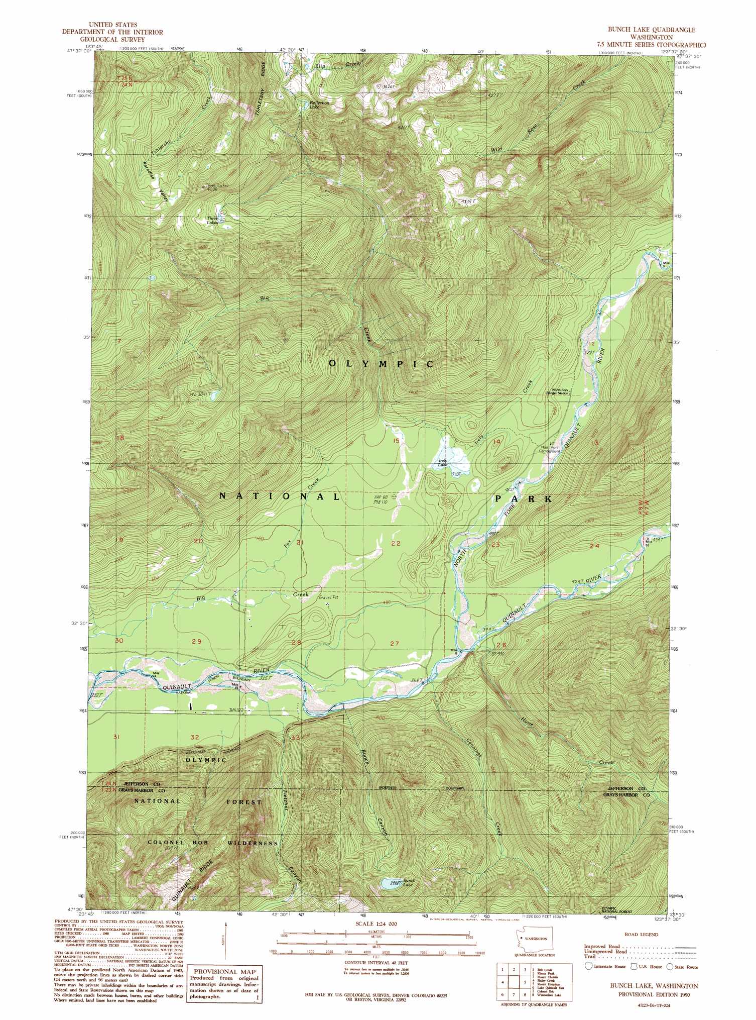
Bunch Lake Topo Map Washington
To zoom in, hover over the map of Bunch Lake
USGS Topo Quad 47123e6 - 1:24,000 scale
| Topo Map Name: | Bunch Lake |
| USGS Topo Quad ID: | 47123e6 |
| Print Size: | ca. 21 1/4" wide x 27" high |
| Southeast Coordinates: | 47.5° N latitude / 123.625° W longitude |
| Map Center Coordinates: | 47.5625° N latitude / 123.6875° W longitude |
| U.S. State: | WA |
| Filename: | o47123e6.jpg |
| Download Map JPG Image: | Bunch Lake topo map 1:24,000 scale |
| Map Type: | Topographic |
| Topo Series: | 7.5´ |
| Map Scale: | 1:24,000 |
| Source of Map Images: | United States Geological Survey (USGS) |
| Alternate Map Versions: |
Bunch Lake WA 1990, updated 1990 Download PDF Buy paper map Bunch Lake WA 2011 Download PDF Buy paper map Bunch Lake WA 2014 Download PDF Buy paper map |
| FStopo: | US Forest Service topo Bunch Lake is available: Download FStopo PDF Download FStopo TIF |
1:24,000 Topo Quads surrounding Bunch Lake
Owl Mountain |
Mount Tom |
Mount Olympus |
Mount Queets |
Mccartney Peak |
Kloochman Rock |
Bob Creek |
Kimta Peak |
Mount Christie |
Chimney Peak |
Matheny Ridge |
Finley Creek |
Bunch Lake |
Mount Hoquiam |
Mount Olsen |
Quinault Lake West |
Quinault Lake East |
Colonel Bob |
Wynoochee Lake |
Mount Tebo |
Stevens Creek |
Burnt Hill |
Larsen Creek |
Grisdale |
Dry Bed Lakes |
> Back to 47123e1 at 1:100,000 scale
> Back to 47122a1 at 1:250,000 scale
> Back to U.S. Topo Maps home
Bunch Lake topo map: Gazetteer
Bunch Lake: Basins
Paradise Valley elevation 884m 2900′Bunch Lake: Lakes
Bunch Lake elevation 894m 2933′Irely Lake elevation 167m 547′
Reflection Lake elevation 1056m 3464′
Three Lakes elevation 976m 3202′
Bunch Lake: Streams
Cannings Creek elevation 115m 377′Fox Creek elevation 104m 341′
Howe Creek elevation 119m 390′
Irely Creek elevation 160m 524′
North Fork Quinault River elevation 120m 393′
Bunch Lake: Valleys
Bunch Canyon elevation 110m 360′Fletcher Canyon elevation 110m 360′
Paradise Valley elevation 856m 2808′
Bunch Lake digital topo map on disk
Buy this Bunch Lake topo map showing relief, roads, GPS coordinates and other geographical features, as a high-resolution digital map file on DVD: