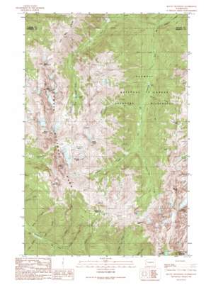
Mount Deception Topo Map Washington
To zoom in, hover over the map of Mount Deception
USGS Topo Quad 47123g2 - 1:24,000 scale
| Topo Map Name: | Mount Deception |
| USGS Topo Quad ID: | 47123g2 |
| Print Size: | ca. 21 1/4" wide x 27" high |
| Southeast Coordinates: | 47.75° N latitude / 123.125° W longitude |
| Map Center Coordinates: | 47.8125° N latitude / 123.1875° W longitude |
| U.S. State: | WA |
| Filename: | o47123g2.jpg |
| Download Map JPG Image: | Mount Deception topo map 1:24,000 scale |
| Map Type: | Topographic |
| Topo Series: | 7.5´ |
| Map Scale: | 1:24,000 |
| Source of Map Images: | United States Geological Survey (USGS) |
| Alternate Map Versions: |
Mount Deception WA 1990, updated 1990 Download PDF Buy paper map Mount Deception WA 2011 Download PDF Buy paper map Mount Deception WA 2014 Download PDF Buy paper map |
| FStopo: | US Forest Service topo Mount Deception is available: Download FStopo PDF Download FStopo TIF |
1:24,000 Topo Quads surrounding Mount Deception
> Back to 47123e1 at 1:100,000 scale
> Back to 47122a1 at 1:250,000 scale
> Back to U.S. Topo Maps home
Mount Deception topo map: Gazetteer
Mount Deception: Basins
Deception Basin elevation 1901m 6236′Royal Basin elevation 1549m 5082′
Mount Deception: Flats
Sunnybrook Meadows elevation 1660m 5446′Mount Deception: Gaps
Buckhorn Pass elevation 1783m 5849′Constance Pass elevation 1772m 5813′
Marmot Pass elevation 1820m 5971′
Mount Deception: Lakes
Charlia Lakes elevation 1749m 5738′Home Lake elevation 1622m 5321′
Lake Constance elevation 1432m 4698′
Royal Lake elevation 1562m 5124′
Mount Deception: Ridges
Gray Wolf Ridge elevation 1926m 6318′The Needles elevation 2188m 7178′
Mount Deception: Streams
Crag Creek elevation 702m 2303′Ghoul Creek elevation 962m 3156′
Hawk Creek elevation 734m 2408′
Heather Creek elevation 1049m 3441′
Home Creek elevation 1049m 3441′
Lower Twin Creek elevation 619m 2030′
Milk Creek elevation 973m 3192′
Royal Creek elevation 817m 2680′
Slide Creek elevation 693m 2273′
Still Creek elevation 872m 2860′
Upper Twin Creek elevation 653m 2142′
West Branch Home Creek elevation 1220m 4002′
Mount Deception: Summits
Hal Foss Peak elevation 2120m 6955′Little Mystery elevation 2026m 6646′
Mount Clark elevation 2213m 7260′
Mount Constance elevation 2332m 7650′
Mount Deception elevation 2369m 7772′
Mount Fricaba elevation 2164m 7099′
Mount Mystery elevation 2298m 7539′
Mount Valerianos (not official) elevation 1695m 5561′
Mount Walkinshaw elevation 2157m 7076′
Warrior Peak elevation 2197m 7208′
Mount Deception: Trails
Royal Creek Trail elevation 1276m 4186′Mount Deception digital topo map on disk
Buy this Mount Deception topo map showing relief, roads, GPS coordinates and other geographical features, as a high-resolution digital map file on DVD:


