Mccartney Peak Topo Map Washington
To zoom in, hover over the map of Mccartney Peak
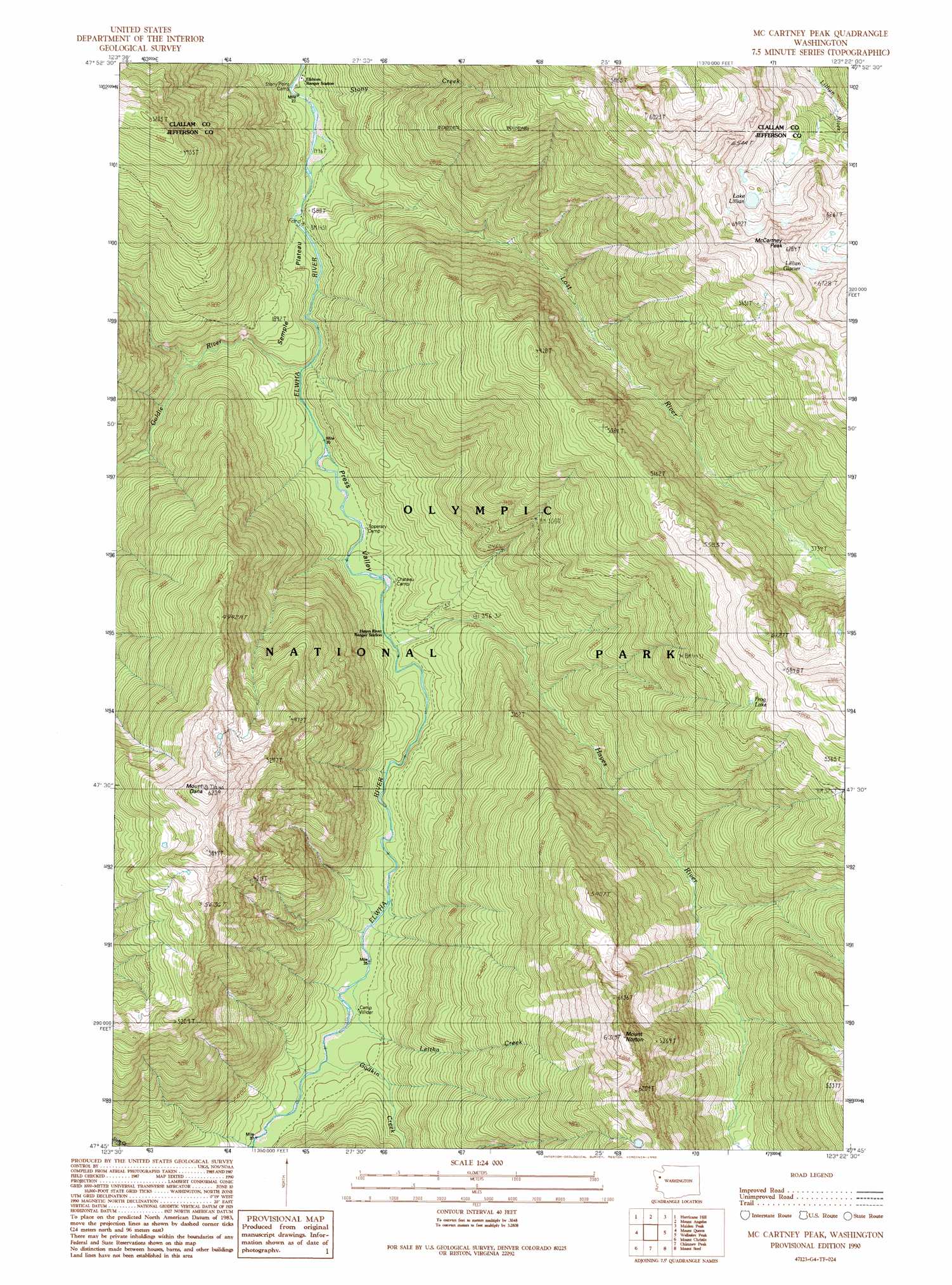
USGS Topo Quad 47123g4 - 1:24,000 scale
| Topo Map Name: | Mccartney Peak |
| USGS Topo Quad ID: | 47123g4 |
| Print Size: | ca. 21 1/4" wide x 27" high |
| Southeast Coordinates: | 47.75° N latitude / 123.375° W longitude |
| Map Center Coordinates: | 47.8125° N latitude / 123.4375° W longitude |
| U.S. State: | WA |
| Filename: | o47123g4.jpg |
| Download Map JPG Image: | Mccartney Peak topo map 1:24,000 scale |
| Map Type: | Topographic |
| Topo Series: | 7.5´ |
| Map Scale: | 1:24,000 |
| Source of Map Images: | United States Geological Survey (USGS) |
| Alternate Map Versions: |
Mc Cartney Peak WA 1990, updated 1990 Download PDF Buy paper map McCartney Peak WA 2011 Download PDF Buy paper map McCartney Peak WA 2014 Download PDF Buy paper map |
1:24,000 Topo Quads surrounding Mccartney Peak
Lake Sutherland |
Elwha |
Port Angeles |
Morse Creek |
Carlsborg |
Mount Carrie |
Hurricane Hill |
Mount Angeles |
Maiden Peak |
Tyler Peak |
Mount Olympus |
Mount Queets |
Mccartney Peak |
Wellesley Peak |
Mount Deception |
Kimta Peak |
Mount Christie |
Chimney Peak |
Mount Steel |
The Brothers |
Bunch Lake |
Mount Hoquiam |
Mount Olsen |
Mount Skokomish |
Mount Washington |
> Back to 47123e1 at 1:100,000 scale
> Back to 47122a1 at 1:250,000 scale
> Back to U.S. Topo Maps home
Mccartney Peak topo map: Gazetteer
Mccartney Peak: Benches
Semple Plateau elevation 553m 1814′Mccartney Peak: Flats
Press Valley elevation 482m 1581′Mccartney Peak: Glaciers
Lillian Glacier elevation 1912m 6272′Mccartney Peak: Lakes
Frog Lake elevation 1599m 5246′Lake Lillian elevation 1764m 5787′
Mccartney Peak: Streams
Godkin Creek elevation 596m 1955′Goldie River elevation 460m 1509′
Hayes River elevation 512m 1679′
Leitha Creek elevation 577m 1893′
Lost River elevation 440m 1443′
Stony Creek elevation 443m 1453′
Mccartney Peak: Summits
McCartney Peak elevation 2051m 6729′Mount Dana elevation 1890m 6200′
Mount Norton elevation 1901m 6236′
South Dana elevation 1701m 5580′
Mccartney Peak: Trails
Elwha River Trail elevation 525m 1722′Mccartney Peak digital topo map on disk
Buy this Mccartney Peak topo map showing relief, roads, GPS coordinates and other geographical features, as a high-resolution digital map file on DVD: