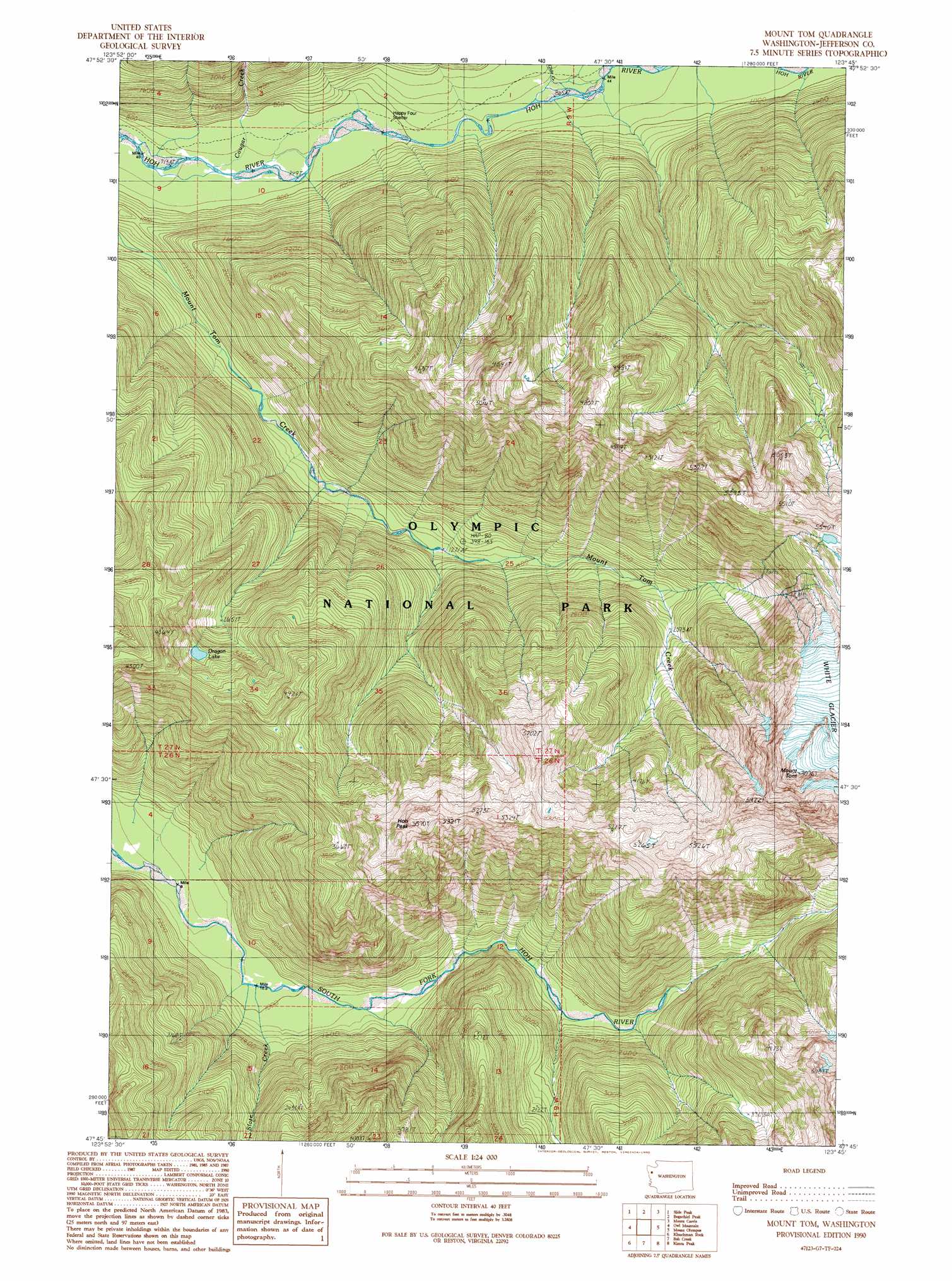
Mount Tom Topo Map Washington
To zoom in, hover over the map of Mount Tom
USGS Topo Quad 47123g7 - 1:24,000 scale
| Topo Map Name: | Mount Tom |
| USGS Topo Quad ID: | 47123g7 |
| Print Size: | ca. 21 1/4" wide x 27" high |
| Southeast Coordinates: | 47.75° N latitude / 123.75° W longitude |
| Map Center Coordinates: | 47.8125° N latitude / 123.8125° W longitude |
| U.S. State: | WA |
| Filename: | o47123g7.jpg |
| Download Map JPG Image: | Mount Tom topo map 1:24,000 scale |
| Map Type: | Topographic |
| Topo Series: | 7.5´ |
| Map Scale: | 1:24,000 |
| Source of Map Images: | United States Geological Survey (USGS) |
| Alternate Map Versions: |
Mount Tom WA 1990, updated 1990 Download PDF Buy paper map Mount Tom WA 2011 Download PDF Buy paper map Mount Tom WA 2014 Download PDF Buy paper map |
1:24,000 Topo Quads surrounding Mount Tom
Snider Peak |
Mount Muller |
Lake Crescent |
Lake Sutherland |
Elwha |
Hunger Mountain |
Slide Peak |
Bogachiel Peak |
Mount Carrie |
Hurricane Hill |
Spruce Mountain |
Owl Mountain |
Mount Tom |
Mount Olympus |
Mount Queets |
Stequaleho Creek |
Kloochman Rock |
Bob Creek |
Kimta Peak |
Mount Christie |
Salmon River East |
Matheny Ridge |
Finley Creek |
Bunch Lake |
Mount Hoquiam |
> Back to 47123e1 at 1:100,000 scale
> Back to 47122a1 at 1:250,000 scale
> Back to U.S. Topo Maps home
Mount Tom topo map: Gazetteer
Mount Tom: Capes
Olympic Peninsula elevation 1624m 5328′Mount Tom: Lakes
Dragon Lake elevation 1024m 3359′Mount Tom: Streams
Clide Creek elevation 267m 875′Cougar Creek elevation 240m 787′
Lake Creek elevation 435m 1427′
Slate Creek elevation 300m 984′
Mount Tom: Summits
Hoh Peak elevation 1633m 5357′Mount Tom elevation 2148m 7047′
Mount Tom digital topo map on disk
Buy this Mount Tom topo map showing relief, roads, GPS coordinates and other geographical features, as a high-resolution digital map file on DVD: