Maiden Peak Topo Map Washington
To zoom in, hover over the map of Maiden Peak
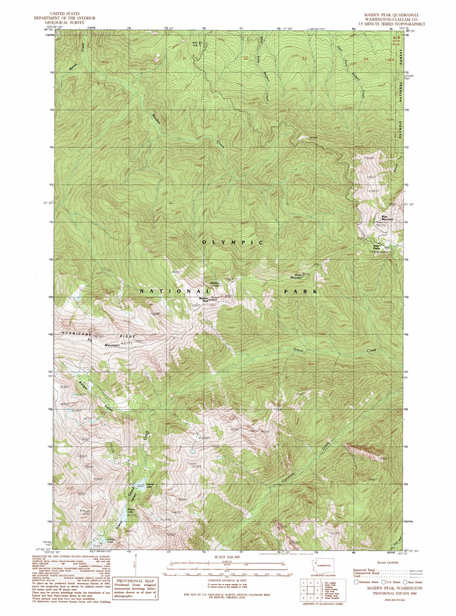
USGS Topo Quad 47123h3 - 1:24,000 scale
| Topo Map Name: | Maiden Peak |
| USGS Topo Quad ID: | 47123h3 |
| Print Size: | ca. 21 1/4" wide x 27" high |
| Southeast Coordinates: | 47.875° N latitude / 123.25° W longitude |
| Map Center Coordinates: | 47.9375° N latitude / 123.3125° W longitude |
| U.S. State: | WA |
| Filename: | o47123h3.jpg |
| Download Map JPG Image: | Maiden Peak topo map 1:24,000 scale |
| Map Type: | Topographic |
| Topo Series: | 7.5´ |
| Map Scale: | 1:24,000 |
| Source of Map Images: | United States Geological Survey (USGS) |
| Alternate Map Versions: |
Maiden Peak WA 1990, updated 1990 Download PDF Buy paper map Maiden Peak WA 1990, updated 1990 Download PDF Buy paper map Maiden Peak WA 2011 Download PDF Buy paper map Maiden Peak WA 2014 Download PDF Buy paper map |
| FStopo: | US Forest Service topo Maiden Peak is available: Download FStopo PDF Download FStopo TIF |
1:24,000 Topo Quads surrounding Maiden Peak
Angeles Point |
Ediz Hook |
Dungeness |
||
Elwha |
Port Angeles |
Morse Creek |
Carlsborg |
Sequim |
Hurricane Hill |
Mount Angeles |
Maiden Peak |
Tyler Peak |
Mount Zion |
Mount Queets |
Mccartney Peak |
Wellesley Peak |
Mount Deception |
Mount Townsend |
Mount Christie |
Chimney Peak |
Mount Steel |
The Brothers |
Mount Jupiter |
> Back to 47123e1 at 1:100,000 scale
> Back to 47122a1 at 1:250,000 scale
> Back to U.S. Topo Maps home
Maiden Peak topo map: Gazetteer
Maiden Peak: Lakes
Gladys Lake elevation 1644m 5393′Grand Lake elevation 1448m 4750′
Maiden Lake elevation 1694m 5557′
Marmot Lake elevation 840m 2755′
Moose Lake elevation 1549m 5082′
Maiden Peak: Streams
Maiden Creek elevation 417m 1368′Maiden Peak: Summits
Blue Mountain elevation 1804m 5918′Green Mountain elevation 1697m 5567′
Maiden Peak elevation 1943m 6374′
Maiden Peak: Valleys
Badger Valley elevation 1292m 4238′Grand Valley elevation 1401m 4596′
Maiden Peak digital topo map on disk
Buy this Maiden Peak topo map showing relief, roads, GPS coordinates and other geographical features, as a high-resolution digital map file on DVD: