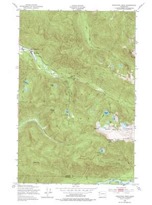
Bogachiel Peak Topo Map Washington
To zoom in, hover over the map of Bogachiel Peak
USGS Topo Quad 47123h7 - 1:24,000 scale
| Topo Map Name: | Bogachiel Peak |
| USGS Topo Quad ID: | 47123h7 |
| Print Size: | ca. 21 1/4" wide x 27" high |
| Southeast Coordinates: | 47.875° N latitude / 123.75° W longitude |
| Map Center Coordinates: | 47.9375° N latitude / 123.8125° W longitude |
| U.S. State: | WA |
| Filename: | o47123h7.jpg |
| Download Map JPG Image: | Bogachiel Peak topo map 1:24,000 scale |
| Map Type: | Topographic |
| Topo Series: | 7.5´ |
| Map Scale: | 1:24,000 |
| Source of Map Images: | United States Geological Survey (USGS) |
| Alternate Map Versions: |
Bogachiel Peak WA 1950, updated 1956 Download PDF Buy paper map Bogachiel Peak WA 1950, updated 1965 Download PDF Buy paper map Bogachiel Peak WA 1950, updated 1977 Download PDF Buy paper map Bogachiel Peak WA 1950, updated 1977 Download PDF Buy paper map Bogachiel Peak WA 2011 Download PDF Buy paper map Bogachiel Peak WA 2014 Download PDF Buy paper map |
1:24,000 Topo Quads surrounding Bogachiel Peak
> Back to 47123e1 at 1:100,000 scale
> Back to 47122a1 at 1:250,000 scale
> Back to U.S. Topo Maps home
Bogachiel Peak topo map: Gazetteer
Bogachiel Peak: Basins
Seven Lakes Basin elevation 1340m 4396′Bogachiel Peak: Falls
Sol Duc Falls elevation 597m 1958′Bogachiel Peak: Flats
Bogachiel Park elevation 954m 3129′Bogachiel Peak: Lakes
Bogachiel Lake elevation 1077m 3533′Clear Lake elevation 1293m 4242′
Deer Lake elevation 1075m 3526′
Hidden Lake elevation 859m 2818′
Hoh Lake elevation 1385m 4543′
Long Lake elevation 1170m 3838′
Lunch Lake elevation 1366m 4481′
Mink Lake elevation 940m 3083′
Morgenroth Lake elevation 1259m 4130′
No Name Lake elevation 1275m 4183′
Round Lake elevation 1306m 4284′
Sol Duc Lake elevation 1123m 3684′
Y Lake elevation 1331m 4366′
Bogachiel Peak: Post Offices
Solduc Post Office (historical) elevation 497m 1630′Bogachiel Peak: Ridges
Low Divide elevation 1160m 3805′Bogachiel Peak: Streams
Canyon Creek elevation 572m 1876′Hoh Creek elevation 295m 967′
Seven Lakes Creek elevation 682m 2237′
Bogachiel Peak: Summits
Bogachiel Peak elevation 1667m 5469′Boulder Peak elevation 1715m 5626′
Green Peak elevation 1409m 4622′
Bogachiel Peak: Trails
Canyon Creek Hoh Trail elevation 1077m 3533′Deer Lake Cutoff elevation 1159m 3802′
Deer Lake Trail elevation 886m 2906′
Lovers Lane elevation 530m 1738′
Mink Lake Trail elevation 968m 3175′
Soleduck Trail elevation 747m 2450′
Upper Hoh River Trail elevation 277m 908′
Bogachiel Peak digital topo map on disk
Buy this Bogachiel Peak topo map showing relief, roads, GPS coordinates and other geographical features, as a high-resolution digital map file on DVD:


