Winfield Creek Topo Map Washington
To zoom in, hover over the map of Winfield Creek
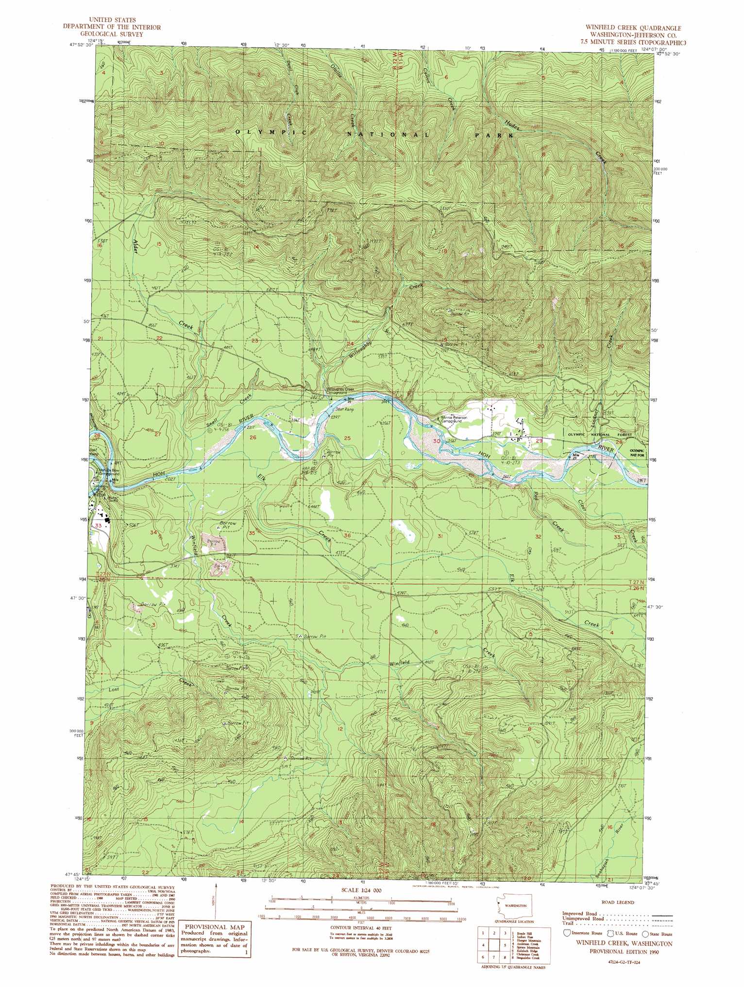
USGS Topo Quad 47124g2 - 1:24,000 scale
| Topo Map Name: | Winfield Creek |
| USGS Topo Quad ID: | 47124g2 |
| Print Size: | ca. 21 1/4" wide x 27" high |
| Southeast Coordinates: | 47.75° N latitude / 124.125° W longitude |
| Map Center Coordinates: | 47.8125° N latitude / 124.1875° W longitude |
| U.S. State: | WA |
| Filename: | o47124g2.jpg |
| Download Map JPG Image: | Winfield Creek topo map 1:24,000 scale |
| Map Type: | Topographic |
| Topo Series: | 7.5´ |
| Map Scale: | 1:24,000 |
| Source of Map Images: | United States Geological Survey (USGS) |
| Alternate Map Versions: |
Winfield Creek WA 1990, updated 1990 Download PDF Buy paper map Winfield Creek WA 2011 Download PDF Buy paper map Winfield Creek WA 2014 Download PDF Buy paper map |
| FStopo: | US Forest Service topo Winfield Creek is available: Download FStopo PDF Download FStopo TIF |
1:24,000 Topo Quads surrounding Winfield Creek
Gunderson Mountain |
Lake Pleasant |
Deadmans Hill |
Snider Peak |
Mount Muller |
Forks |
Reade Hill |
Indian Pass |
Hunger Mountain |
Slide Peak |
Hoh Head |
Anderson Creek |
Winfield Creek |
Spruce Mountain |
Owl Mountain |
Destruction Island |
Kalaoch Ridge |
Christmas Creek |
Stequaleho Creek |
Kloochman Rock |
Queets |
Salmon River West |
Salmon River East |
Matheny Ridge |
> Back to 47124e1 at 1:100,000 scale
> Back to 47124a1 at 1:250,000 scale
> Back to U.S. Topo Maps home
Winfield Creek topo map: Gazetteer
Winfield Creek: Streams
Alder Creek elevation 64m 209′Clear Creek elevation 83m 272′
Elk Creek elevation 68m 223′
Lindner Creek elevation 87m 285′
Red Creek elevation 85m 278′
Snell Creek elevation 70m 229′
Willoughby Creek elevation 76m 249′
Winfield Creek elevation 64m 209′
Winfield Creek digital topo map on disk
Buy this Winfield Creek topo map showing relief, roads, GPS coordinates and other geographical features, as a high-resolution digital map file on DVD: