Hunger Mountain Topo Map Washington
To zoom in, hover over the map of Hunger Mountain
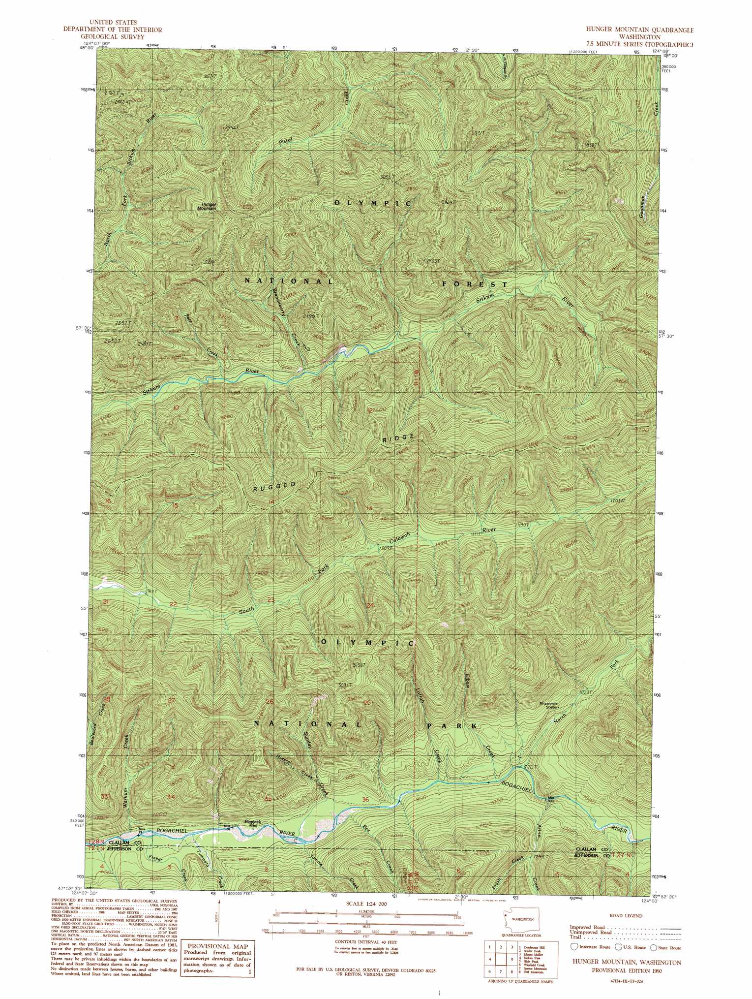
USGS Topo Quad 47124h1 - 1:24,000 scale
| Topo Map Name: | Hunger Mountain |
| USGS Topo Quad ID: | 47124h1 |
| Print Size: | ca. 21 1/4" wide x 27" high |
| Southeast Coordinates: | 47.875° N latitude / 124° W longitude |
| Map Center Coordinates: | 47.9375° N latitude / 124.0625° W longitude |
| U.S. State: | WA |
| Filename: | o47124h1.jpg |
| Download Map JPG Image: | Hunger Mountain topo map 1:24,000 scale |
| Map Type: | Topographic |
| Topo Series: | 7.5´ |
| Map Scale: | 1:24,000 |
| Source of Map Images: | United States Geological Survey (USGS) |
| Alternate Map Versions: |
Hunger Mountain WA 1990, updated 1990 Download PDF Buy paper map Hunger Mountain WA 1995, updated 1997 Download PDF Buy paper map Hunger Mountain WA 2002, updated 2006 Download PDF Buy paper map Hunger Mountain WA 2011 Download PDF Buy paper map Hunger Mountain WA 2014 Download PDF Buy paper map |
| FStopo: | US Forest Service topo Hunger Mountain is available: Download FStopo PDF Download FStopo TIF |
1:24,000 Topo Quads surrounding Hunger Mountain
Ellis Mountain |
West Of Pysht |
Pysht |
Twin Rivers |
Disque |
Lake Pleasant |
Deadmans Hill |
Snider Peak |
Mount Muller |
Lake Crescent |
Reade Hill |
Indian Pass |
Hunger Mountain |
Slide Peak |
Bogachiel Peak |
Anderson Creek |
Winfield Creek |
Spruce Mountain |
Owl Mountain |
Mount Tom |
Kalaoch Ridge |
Christmas Creek |
Stequaleho Creek |
Kloochman Rock |
Bob Creek |
> Back to 47124e1 at 1:100,000 scale
> Back to 47124a1 at 1:250,000 scale
> Back to U.S. Topo Maps home
Hunger Mountain topo map: Gazetteer
Hunger Mountain: Ridges
Rugged Ridge elevation 875m 2870′Hunger Mountain: Streams
All-In Creek elevation 385m 1263′Bee Creek elevation 191m 626′
Brandeberry Creek elevation 322m 1056′
Brush Creek elevation 289m 948′
Elbow Creek elevation 232m 761′
Fraker Creek elevation 167m 547′
Lotloh Creek elevation 217m 711′
Mineral Creek elevation 327m 1072′
North Fork Bogachiel River elevation 235m 770′
Pete Creek elevation 304m 997′
Spruce Creek elevation 189m 620′
Sunday Creek elevation 190m 623′
Tumwata Creek elevation 167m 547′
Vast Creek elevation 364m 1194′
Warkum Creek elevation 175m 574′
Hunger Mountain: Summits
Hunger Mountain elevation 1022m 3353′Hunger Mountain digital topo map on disk
Buy this Hunger Mountain topo map showing relief, roads, GPS coordinates and other geographical features, as a high-resolution digital map file on DVD: