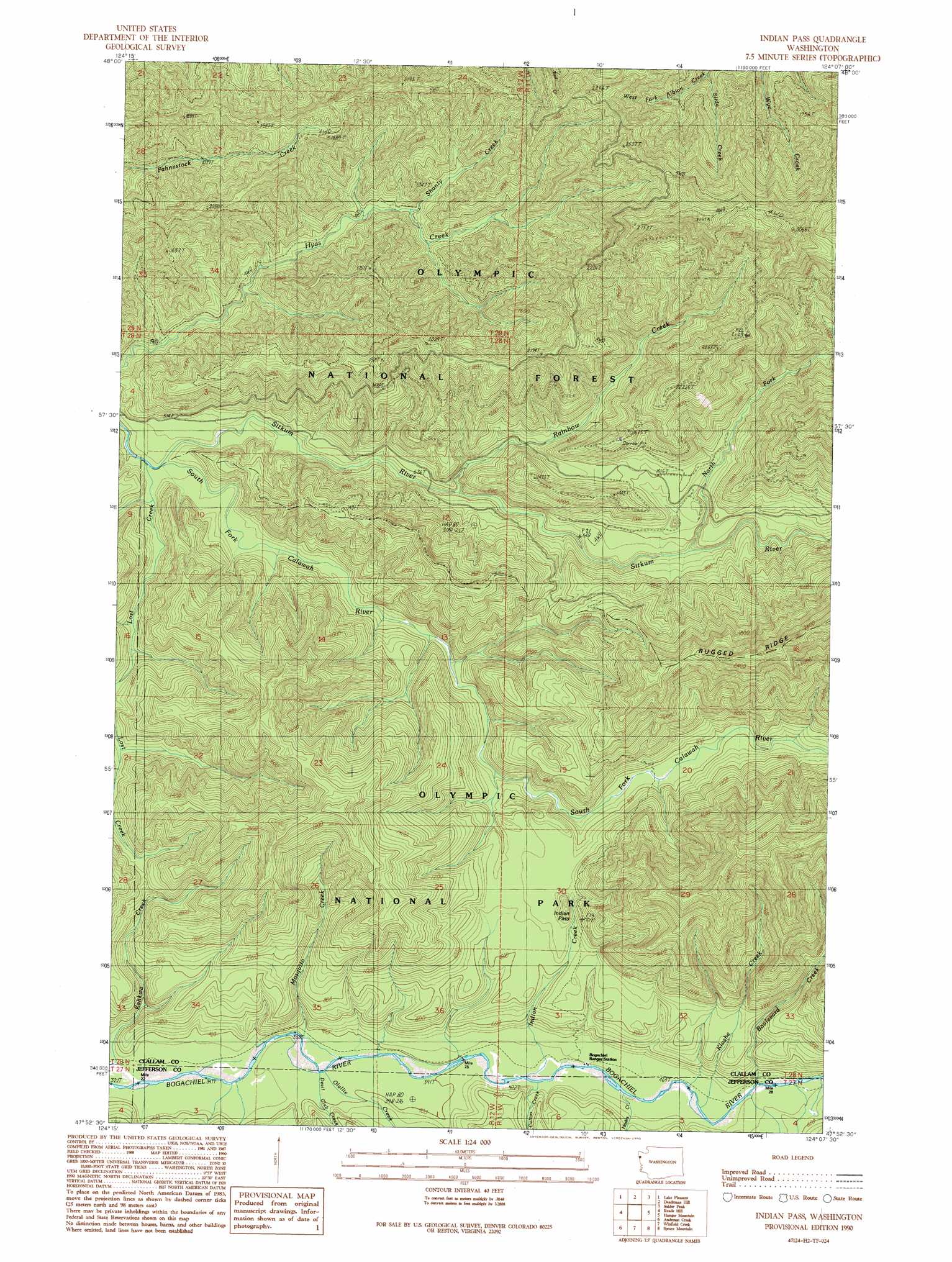
Indian Pass Topo Map Washington
To zoom in, hover over the map of Indian Pass
USGS Topo Quad 47124h2 - 1:24,000 scale
| Topo Map Name: | Indian Pass |
| USGS Topo Quad ID: | 47124h2 |
| Print Size: | ca. 21 1/4" wide x 27" high |
| Southeast Coordinates: | 47.875° N latitude / 124.125° W longitude |
| Map Center Coordinates: | 47.9375° N latitude / 124.1875° W longitude |
| U.S. State: | WA |
| Filename: | o47124h2.jpg |
| Download Map JPG Image: | Indian Pass topo map 1:24,000 scale |
| Map Type: | Topographic |
| Topo Series: | 7.5´ |
| Map Scale: | 1:24,000 |
| Source of Map Images: | United States Geological Survey (USGS) |
| Alternate Map Versions: |
Indian Pass WA 1990, updated 1990 Download PDF Buy paper map Indian Pass WA 2011 Download PDF Buy paper map Indian Pass WA 2014 Download PDF Buy paper map |
| FStopo: | US Forest Service topo Indian Pass is available: Download FStopo PDF Download FStopo TIF |
1:24,000 Topo Quads surrounding Indian Pass
Hoko Falls |
Ellis Mountain |
West Of Pysht |
Pysht |
Twin Rivers |
Gunderson Mountain |
Lake Pleasant |
Deadmans Hill |
Snider Peak |
Mount Muller |
Forks |
Reade Hill |
Indian Pass |
Hunger Mountain |
Slide Peak |
Hoh Head |
Anderson Creek |
Winfield Creek |
Spruce Mountain |
Owl Mountain |
Destruction Island |
Kalaoch Ridge |
Christmas Creek |
Stequaleho Creek |
Kloochman Rock |
> Back to 47124e1 at 1:100,000 scale
> Back to 47124a1 at 1:250,000 scale
> Back to U.S. Topo Maps home
Indian Pass topo map: Gazetteer
Indian Pass: Streams
Boulevard Creek elevation 148m 485′Cultus Creek elevation 129m 423′
Devil Club Creek elevation 113m 370′
Hades Creek elevation 135m 442′
Indian Creek elevation 128m 419′
Kahkwa Creek elevation 104m 341′
Kloshe Creek elevation 143m 469′
Mosquito Creek elevation 110m 360′
North Fork Sitkum River elevation 204m 669′
Olallie Creek elevation 115m 377′
Rainbow Creek elevation 173m 567′
Shanty Creek elevation 240m 787′
Sitkum River elevation 127m 416′
Slide Creek elevation 280m 918′
Indian Pass: Trails
Pass Trail elevation 344m 1128′Rugged Ridge Trail elevation 522m 1712′
Indian Pass digital topo map on disk
Buy this Indian Pass topo map showing relief, roads, GPS coordinates and other geographical features, as a high-resolution digital map file on DVD: