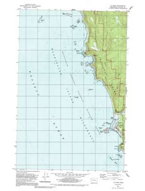
La Push Topo Map Washington
To zoom in, hover over the map of La Push
USGS Topo Quad 47124h6 - 1:24,000 scale
| Topo Map Name: | La Push |
| USGS Topo Quad ID: | 47124h6 |
| Print Size: | ca. 21 1/4" wide x 27" high |
| Southeast Coordinates: | 47.875° N latitude / 124.625° W longitude |
| Map Center Coordinates: | 47.9375° N latitude / 124.6875° W longitude |
| U.S. State: | WA |
| Filename: | o47124h6.jpg |
| Download Map JPG Image: | La Push topo map 1:24,000 scale |
| Map Type: | Topographic |
| Topo Series: | 7.5´ |
| Map Scale: | 1:24,000 |
| Source of Map Images: | United States Geological Survey (USGS) |
| Alternate Map Versions: |
La Push WA 1982, updated 1982 Download PDF Buy paper map La Push WA 1982, updated 1991 Download PDF Buy paper map La Push WA 2011 Download PDF Buy paper map La Push WA 2014 Download PDF Buy paper map |
1:24,000 Topo Quads surrounding La Push
Ozette |
Umbrella Creek |
Hoko Falls |
Allens Bay |
Dickey Lake |
Gunderson Mountain |
La Push |
Quillayute Prairie |
Forks |
|
Toleak Point |
Hoh Head |
Destruction Island |
> Back to 47124e1 at 1:100,000 scale
> Back to 47124a1 at 1:250,000 scale
> Back to U.S. Topo Maps home
La Push topo map: Gazetteer
La Push: Arches
Hole-in-the-Wall elevation 12m 39′La Push: Beaches
First Beach elevation -1m -4′Rialto Beach elevation 0m 0′
La Push: Capes
Cape Johnson elevation 44m 144′Quateata elevation 0m 0′
La Push: Islands
Cakesosta elevation 9m 29′Dahdayla elevation 0m 0′
Jagged Island elevation 65m 213′
James Island elevation 49m 160′
Little James Island elevation 49m 160′
Los Frayles elevation 0m 0′
Sandy Island elevation 0m 0′
Sea Lion Rock elevation 7m 22′
La Push: Pillars
Crying Lady Rock elevation 43m 141′Gunsight Rock elevation 1m 3′
Quillayute Needles elevation 9m 29′
La Push: Populated Places
La Push elevation 7m 22′La Push: Streams
Ellen Creek elevation 0m 0′Johnson Creek elevation 3m 9′
Quillayute River elevation 0m 0′
South Branch Ellen Creek elevation 24m 78′
La Push: Summits
Cake Rock elevation 24m 78′La Push digital topo map on disk
Buy this La Push topo map showing relief, roads, GPS coordinates and other geographical features, as a high-resolution digital map file on DVD:


