Belle Harbor Topo Map Michigan
To zoom in, hover over the map of Belle Harbor
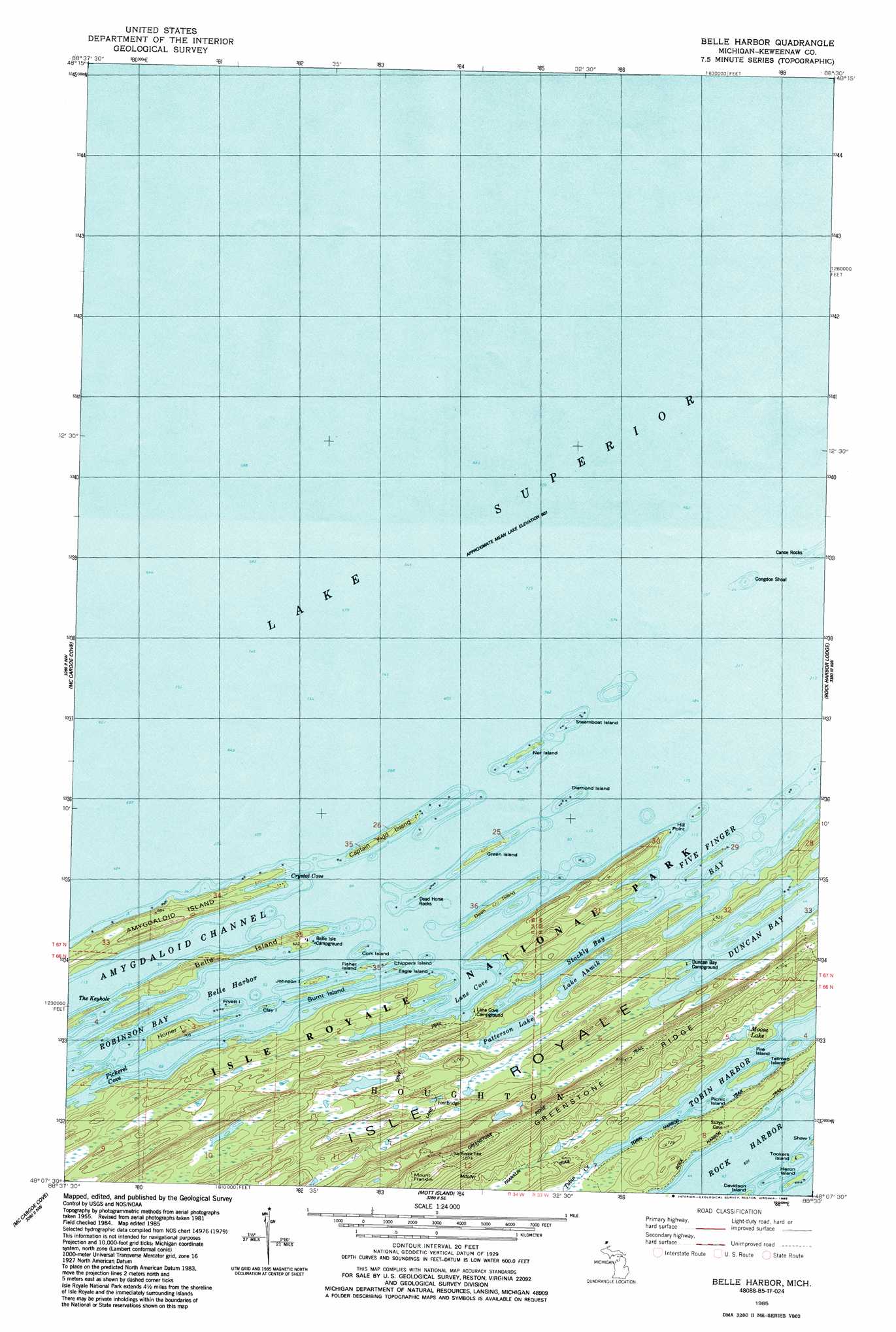
USGS Topo Quad 48088b5 - 1:24,000 scale
| Topo Map Name: | Belle Harbor |
| USGS Topo Quad ID: | 48088b5 |
| Print Size: | ca. 21 1/4" wide x 27" high |
| Southeast Coordinates: | 48.125° N latitude / 88.5° W longitude |
| Map Center Coordinates: | 48.1875° N latitude / 88.5625° W longitude |
| U.S. State: | MI |
| Filename: | o48088b5.jpg |
| Download Map JPG Image: | Belle Harbor topo map 1:24,000 scale |
| Map Type: | Topographic |
| Topo Series: | 7.5´ |
| Map Scale: | 1:24,000 |
| Source of Map Images: | United States Geological Survey (USGS) |
| Alternate Map Versions: |
Belle Harbor MI 1985, updated 1986 Download PDF Buy paper map Belle Harbor MI 2011 Download PDF Buy paper map Belle Harbor MI 2014 Download PDF Buy paper map Belle Harbor MI 2017 Download PDF Buy paper map |
1:24,000 Topo Quads surrounding Belle Harbor
Belle Harbor |
Rock Harbor Lodge |
Passage Island |
||
Todd Harbor |
McCargoe Cove |
Mott Island |
||
Malone Bay |
Lake Richie |
> Back to 48088a1 at 1:100,000 scale
> Back to 48088a1 at 1:250,000 scale
> Back to U.S. Topo Maps home
Belle Harbor topo map: Gazetteer
Belle Harbor: Bars
Congdon Shoal elevation 183m 600′Dead Horse Rocks elevation 185m 606′
Belle Harbor: Bays
Belle Harbor elevation 183m 600′Crystal Cove elevation 183m 600′
Duncan Bay elevation 183m 600′
Five Finger Bay elevation 183m 600′
Lane Cove elevation 183m 600′
Robinson Bay elevation 183m 600′
Stockly Bay elevation 183m 600′
Belle Harbor: Beaches
Hancock Beach elevation 207m 679′Belle Harbor: Capes
Hill Point elevation 194m 636′Belle Harbor: Channels
Amygdaloid Channel elevation 183m 600′The Keyhole elevation 183m 600′
Belle Harbor: Islands
Amygdaloid Island elevation 203m 666′Belle Isle elevation 198m 649′
Burnt Island elevation 189m 620′
Captain Kidd Island elevation 189m 620′
Chippers Island elevation 184m 603′
Clay Island elevation 183m 600′
Cork Island elevation 185m 606′
Dean Island elevation 189m 620′
Diamond Island elevation 185m 606′
Eagle Island elevation 183m 600′
Fire Island elevation 185m 606′
Fisher Island elevation 189m 620′
Fryett Island elevation 183m 600′
Green Island elevation 189m 620′
Heron Island elevation 183m 600′
Horner Island elevation 202m 662′
Johnson Island elevation 189m 620′
Net Island elevation 183m 600′
Picnic Island elevation 185m 606′
Steamboat Island elevation 184m 603′
Tallman Island elevation 189m 620′
Tookers Island elevation 184m 603′
Belle Harbor: Lakes
Lake Ahmik elevation 190m 623′Moose Lake elevation 190m 623′
Patterson Lake elevation 190m 623′
Patterson Lake elevation 190m 623′
Belle Harbor: Parks
Lauren Grove Park elevation 215m 705′Belle Harbor: Streams
Tobin Creek elevation 186m 610′Belle Harbor: Summits
Mount Franklin elevation 286m 938′Belle Harbor: Trails
Lane Cove Trail elevation 275m 902′Mount Franklin Trail elevation 219m 718′
Tobin Harbor Trail elevation 199m 652′
Belle Harbor digital topo map on disk
Buy this Belle Harbor topo map showing relief, roads, GPS coordinates and other geographical features, as a high-resolution digital map file on DVD: