Jackfish Lake Topo Map Minnesota
To zoom in, hover over the map of Jackfish Lake
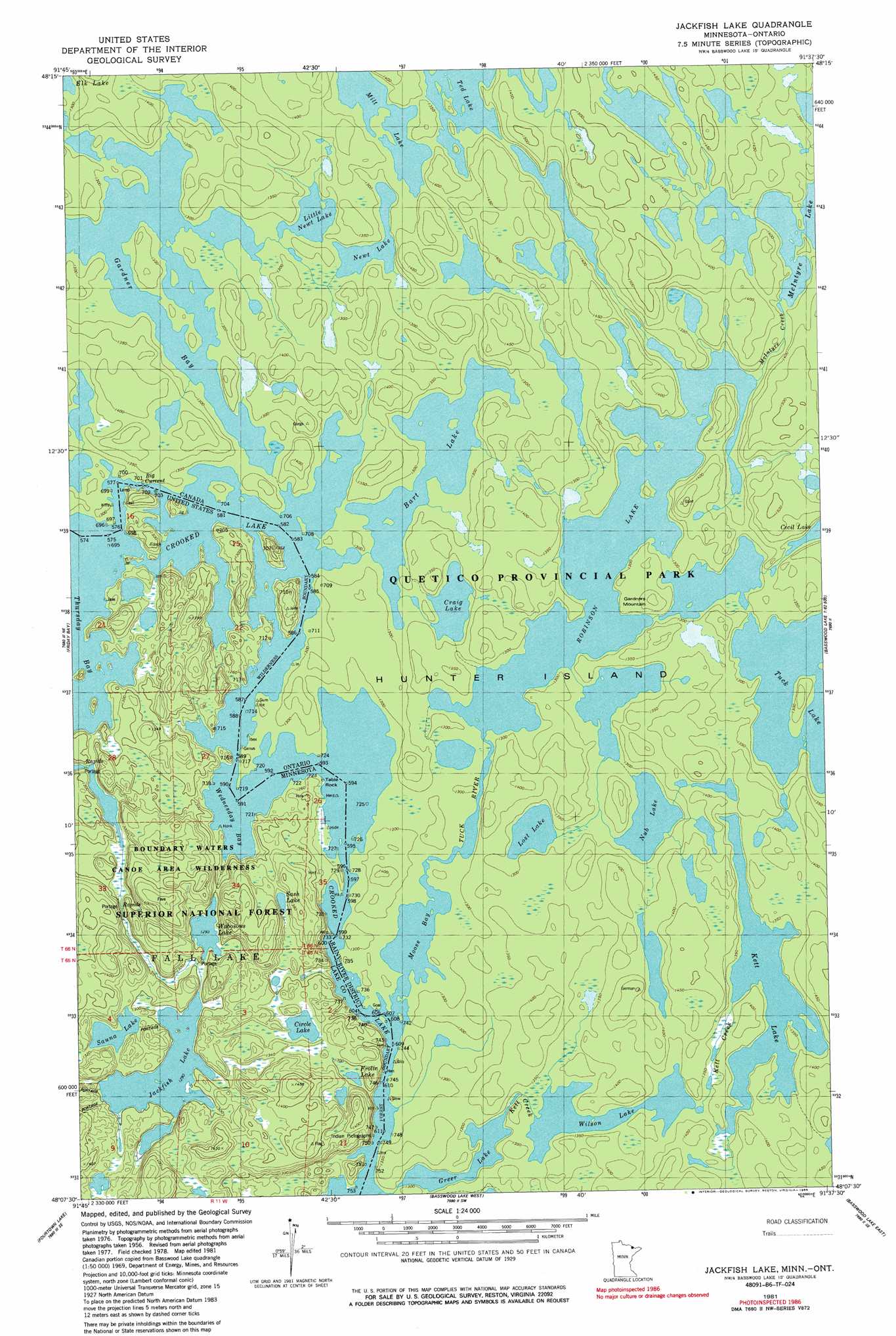
USGS Topo Quad 48091b6 - 1:24,000 scale
| Topo Map Name: | Jackfish Lake |
| USGS Topo Quad ID: | 48091b6 |
| Print Size: | ca. 21 1/4" wide x 27" high |
| Southeast Coordinates: | 48.125° N latitude / 91.625° W longitude |
| Map Center Coordinates: | 48.1875° N latitude / 91.6875° W longitude |
| U.S. State: | MN |
| Filename: | o48091b6.jpg |
| Download Map JPG Image: | Jackfish Lake topo map 1:24,000 scale |
| Map Type: | Topographic |
| Topo Series: | 7.5´ |
| Map Scale: | 1:24,000 |
| Source of Map Images: | United States Geological Survey (USGS) |
| Alternate Map Versions: |
Basswood Lake NW MN 1976, updated 1979 Download PDF Buy paper map Jackfish Lake MN 1981, updated 1982 Download PDF Buy paper map Jackfish Lake MN 1981, updated 1986 Download PDF Buy paper map Jackfish Lake MN 2011 Download PDF Buy paper map Jackfish Lake MN 2013 Download PDF Buy paper map Jackfish Lake MN 2016 Download PDF Buy paper map |
| FStopo: | US Forest Service topo Jackfish Lake is available: Download FStopo PDF Download FStopo TIF |
1:24,000 Topo Quads surrounding Jackfish Lake
Iron Lake |
Friday Bay |
Jackfish Lake |
||
Angleworm Lake |
Fourtown Lake |
Basswood Lake West |
Basswood Lake East |
Ensign Lake West |
Shagawa Lake |
Ely |
Farm Lake |
Ojibway Lake |
Snowbank Lake |
> Back to 48091a1 at 1:100,000 scale
> Back to 48090a1 at 1:250,000 scale
> Back to U.S. Topo Maps home
Jackfish Lake topo map: Gazetteer
Jackfish Lake: Bays
Wednesday Bay elevation 380m 1246′Jackfish Lake: Lakes
Circle Lake elevation 398m 1305′Frolic Lake elevation 394m 1292′
Jackfish Lake elevation 393m 1289′
Sash Lake elevation 400m 1312′
Sauna Lake elevation 398m 1305′
Wabosons Lake elevation 394m 1292′
Jackfish Lake: Pillars
Picture Rock elevation 387m 1269′Table Rock elevation 381m 1250′
Jackfish Lake digital topo map on disk
Buy this Jackfish Lake topo map showing relief, roads, GPS coordinates and other geographical features, as a high-resolution digital map file on DVD: