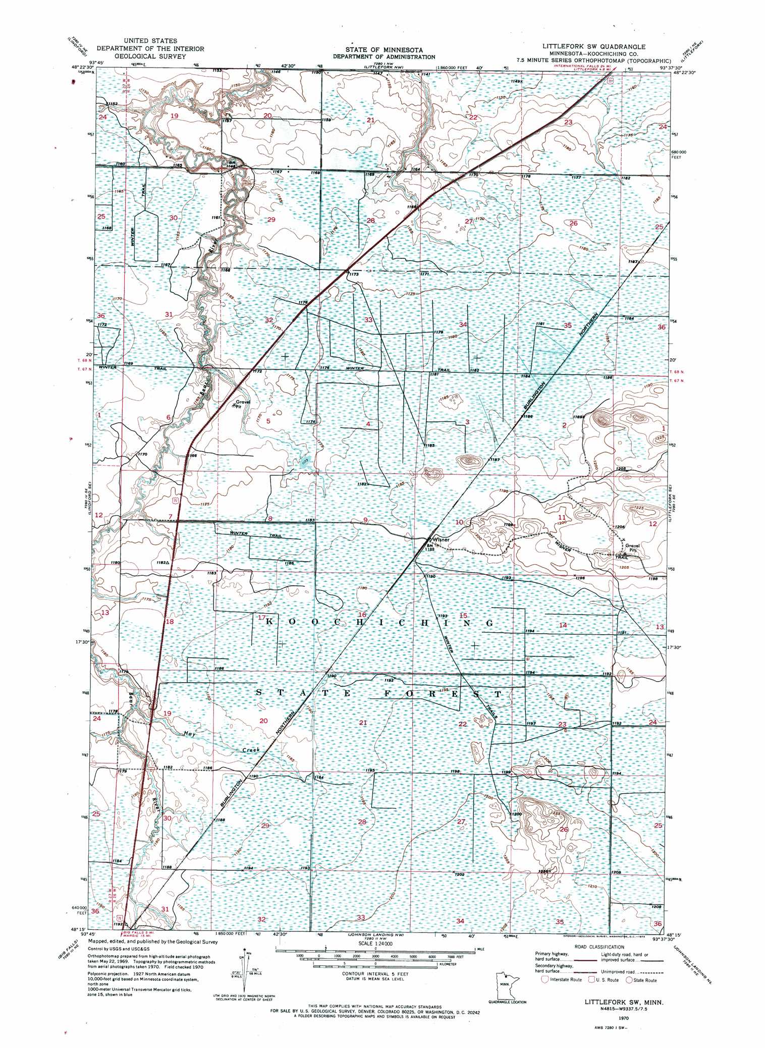
Littlefork Sw Topo Map Minnesota
To zoom in, hover over the map of Littlefork Sw
USGS Topo Quad 48093c6 - 1:24,000 scale
| Topo Map Name: | Littlefork Sw |
| USGS Topo Quad ID: | 48093c6 |
| Print Size: | ca. 21 1/4" wide x 27" high |
| Southeast Coordinates: | 48.25° N latitude / 93.625° W longitude |
| Map Center Coordinates: | 48.3125° N latitude / 93.6875° W longitude |
| U.S. State: | MN |
| Filename: | p48093c6.jpg |
| Download Map JPG Image: | Littlefork Sw topo map 1:24,000 scale |
| Map Type: | Orthophoto |
| Topo Series: | 7.5´ |
| Map Scale: | 1:24,000 |
| Source of Map Images: | United States Geological Survey (USGS) |
| Alternate Map Versions: |
Littlefork SW MN 1970, updated 1973 Download PDF Buy paper map Littlefork SW MN 2010 Download PDF Buy paper map Littlefork SW MN 2013 Download PDF Buy paper map Littlefork SW MN 2016 Download PDF Buy paper map |
1:24,000 Topo Quads surrounding Littlefork Sw
Manitou |
Loman |
Devlin |
Pelland |
International Falls |
Lindford Nw |
Lindford |
Littlefork Nw |
Littlefork |
Ericsburg Nw |
Lindford Sw |
Lindford Se |
Littlefork Sw |
Littlefork Se |
Ericsburg Sw |
Big Falls Nw |
Big Falls |
Johnson Landing Nw |
Johnson Landing Ne |
Nett Lake River West |
Margie |
Big Falls Se |
Johnson Landing |
Johnson Landing Se |
Nett Lake River Sw |
> Back to 48093a1 at 1:100,000 scale
> Back to 48092a1 at 1:250,000 scale
> Back to U.S. Topo Maps home
Littlefork Sw topo map: Gazetteer
Littlefork Sw: Populated Places
Wisner elevation 363m 1190′Littlefork Sw: Post Offices
Waukanha Post Office (historical) elevation 363m 1190′Littlefork Sw: Streams
Hay Creek elevation 357m 1171′Littlefork Sw: Trails
Wisner Trail elevation 372m 1220′Littlefork Sw digital topo map on disk
Buy this Littlefork Sw topo map showing relief, roads, GPS coordinates and other geographical features, as a high-resolution digital map file on DVD: