Lindford Se Topo Map Minnesota
To zoom in, hover over the map of Lindford Se
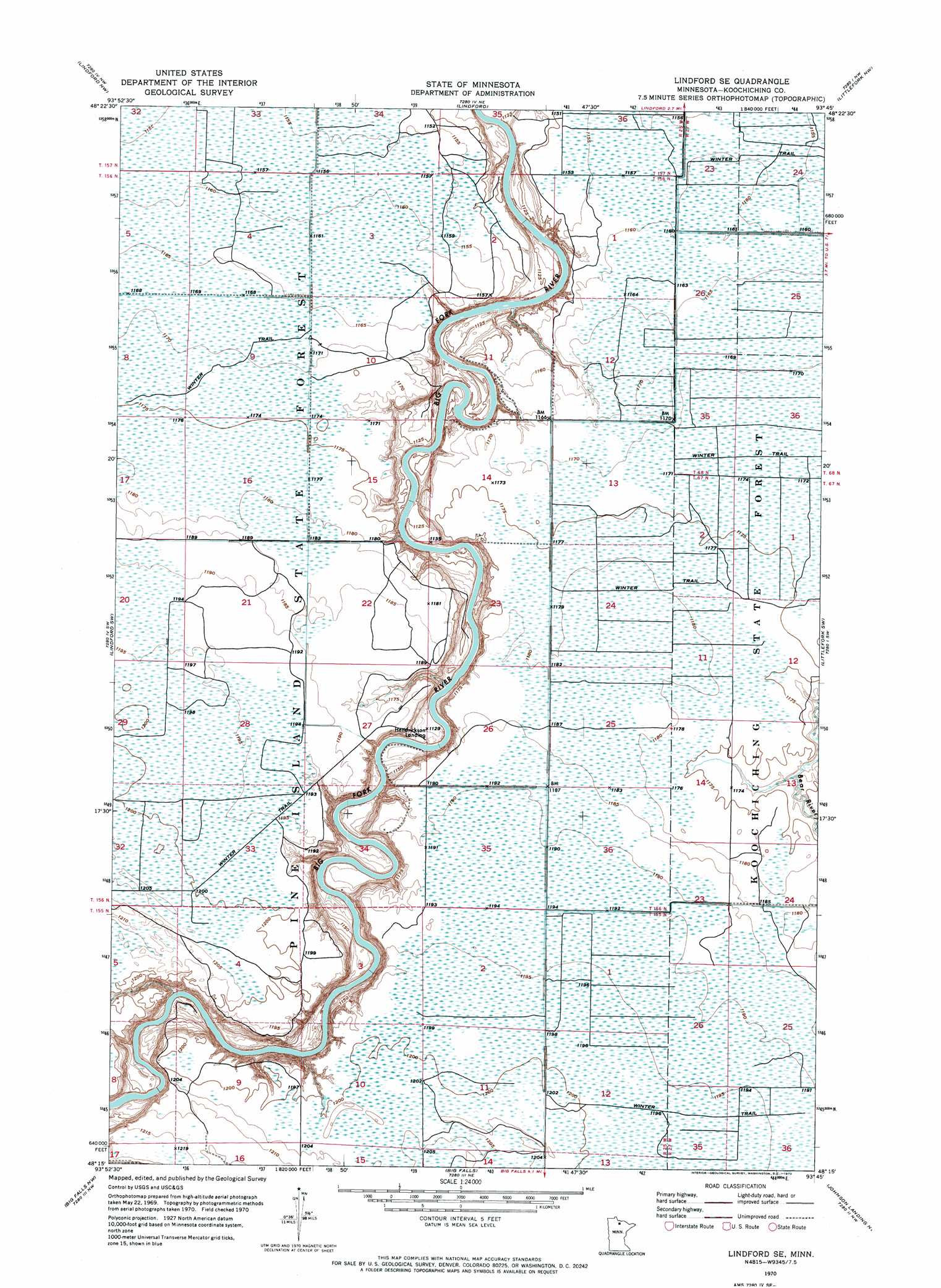
USGS Topo Quad 48093c7 - 1:24,000 scale
| Topo Map Name: | Lindford Se |
| USGS Topo Quad ID: | 48093c7 |
| Print Size: | ca. 21 1/4" wide x 27" high |
| Southeast Coordinates: | 48.25° N latitude / 93.75° W longitude |
| Map Center Coordinates: | 48.3125° N latitude / 93.8125° W longitude |
| U.S. State: | MN |
| Filename: | p48093c7.jpg |
| Download Map JPG Image: | Lindford Se topo map 1:24,000 scale |
| Map Type: | Orthophoto |
| Topo Series: | 7.5´ |
| Map Scale: | 1:24,000 |
| Source of Map Images: | United States Geological Survey (USGS) |
| Alternate Map Versions: |
Lindford SE MN 1970, updated 1973 Download PDF Buy paper map Lindford SE MN 2010 Download PDF Buy paper map Lindford SE MN 2013 Download PDF Buy paper map Lindford SE MN 2016 Download PDF Buy paper map |
1:24,000 Topo Quads surrounding Lindford Se
Birchdale Se |
Manitou |
Loman |
Devlin |
Pelland |
Fairland Ne |
Lindford Nw |
Lindford |
Littlefork Nw |
Littlefork |
Giant Pine Campground |
Lindford Sw |
Lindford Se |
Littlefork Sw |
Littlefork Se |
Ridge Ne |
Big Falls Nw |
Big Falls |
Johnson Landing Nw |
Johnson Landing Ne |
Ridge |
Margie |
Big Falls Se |
Johnson Landing |
Johnson Landing Se |
> Back to 48093a1 at 1:100,000 scale
> Back to 48092a1 at 1:250,000 scale
> Back to U.S. Topo Maps home
Lindford Se topo map: Gazetteer
Lindford Se: Populated Places
Hendrickson Landing elevation 341m 1118′Lindford Se digital topo map on disk
Buy this Lindford Se topo map showing relief, roads, GPS coordinates and other geographical features, as a high-resolution digital map file on DVD: