Graceton Se Topo Map Minnesota
To zoom in, hover over the map of Graceton Se
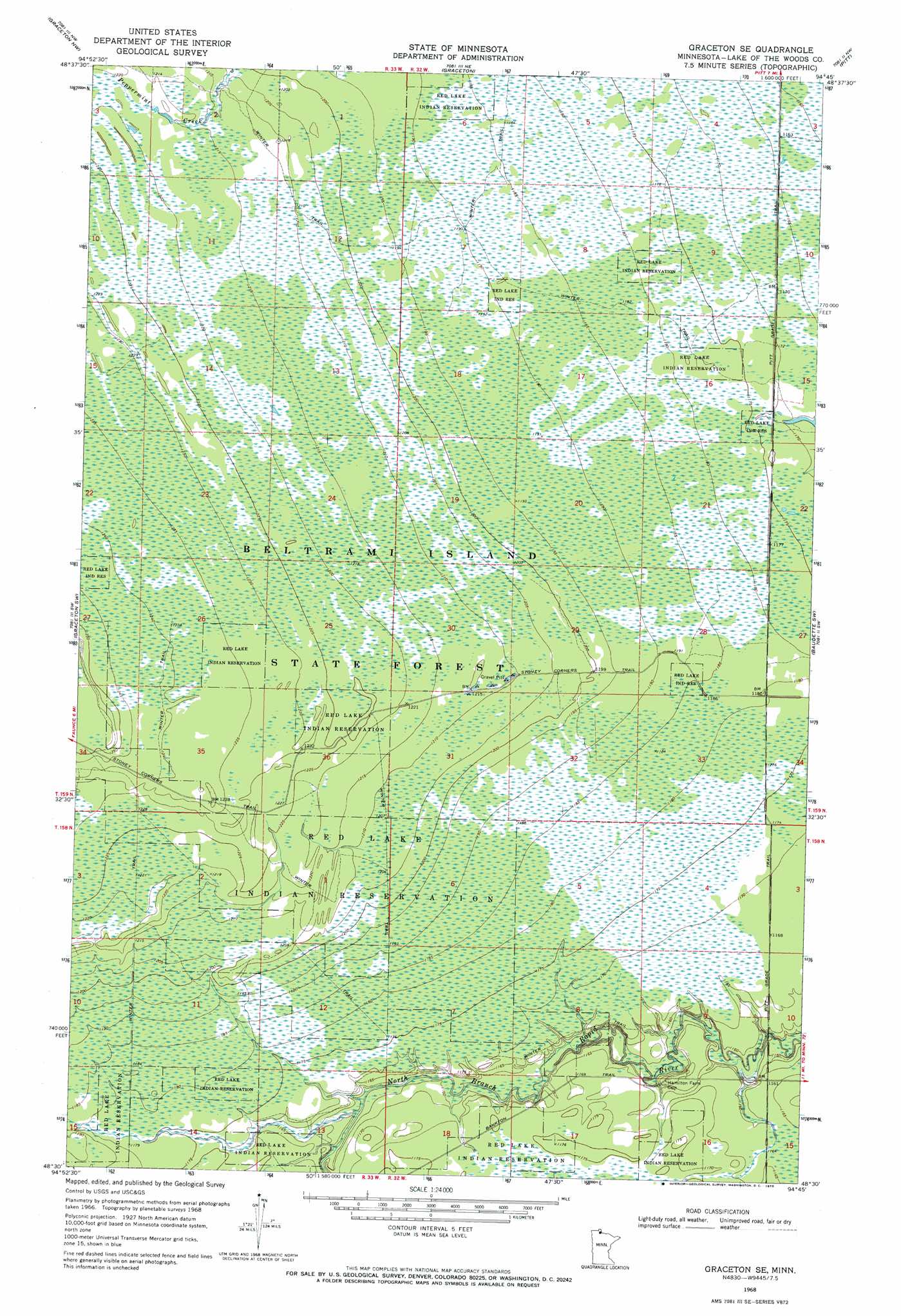
USGS Topo Quad 48094e7 - 1:24,000 scale
| Topo Map Name: | Graceton Se |
| USGS Topo Quad ID: | 48094e7 |
| Print Size: | ca. 21 1/4" wide x 27" high |
| Southeast Coordinates: | 48.5° N latitude / 94.75° W longitude |
| Map Center Coordinates: | 48.5625° N latitude / 94.8125° W longitude |
| U.S. State: | MN |
| Filename: | o48094e7.jpg |
| Download Map JPG Image: | Graceton Se topo map 1:24,000 scale |
| Map Type: | Topographic |
| Topo Series: | 7.5´ |
| Map Scale: | 1:24,000 |
| Source of Map Images: | United States Geological Survey (USGS) |
| Alternate Map Versions: |
Graceton SE MN 1968, updated 1970 Download PDF Buy paper map Graceton SE MN 2010 Download PDF Buy paper map Graceton SE MN 2013 Download PDF Buy paper map Graceton SE MN 2016 Download PDF Buy paper map |
1:24,000 Topo Quads surrounding Graceton Se
Roosevelt |
Williams |
Williams Se |
Wheelers Point |
|
Winter Road Lake |
Graceton Nw |
Graceton |
Pitt |
Baudette |
Winter Road Lake Se |
Graceton Sw |
Graceton Se |
Baudette Sw |
Baudette Se |
Shilling Dam Ne |
Oaks Corner |
Oaks Corner Ne |
Chase Brook |
Chase Brook Ne |
Shilling Dam |
Oaks Corner Sw |
Hilman Lake |
Chase Brook Sw |
Ludlow Lookout Tower |
> Back to 48094e1 at 1:100,000 scale
> Back to 48094a1 at 1:250,000 scale
> Back to U.S. Topo Maps home
Graceton Se topo map: Gazetteer
Graceton Se: Bridges
Lundeen Bridge elevation 350m 1148′Lundeen Bridge elevation 350m 1148′
Lundeen Bridge elevation 350m 1148′
Graceton Se: Trails
Stoney Corners Trail elevation 366m 1200′Graceton Se digital topo map on disk
Buy this Graceton Se topo map showing relief, roads, GPS coordinates and other geographical features, as a high-resolution digital map file on DVD: