Goodridge Sw Topo Map Minnesota
To zoom in, hover over the map of Goodridge Sw
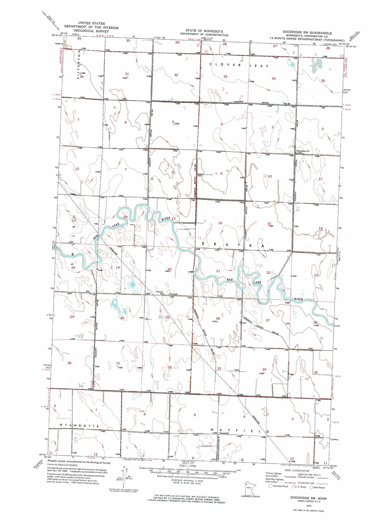
USGS Topo Quad 48095a8 - 1:24,000 scale
| Topo Map Name: | Goodridge Sw |
| USGS Topo Quad ID: | 48095a8 |
| Print Size: | ca. 21 1/4" wide x 27" high |
| Southeast Coordinates: | 48° N latitude / 95.875° W longitude |
| Map Center Coordinates: | 48.0625° N latitude / 95.9375° W longitude |
| U.S. State: | MN |
| Filename: | p48095a8.jpg |
| Download Map JPG Image: | Goodridge Sw topo map 1:24,000 scale |
| Map Type: | Orthophoto |
| Topo Series: | 7.5´ |
| Map Scale: | 1:24,000 |
| Source of Map Images: | United States Geological Survey (USGS) |
| Alternate Map Versions: |
Goodridge SW MN 1972, updated 1976 Download PDF Buy paper map Goodridge SW MN 2010 Download PDF Buy paper map Goodridge SW MN 2013 Download PDF Buy paper map Goodridge SW MN 2016 Download PDF Buy paper map |
1:24,000 Topo Quads surrounding Goodridge Sw
Holt |
Middle River Se |
Gatzke Sw |
Gatzke Se |
Grygla Sw |
Thief River Falls Nw |
Thief River Falls Ne |
Mavie |
Goodridge |
Erie Nw |
Thief River Falls |
Hazel |
Goodridge Sw |
High Landing |
Erie |
Plummer Nw |
Plummer |
Oklee Nw |
Roland |
Gully Nw |
Terrebonne |
Brooks |
Oklee Sw |
Oklee |
Trail |
> Back to 48095a1 at 1:100,000 scale
> Back to 48094a1 at 1:250,000 scale
> Back to U.S. Topo Maps home
Goodridge Sw topo map: Gazetteer
Goodridge Sw: Canals
County Ditch Number Fiftynine elevation 351m 1151′County Ditch Number Fortyfive elevation 349m 1145′
County Ditch Number Fortyfour elevation 352m 1154′
County Ditch Number Fortytwo elevation 349m 1145′
County Ditch Number Thirtynine elevation 351m 1151′
County Ditch Number Thirtytwo elevation 349m 1145′
Goodridge Sw: Post Offices
Kratka Post Office (historical) elevation 351m 1151′Goodridge Sw digital topo map on disk
Buy this Goodridge Sw topo map showing relief, roads, GPS coordinates and other geographical features, as a high-resolution digital map file on DVD: