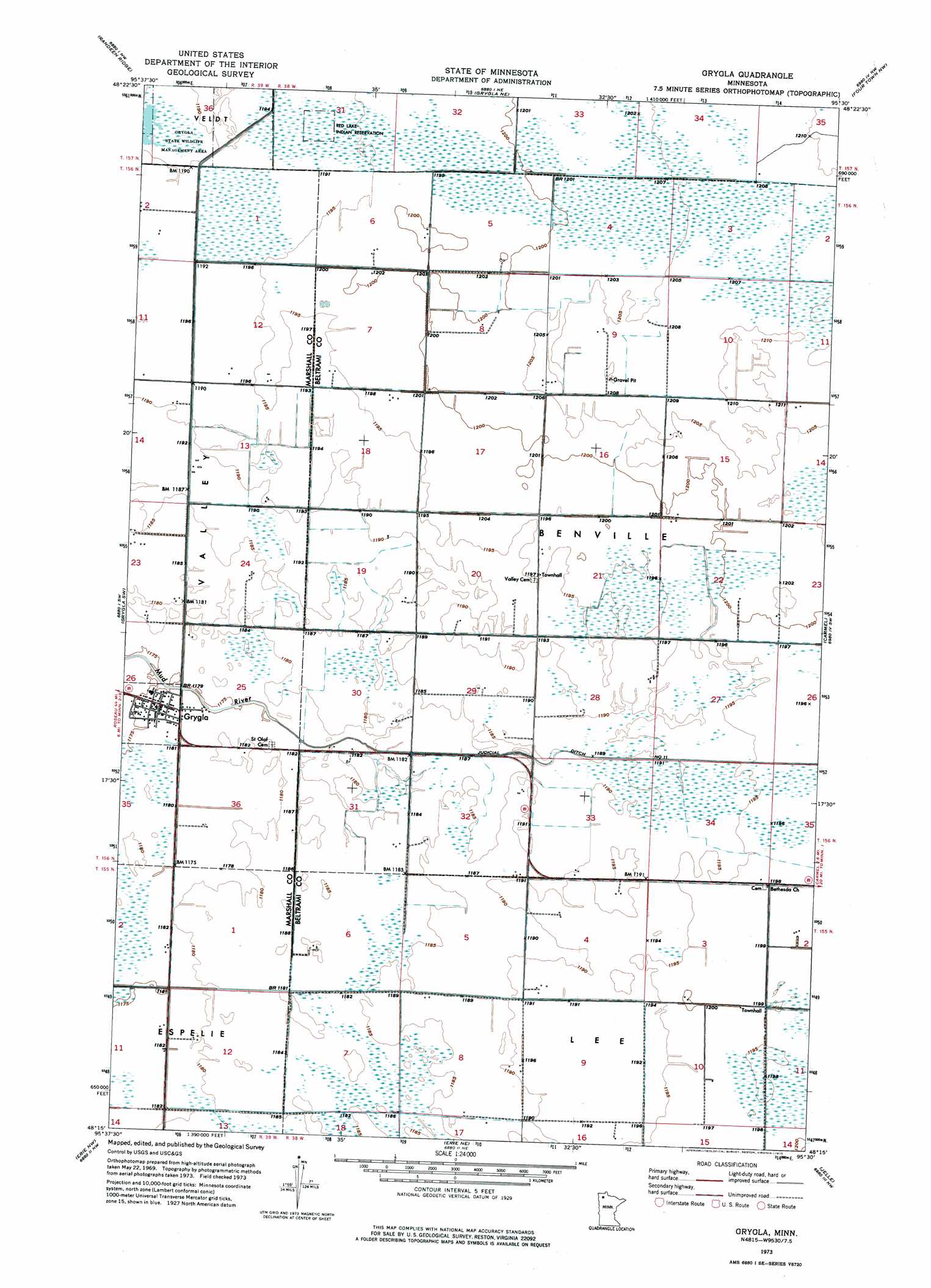
Grygla Topo Map Minnesota
To zoom in, hover over the map of Grygla
USGS Topo Quad 48095c5 - 1:24,000 scale
| Topo Map Name: | Grygla |
| USGS Topo Quad ID: | 48095c5 |
| Print Size: | ca. 21 1/4" wide x 27" high |
| Southeast Coordinates: | 48.25° N latitude / 95.5° W longitude |
| Map Center Coordinates: | 48.3125° N latitude / 95.5625° W longitude |
| U.S. State: | MN |
| Filename: | p48095c5.jpg |
| Download Map JPG Image: | Grygla topo map 1:24,000 scale |
| Map Type: | Orthophoto |
| Topo Series: | 7.5´ |
| Map Scale: | 1:24,000 |
| Source of Map Images: | United States Geological Survey (USGS) |
| Alternate Map Versions: |
Grygla MN 1973, updated 1976 Download PDF Buy paper map Grygla MN 2010 Download PDF Buy paper map Grygla MN 2013 Download PDF Buy paper map Grygla MN 2016 Download PDF Buy paper map |
1:24,000 Topo Quads surrounding Grygla
Thief Lake Se |
Wannaska Sw |
Skime |
Mulligan Lake Sw |
Mulligan Lake |
Gatzke |
Randeen Ridge |
Grygla Ne |
Four Town Nw |
Gates Corner |
Gatzke Se |
Grygla Sw |
Grygla |
Carmel |
Four Town |
Goodridge |
Erie Nw |
Erie Ne |
Jelle |
Jelle Ne |
High Landing |
Erie |
Good Lake |
Cahill Lake |
Gimiwan Lake |
> Back to 48095a1 at 1:100,000 scale
> Back to 48094a1 at 1:250,000 scale
> Back to U.S. Topo Maps home
Grygla topo map: Gazetteer
Grygla: Canals
Judicial Ditch Number Eleven elevation 362m 1187′Grygla: Parks
Grygla State Wildlife Management Area elevation 363m 1190′Grygla: Populated Places
Grygla elevation 359m 1177′Grygla Trailer Court elevation 359m 1177′
Grygla: Post Offices
Grygla Post Office (historical) elevation 359m 1177′Myran Post Office (historical) elevation 365m 1197′
Grygla digital topo map on disk
Buy this Grygla topo map showing relief, roads, GPS coordinates and other geographical features, as a high-resolution digital map file on DVD: