Gatzke Se Topo Map Minnesota
To zoom in, hover over the map of Gatzke Se
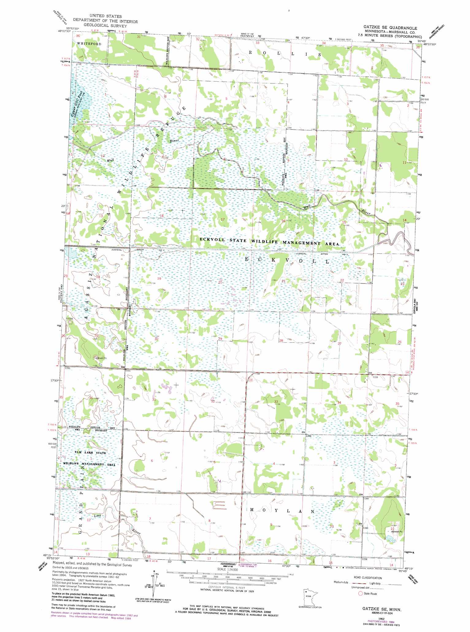
USGS Topo Quad 48095c7 - 1:24,000 scale
| Topo Map Name: | Gatzke Se |
| USGS Topo Quad ID: | 48095c7 |
| Print Size: | ca. 21 1/4" wide x 27" high |
| Southeast Coordinates: | 48.25° N latitude / 95.75° W longitude |
| Map Center Coordinates: | 48.3125° N latitude / 95.8125° W longitude |
| U.S. State: | MN |
| Filename: | o48095c7.jpg |
| Download Map JPG Image: | Gatzke Se topo map 1:24,000 scale |
| Map Type: | Topographic |
| Topo Series: | 7.5´ |
| Map Scale: | 1:24,000 |
| Source of Map Images: | United States Geological Survey (USGS) |
| Alternate Map Versions: |
Gatzke SE MN 1962, updated 1964 Download PDF Buy paper map Gatzke SE MN 1962, updated 1984 Download PDF Buy paper map Gatzke SE MN 2010 Download PDF Buy paper map Gatzke SE MN 2013 Download PDF Buy paper map Gatzke SE MN 2016 Download PDF Buy paper map |
1:24,000 Topo Quads surrounding Gatzke Se
Greenbush Se |
Thief Lake |
Thief Lake Se |
Wannaska Sw |
Skime |
Middle River Ne |
Gatzke Nw |
Gatzke |
Randeen Ridge |
Grygla Ne |
Middle River Se |
Gatzke Sw |
Gatzke Se |
Grygla Sw |
Grygla |
Thief River Falls Ne |
Mavie |
Goodridge |
Erie Nw |
Erie Ne |
Hazel |
Goodridge Sw |
High Landing |
Erie |
Good Lake |
> Back to 48095a1 at 1:100,000 scale
> Back to 48094a1 at 1:250,000 scale
> Back to U.S. Topo Maps home
Gatzke Se topo map: Gazetteer
Gatzke Se: Airports
Arthur Field elevation 352m 1154′Klamar Field elevation 353m 1158′
Gatzke Se: Parks
Eckvoll Wildlife Management Area elevation 352m 1154′Gatzke Se: Post Offices
Anstad Post Office (historical) elevation 354m 1161′Fram Post Office (historical) elevation 352m 1154′
Gatzke Se digital topo map on disk
Buy this Gatzke Se topo map showing relief, roads, GPS coordinates and other geographical features, as a high-resolution digital map file on DVD: