Mulligan Lake Nw Topo Map Minnesota
To zoom in, hover over the map of Mulligan Lake Nw
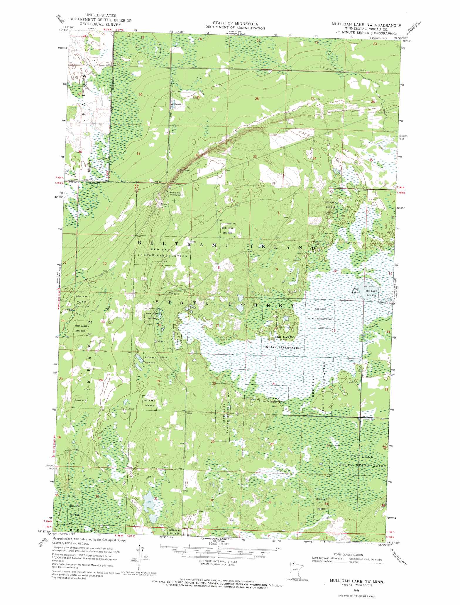
USGS Topo Quad 48095f4 - 1:24,000 scale
| Topo Map Name: | Mulligan Lake Nw |
| USGS Topo Quad ID: | 48095f4 |
| Print Size: | ca. 21 1/4" wide x 27" high |
| Southeast Coordinates: | 48.625° N latitude / 95.375° W longitude |
| Map Center Coordinates: | 48.6875° N latitude / 95.4375° W longitude |
| U.S. State: | MN |
| Filename: | o48095f4.jpg |
| Download Map JPG Image: | Mulligan Lake Nw topo map 1:24,000 scale |
| Map Type: | Topographic |
| Topo Series: | 7.5´ |
| Map Scale: | 1:24,000 |
| Source of Map Images: | United States Geological Survey (USGS) |
| Alternate Map Versions: |
Mulligan Lake NW MN 1968, updated 1971 Download PDF Buy paper map Mulligan Lake NW MN 2010 Download PDF Buy paper map Mulligan Lake NW MN 2013 Download PDF Buy paper map Mulligan Lake NW MN 2016 Download PDF Buy paper map |
1:24,000 Topo Quads surrounding Mulligan Lake Nw
Salol Nw |
Salol Ne |
Warroad Nw |
Warroad |
Roosevelt Nw |
Malung |
Salol |
Warroad Sw |
Warroad Se |
Swift |
Wannaska |
Wannaska Ne |
Mulligan Lake Nw |
Mulligan Lake Ne |
Winter Road Lake Nw |
Wannaska Sw |
Skime |
Mulligan Lake Sw |
Mulligan Lake |
Winter Road Lake Sw |
Randeen Ridge |
Grygla Ne |
Four Town Nw |
Gates Corner |
Shilling Dam Nw |
> Back to 48095e1 at 1:100,000 scale
> Back to 48094a1 at 1:250,000 scale
> Back to U.S. Topo Maps home
Mulligan Lake Nw digital topo map on disk
Buy this Mulligan Lake Nw topo map showing relief, roads, GPS coordinates and other geographical features, as a high-resolution digital map file on DVD: