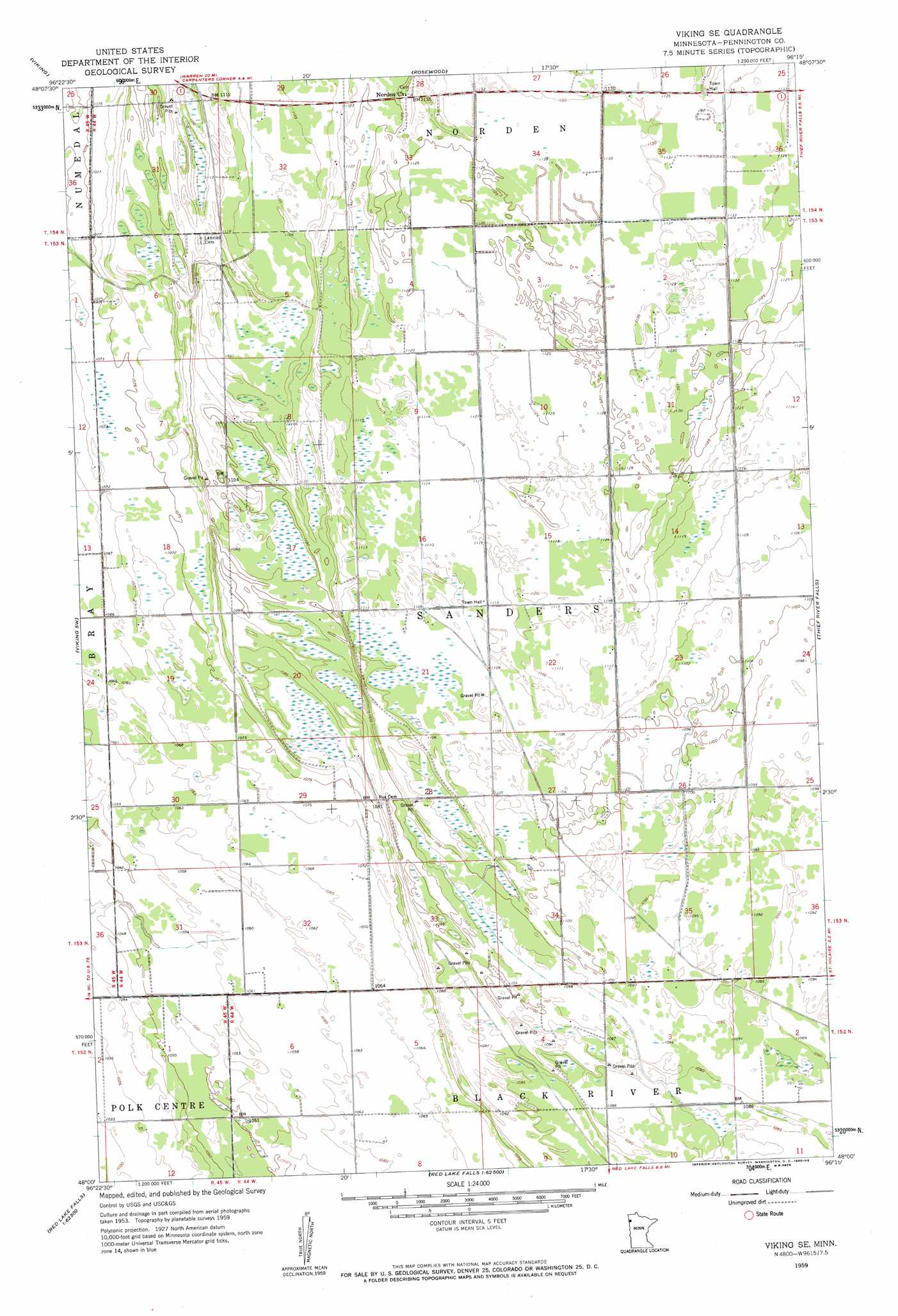
Viking Se Topo Map Minnesota
To zoom in, hover over the map of Viking Se
USGS Topo Quad 48096a3 - 1:24,000 scale
| Topo Map Name: | Viking Se |
| USGS Topo Quad ID: | 48096a3 |
| Print Size: | ca. 21 1/4" wide x 27" high |
| Southeast Coordinates: | 48° N latitude / 96.25° W longitude |
| Map Center Coordinates: | 48.0625° N latitude / 96.3125° W longitude |
| U.S. State: | MN |
| Filename: | o48096a3.jpg |
| Download Map JPG Image: | Viking Se topo map 1:24,000 scale |
| Map Type: | Topographic |
| Topo Series: | 7.5´ |
| Map Scale: | 1:24,000 |
| Source of Map Images: | United States Geological Survey (USGS) |
| Alternate Map Versions: |
Viking SE MN 1959, updated 1960 Download PDF Buy paper map Viking SE MN 2010 Download PDF Buy paper map Viking SE MN 2013 Download PDF Buy paper map Viking SE MN 2016 Download PDF Buy paper map |
1:24,000 Topo Quads surrounding Viking Se
Florian Se |
Ellerth |
Newfolden |
Holt |
Middle River Se |
Radium |
Viking |
Rosewood |
Thief River Falls Nw |
Thief River Falls Ne |
Angus Se |
Viking Sw |
Viking Se |
Thief River Falls |
Hazel |
Crookston Ne |
Dorothy |
Red Lake Falls |
Plummer Nw |
Plummer |
Crookston |
Gentilly |
Marcoux Corners |
Terrebonne |
Brooks |
> Back to 48096a1 at 1:100,000 scale
> Back to 48096a1 at 1:250,000 scale
> Back to U.S. Topo Maps home
Viking Se digital topo map on disk
Buy this Viking Se topo map showing relief, roads, GPS coordinates and other geographical features, as a high-resolution digital map file on DVD:
Eastern North Dakota & Eastern South Dakota
Buy digital topo maps: Eastern North Dakota & Eastern South Dakota