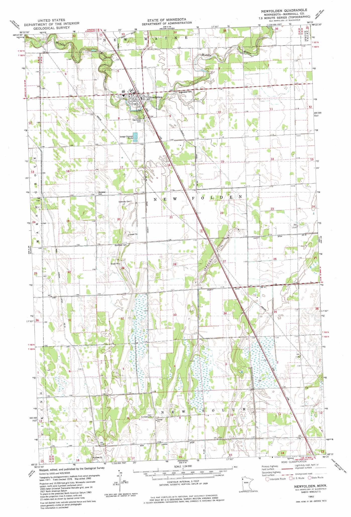
Newfolden Topo Map Minnesota
To zoom in, hover over the map of Newfolden
USGS Topo Quad 48096c3 - 1:24,000 scale
| Topo Map Name: | Newfolden |
| USGS Topo Quad ID: | 48096c3 |
| Print Size: | ca. 21 1/4" wide x 27" high |
| Southeast Coordinates: | 48.25° N latitude / 96.25° W longitude |
| Map Center Coordinates: | 48.3125° N latitude / 96.3125° W longitude |
| U.S. State: | MN |
| Filename: | o48096c3.jpg |
| Download Map JPG Image: | Newfolden topo map 1:24,000 scale |
| Map Type: | Topographic |
| Topo Series: | 7.5´ |
| Map Scale: | 1:24,000 |
| Source of Map Images: | United States Geological Survey (USGS) |
| Alternate Map Versions: |
Newfolden MN 1982, updated 1982 Download PDF Buy paper map Newfolden MN 2010 Download PDF Buy paper map Newfolden MN 2013 Download PDF Buy paper map Newfolden MN 2016 Download PDF Buy paper map |
1:24,000 Topo Quads surrounding Newfolden
Karlstad |
Twistal Swamp |
Pelan Se |
Strathcona |
Greenbush Se |
Florian Ne |
Strandquist |
Nelson Slough |
Middle River |
Middle River Ne |
Florian Se |
Ellerth |
Newfolden |
Holt |
Middle River Se |
Radium |
Viking |
Rosewood |
Thief River Falls Nw |
Thief River Falls Ne |
Angus Se |
Viking Sw |
Viking Se |
Thief River Falls |
Hazel |
> Back to 48096a1 at 1:100,000 scale
> Back to 48096a1 at 1:250,000 scale
> Back to U.S. Topo Maps home
Newfolden topo map: Gazetteer
Newfolden: Canals
County Ditch Number Fifteen elevation 340m 1115′County Ditch Number Forty elevation 340m 1115′
Main Judicial Ditch Number Fifteen elevation 332m 1089′
Newfolden: Populated Places
Newfolden elevation 334m 1095′Newfolden: Post Offices
Baltic Post Office (historical) elevation 342m 1122′Klep Post Office (historical) elevation 336m 1102′
Llewellyn Post Office (historical) elevation 348m 1141′
Newfolden Post Office (historical) elevation 334m 1095′
Newfolden digital topo map on disk
Buy this Newfolden topo map showing relief, roads, GPS coordinates and other geographical features, as a high-resolution digital map file on DVD:
Eastern North Dakota & Eastern South Dakota
Buy digital topo maps: Eastern North Dakota & Eastern South Dakota