Karlstad Topo Map Minnesota
To zoom in, hover over the map of Karlstad
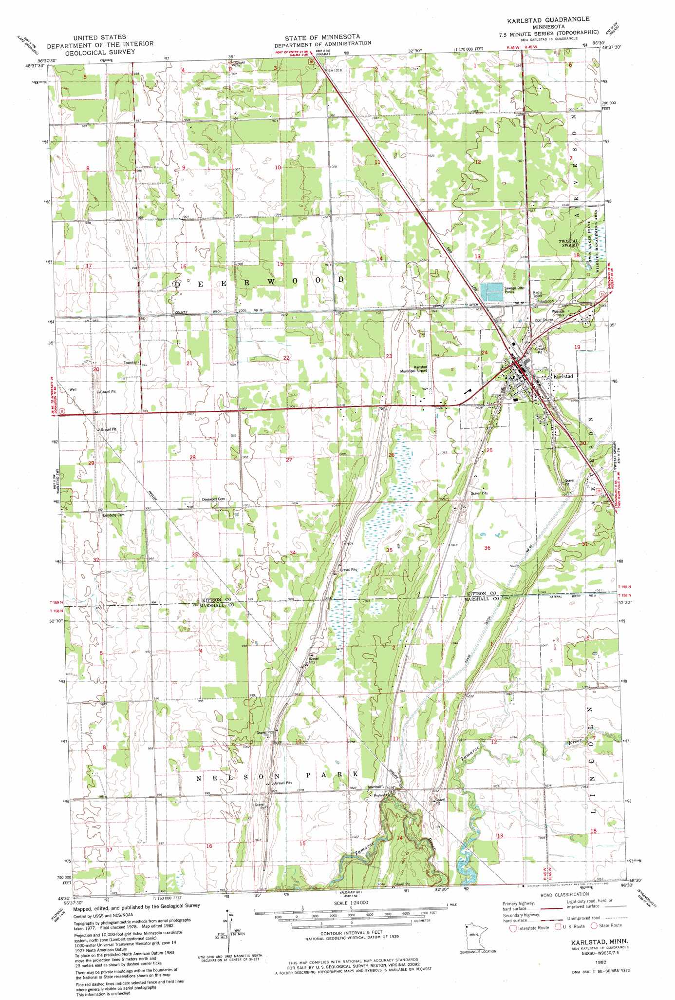
USGS Topo Quad 48096e5 - 1:24,000 scale
| Topo Map Name: | Karlstad |
| USGS Topo Quad ID: | 48096e5 |
| Print Size: | ca. 21 1/4" wide x 27" high |
| Southeast Coordinates: | 48.5° N latitude / 96.5° W longitude |
| Map Center Coordinates: | 48.5625° N latitude / 96.5625° W longitude |
| U.S. State: | MN |
| Filename: | o48096e5.jpg |
| Download Map JPG Image: | Karlstad topo map 1:24,000 scale |
| Map Type: | Topographic |
| Topo Series: | 7.5´ |
| Map Scale: | 1:24,000 |
| Source of Map Images: | United States Geological Survey (USGS) |
| Alternate Map Versions: |
Karlstad MN 1982, updated 1982 Download PDF Buy paper map Karlstad MN 2010 Download PDF Buy paper map Karlstad MN 2013 Download PDF Buy paper map Karlstad MN 2016 Download PDF Buy paper map |
1:24,000 Topo Quads surrounding Karlstad
Lancaster |
Skull Lake Sw |
Skull Lake Se |
Juneberry Ridge |
Leo |
Enok |
Lake Bronson |
Halma |
Pelan |
Pelan Ne |
Kennedy Se |
Karlstad Sw |
Karlstad |
Twistal Swamp |
Pelan Se |
Stephen East |
Florian |
Florian Ne |
Strandquist |
Nelson Slough |
Argyle |
Florian Sw |
Florian Se |
Ellerth |
Newfolden |
> Back to 48096e1 at 1:100,000 scale
> Back to 48096a1 at 1:250,000 scale
> Back to U.S. Topo Maps home
Karlstad topo map: Gazetteer
Karlstad: Airports
Karlstad Municipal Airport elevation 313m 1026′Karlstad: Canals
County Ditch Number Ten elevation 305m 1000′State Ditch Number Ninty elevation 319m 1046′
Karlstad: Populated Places
Deerwood elevation 305m 1000′Green Lea Mobile Home Park elevation 320m 1049′
Karlstad elevation 320m 1049′
Sundby Mobile Home Court elevation 320m 1049′
Karlstad: Post Offices
Beaton Post Office (historical) elevation 306m 1003′Fir Post Office (historical) elevation 309m 1013′
Karlstad Post Office elevation 320m 1049′
Karlstad digital topo map on disk
Buy this Karlstad topo map showing relief, roads, GPS coordinates and other geographical features, as a high-resolution digital map file on DVD:
Eastern North Dakota & Eastern South Dakota
Buy digital topo maps: Eastern North Dakota & Eastern South Dakota