Enok Topo Map Minnesota
To zoom in, hover over the map of Enok
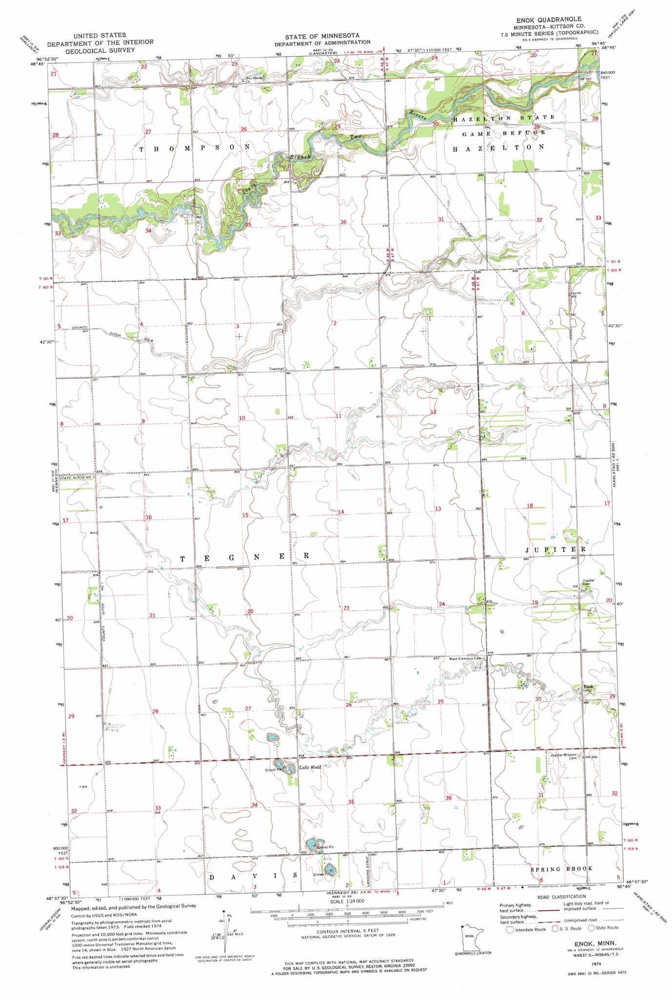
USGS Topo Quad 48096f7 - 1:24,000 scale
| Topo Map Name: | Enok |
| USGS Topo Quad ID: | 48096f7 |
| Print Size: | ca. 21 1/4" wide x 27" high |
| Southeast Coordinates: | 48.625° N latitude / 96.75° W longitude |
| Map Center Coordinates: | 48.6875° N latitude / 96.8125° W longitude |
| U.S. State: | MN |
| Filename: | o48096f7.jpg |
| Download Map JPG Image: | Enok topo map 1:24,000 scale |
| Map Type: | Topographic |
| Topo Series: | 7.5´ |
| Map Scale: | 1:24,000 |
| Source of Map Images: | United States Geological Survey (USGS) |
| Alternate Map Versions: |
Enok MN 1974, updated 1976 Download PDF Buy paper map Enok MN 2010 Download PDF Buy paper map Enok MN 2013 Download PDF Buy paper map Enok MN 2016 Download PDF Buy paper map |
1:24,000 Topo Quads surrounding Enok
Humboldt |
Orleans |
Hallock Ne |
Skull Lake |
Skull Lake Ne |
Hill Siding |
Hallock |
Lancaster |
Skull Lake Sw |
Skull Lake Se |
Mattson |
Kennedy |
Enok |
Lake Bronson |
Halma |
Drayton Se |
Donaldson |
Kennedy Se |
Karlstad Sw |
Karlstad |
Big Woods Ne |
Stephen West |
Stephen East |
Florian |
Florian Ne |
> Back to 48096e1 at 1:100,000 scale
> Back to 48096a1 at 1:250,000 scale
> Back to U.S. Topo Maps home
Enok topo map: Gazetteer
Enok: Airports
Anderson Field elevation 262m 859′Enok: Lakes
Lake Wold elevation 256m 839′Enok: Populated Places
Enok elevation 269m 882′Enok: Post Offices
Enok Post Office (historical) elevation 269m 882′Hazelton Post Office (historical) elevation 273m 895′
Enok digital topo map on disk
Buy this Enok topo map showing relief, roads, GPS coordinates and other geographical features, as a high-resolution digital map file on DVD:
Eastern North Dakota & Eastern South Dakota
Buy digital topo maps: Eastern North Dakota & Eastern South Dakota