Glasston Ne Topo Map North Dakota
To zoom in, hover over the map of Glasston Ne
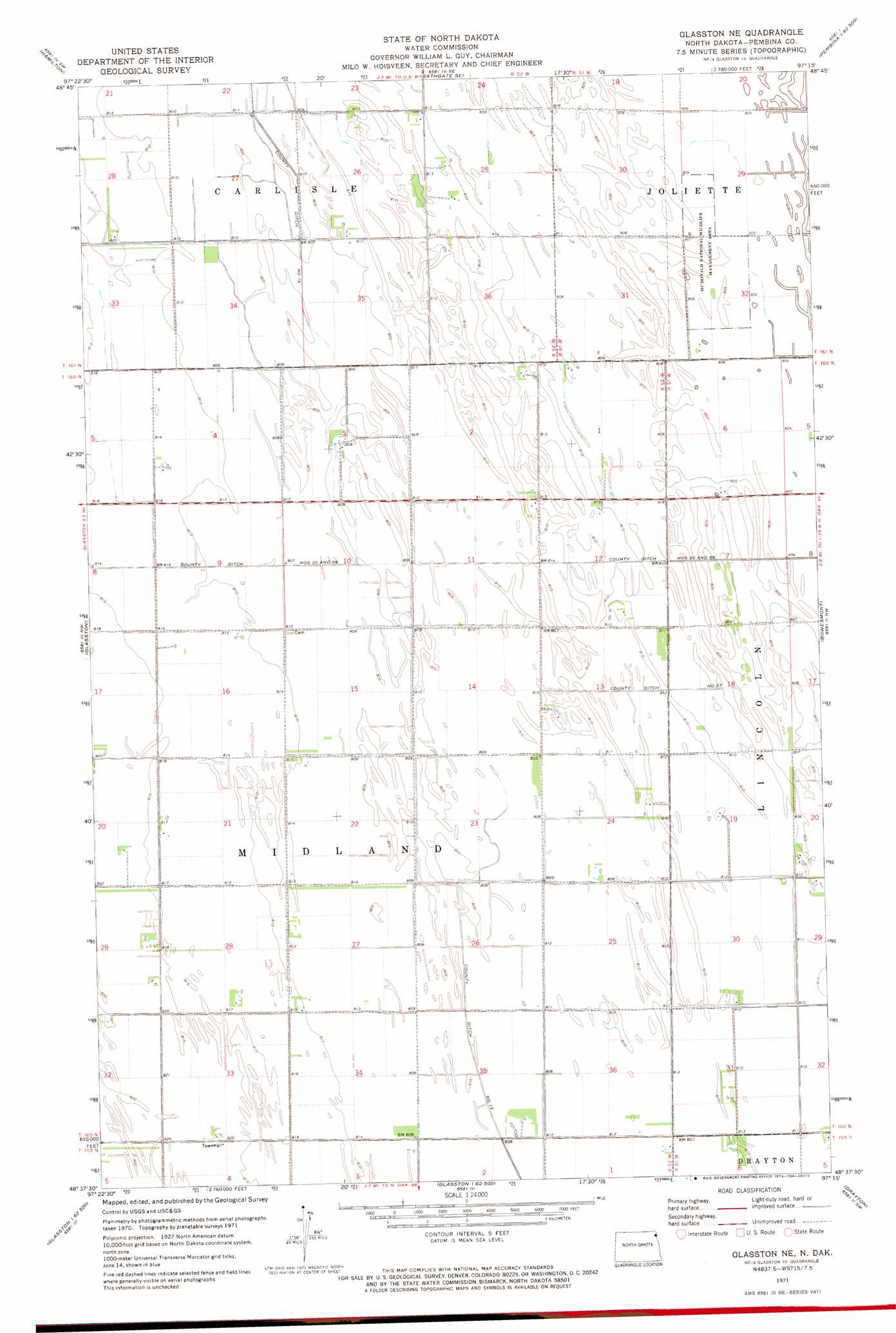
USGS Topo Quad 48097f3 - 1:24,000 scale
| Topo Map Name: | Glasston Ne |
| USGS Topo Quad ID: | 48097f3 |
| Print Size: | ca. 21 1/4" wide x 27" high |
| Southeast Coordinates: | 48.625° N latitude / 97.25° W longitude |
| Map Center Coordinates: | 48.6875° N latitude / 97.3125° W longitude |
| U.S. State: | ND |
| Filename: | O48097F3.jpg |
| Download Map JPG Image: | Glasston Ne topo map 1:24,000 scale |
| Map Type: | Topographic |
| Topo Series: | 7.5´ |
| Map Scale: | 1:24,000 |
| Source of Map Images: | United States Geological Survey (USGS) |
| Alternate Map Versions: |
Glasston NE ND 1971, updated 1973 Download PDF Buy paper map Glasston NE ND 2011 Download PDF Buy paper map Glasston NE ND 2014 Download PDF Buy paper map |
1:24,000 Topo Quads surrounding Glasston Ne
Neche |
Bathgate |
Bathgate Ne |
Pembina |
Humboldt |
Cavalier |
Hamilton |
Bathgate Se |
Joliette |
Hill Siding |
Crystal Ne |
Glasston |
Glasston Ne |
Bowesmont |
Mattson |
Crystal Se |
Saint Thomas |
North Salt Lake |
Drayton |
Drayton Se |
Nash |
Grafton |
Oakwood |
Big Woods Nw |
Big Woods Ne |
> Back to 48097e1 at 1:100,000 scale
> Back to 48096a1 at 1:250,000 scale
> Back to U.S. Topo Maps home
Glasston Ne topo map: Gazetteer
Glasston Ne: Canals
County Ditch Numbers 20 and 66 elevation 246m 807′Glasston Ne: Parks
McDonald National Wildlife Management Area elevation 246m 807′Glasston Ne digital topo map on disk
Buy this Glasston Ne topo map showing relief, roads, GPS coordinates and other geographical features, as a high-resolution digital map file on DVD:
Eastern North Dakota & Eastern South Dakota
Buy digital topo maps: Eastern North Dakota & Eastern South Dakota