Cavalier Topo Map North Dakota
To zoom in, hover over the map of Cavalier
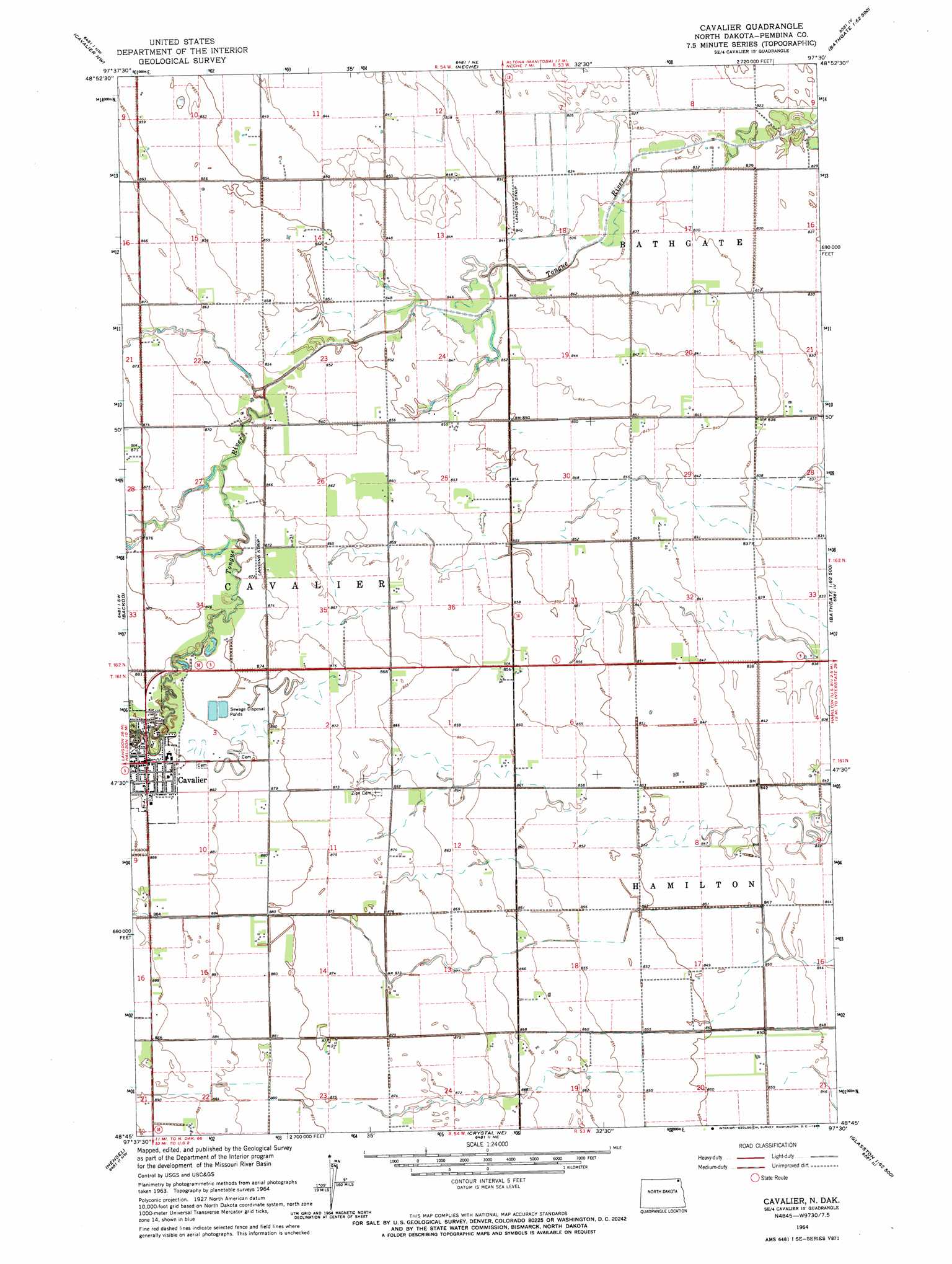
USGS Topo Quad 48097g5 - 1:24,000 scale
| Topo Map Name: | Cavalier |
| USGS Topo Quad ID: | 48097g5 |
| Print Size: | ca. 21 1/4" wide x 27" high |
| Southeast Coordinates: | 48.75° N latitude / 97.5° W longitude |
| Map Center Coordinates: | 48.8125° N latitude / 97.5625° W longitude |
| U.S. State: | ND |
| Filename: | O48097G5.jpg |
| Download Map JPG Image: | Cavalier topo map 1:24,000 scale |
| Map Type: | Topographic |
| Topo Series: | 7.5´ |
| Map Scale: | 1:24,000 |
| Source of Map Images: | United States Geological Survey (USGS) |
| Alternate Map Versions: |
Cavalier ND 1964, updated 1965 Download PDF Buy paper map Cavalier ND 2011 Download PDF Buy paper map Cavalier ND 2014 Download PDF Buy paper map |
1:24,000 Topo Quads surrounding Cavalier
Leroy |
Cavalier Nw |
Neche |
Bathgate |
Bathgate Ne |
Hallson |
Backoo |
Cavalier |
Hamilton |
Bathgate Se |
Mountain |
Hensel |
Crystal Ne |
Glasston |
Glasston Ne |
Gardar |
Crystal |
Crystal Se |
Saint Thomas |
North Salt Lake |
> Back to 48097e1 at 1:100,000 scale
> Back to 48096a1 at 1:250,000 scale
> Back to U.S. Topo Maps home
Cavalier topo map: Gazetteer
Cavalier: Airports
Magnuson Field elevation 253m 830′Cavalier: Populated Places
Cavalier elevation 270m 885′Cavalier digital topo map on disk
Buy this Cavalier topo map showing relief, roads, GPS coordinates and other geographical features, as a high-resolution digital map file on DVD:
Eastern North Dakota & Eastern South Dakota
Buy digital topo maps: Eastern North Dakota & Eastern South Dakota