Devils Lake Topo Map North Dakota
To zoom in, hover over the map of Devils Lake
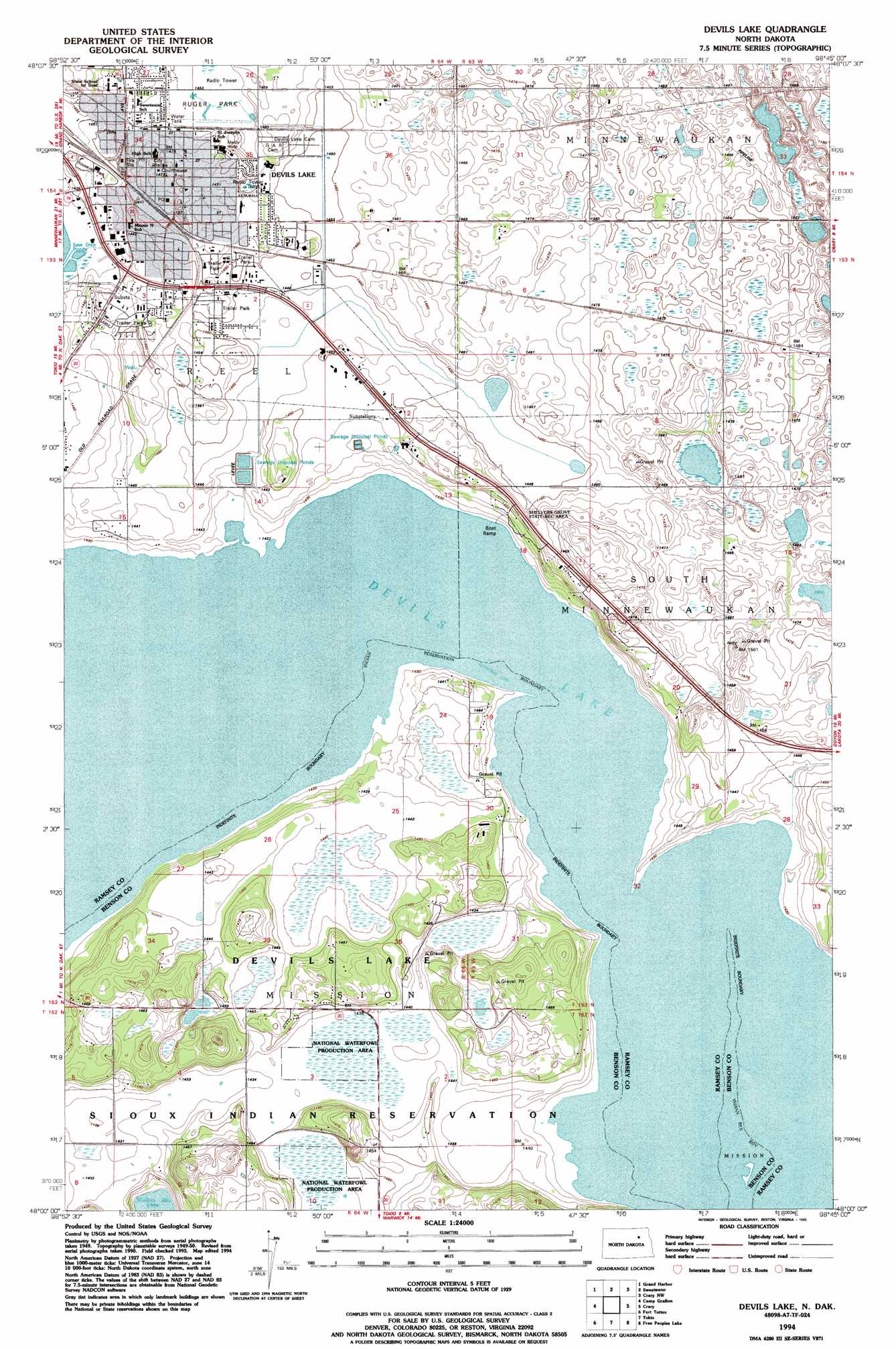
USGS Topo Quad 48098a7 - 1:24,000 scale
| Topo Map Name: | Devils Lake |
| USGS Topo Quad ID: | 48098a7 |
| Print Size: | ca. 21 1/4" wide x 27" high |
| Southeast Coordinates: | 48° N latitude / 98.75° W longitude |
| Map Center Coordinates: | 48.0625° N latitude / 98.8125° W longitude |
| U.S. State: | ND |
| Filename: | O48098A7.jpg |
| Download Map JPG Image: | Devils Lake topo map 1:24,000 scale |
| Map Type: | Topographic |
| Topo Series: | 7.5´ |
| Map Scale: | 1:24,000 |
| Source of Map Images: | United States Geological Survey (USGS) |
| Alternate Map Versions: |
Devils Lake ND 1951, updated 1951 Download PDF Buy paper map Devils Lake ND 1951, updated 1977 Download PDF Buy paper map Devils Lake ND 1994, updated 1995 Download PDF Buy paper map Devils Lake ND 2011 Download PDF Buy paper map Devils Lake ND 2014 Download PDF Buy paper map |
1:24,000 Topo Quads surrounding Devils Lake
Cando Se |
Webster |
Starkweather Se |
Derrick Sw |
Derrick Se |
Penn |
Grand Harbor |
Sweetwater |
Crary Nw |
Southam |
Grahams Island |
Camp Grafton |
Devils Lake |
Crary |
Doyon |
Crow Hill |
Fort Totten |
Tokio |
Free Peoples Lake |
Devils Lake Mountain |
Sheyenne |
Tokio Sw |
Horseshoe Lake |
Warwick |
Hamar |
> Back to 48098a1 at 1:100,000 scale
> Back to 48098a1 at 1:250,000 scale
> Back to U.S. Topo Maps home
Devils Lake topo map: Gazetteer
Devils Lake: Parks
Roosevelt Park elevation 439m 1440′Devils Lake: Populated Places
Devils Lake elevation 441m 1446′Keith elevation 452m 1482′
Devils Lake digital topo map on disk
Buy this Devils Lake topo map showing relief, roads, GPS coordinates and other geographical features, as a high-resolution digital map file on DVD:
Eastern North Dakota & Eastern South Dakota
Buy digital topo maps: Eastern North Dakota & Eastern South Dakota