Langdon East Topo Map North Dakota
To zoom in, hover over the map of Langdon East
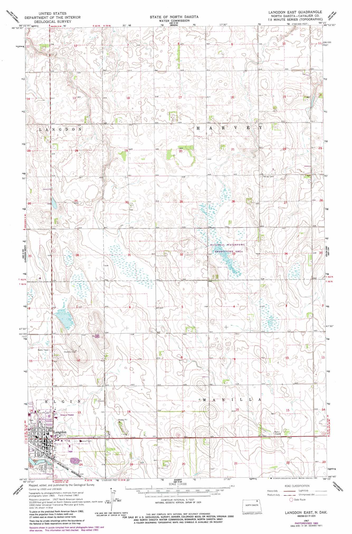
USGS Topo Quad 48098g3 - 1:24,000 scale
| Topo Map Name: | Langdon East |
| USGS Topo Quad ID: | 48098g3 |
| Print Size: | ca. 21 1/4" wide x 27" high |
| Southeast Coordinates: | 48.75° N latitude / 98.25° W longitude |
| Map Center Coordinates: | 48.8125° N latitude / 98.3125° W longitude |
| U.S. State: | ND |
| Filename: | O48098G3.jpg |
| Download Map JPG Image: | Langdon East topo map 1:24,000 scale |
| Map Type: | Topographic |
| Topo Series: | 7.5´ |
| Map Scale: | 1:24,000 |
| Source of Map Images: | United States Geological Survey (USGS) |
| Alternate Map Versions: |
Langdon East ND 1967, updated 1969 Download PDF Buy paper map Langdon East ND 1967, updated 1984 Download PDF Buy paper map Langdon East ND 2011 Download PDF Buy paper map Langdon East ND 2014 Download PDF Buy paper map |
1:24,000 Topo Quads surrounding Langdon East
Wales |
Mount Carmel |
Maida |
Olga Nw |
Vang |
Hannah Se |
Langdon West |
Langdon East |
Olga Sw |
Olga |
Loma |
Nekoma Nw |
Easby |
Osnabrock |
Milton |
Alsen Se |
Billings Lake |
Nekoma |
Osnabrock Sw |
Waterloo Lake |
> Back to 48098e1 at 1:100,000 scale
> Back to 48098a1 at 1:250,000 scale
> Back to U.S. Topo Maps home
Langdon East digital topo map on disk
Buy this Langdon East topo map showing relief, roads, GPS coordinates and other geographical features, as a high-resolution digital map file on DVD:
Eastern North Dakota & Eastern South Dakota
Buy digital topo maps: Eastern North Dakota & Eastern South Dakota