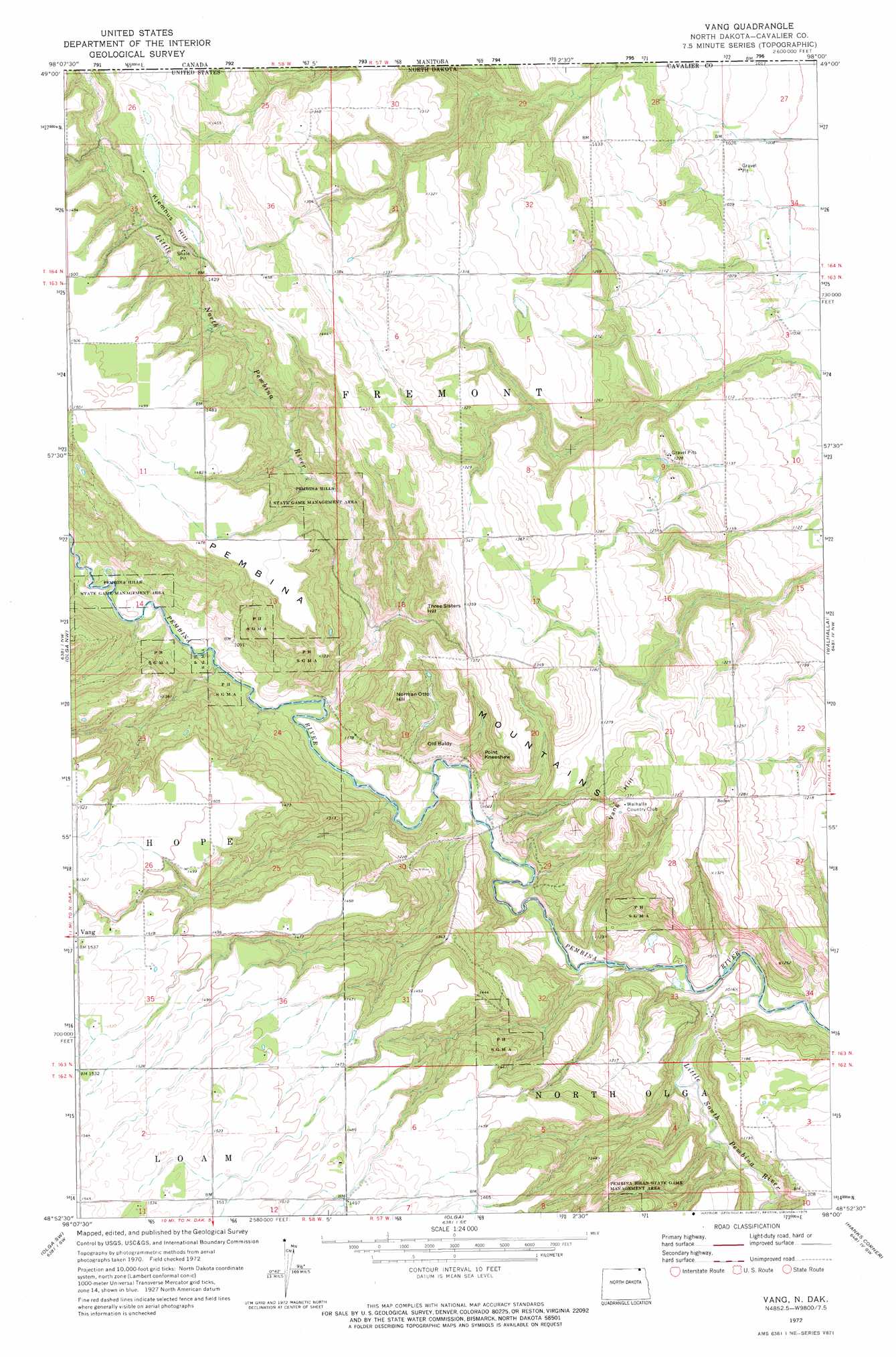
Vang Topo Map North Dakota
To zoom in, hover over the map of Vang
USGS Topo Quad 48098h1 - 1:24,000 scale
| Topo Map Name: | Vang |
| USGS Topo Quad ID: | 48098h1 |
| Print Size: | ca. 21 1/4" wide x 27" high |
| Southeast Coordinates: | 48.875° N latitude / 98° W longitude |
| Map Center Coordinates: | 48.9375° N latitude / 98.0625° W longitude |
| U.S. State: | ND |
| Filename: | O48098H1.jpg |
| Download Map JPG Image: | Vang topo map 1:24,000 scale |
| Map Type: | Topographic |
| Topo Series: | 7.5´ |
| Map Scale: | 1:24,000 |
| Source of Map Images: | United States Geological Survey (USGS) |
| Alternate Map Versions: |
Vang ND 1972, updated 1975 Download PDF Buy paper map Vang ND 2011 Download PDF Buy paper map Vang ND 2014 Download PDF Buy paper map |
1:24,000 Topo Quads surrounding Vang
Maida |
Olga Nw |
Vang |
Walhalla |
Leroy |
Langdon East |
Olga Sw |
Olga |
Hanks Corner |
Hallson |
Easby |
Osnabrock |
Milton |
Concrete |
Mountain |
> Back to 48098e1 at 1:100,000 scale
> Back to 48098a1 at 1:250,000 scale
> Back to U.S. Topo Maps home
Vang topo map: Gazetteer
Vang: Parks
Pembina Hills State Game Management Area elevation 398m 1305′Vang: Populated Places
Vang elevation 466m 1528′Vang: Streams
Little North Pembina River elevation 317m 1040′Little South Pembina River elevation 297m 974′
Vang: Summits
Kjemhus Hill elevation 446m 1463′Norman Otto Hill elevation 432m 1417′
Old Baldy elevation 357m 1171′
Point Kneeshaw elevation 374m 1227′
Three Sisters Hill elevation 409m 1341′
Vang Hill elevation 421m 1381′
Vang digital topo map on disk
Buy this Vang topo map showing relief, roads, GPS coordinates and other geographical features, as a high-resolution digital map file on DVD:
Eastern North Dakota & Eastern South Dakota
Buy digital topo maps: Eastern North Dakota & Eastern South Dakota