Grahams Island Topo Map North Dakota
To zoom in, hover over the map of Grahams Island
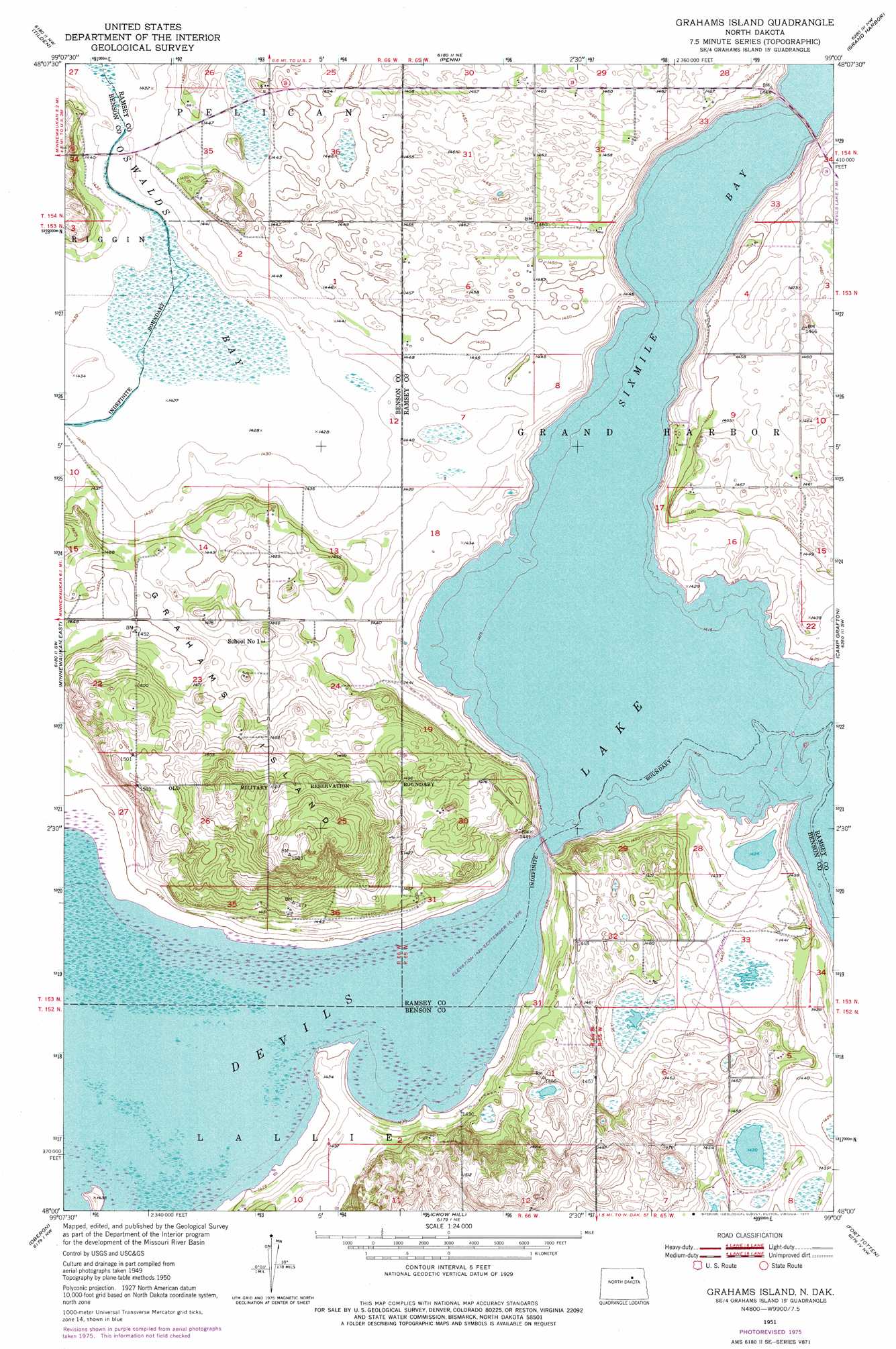
USGS Topo Quad 48099a1 - 1:24,000 scale
| Topo Map Name: | Grahams Island |
| USGS Topo Quad ID: | 48099a1 |
| Print Size: | ca. 21 1/4" wide x 27" high |
| Southeast Coordinates: | 48° N latitude / 99° W longitude |
| Map Center Coordinates: | 48.0625° N latitude / 99.0625° W longitude |
| U.S. State: | ND |
| Filename: | O48099A1.jpg |
| Download Map JPG Image: | Grahams Island topo map 1:24,000 scale |
| Map Type: | Topographic |
| Topo Series: | 7.5´ |
| Map Scale: | 1:24,000 |
| Source of Map Images: | United States Geological Survey (USGS) |
| Alternate Map Versions: |
Grahams Island ND 1951, updated 1951 Download PDF Buy paper map Grahams Island ND 1951, updated 1977 Download PDF Buy paper map Grahams Island ND 2011 Download PDF Buy paper map Grahams Island ND 2014 Download PDF Buy paper map |
1:24,000 Topo Quads surrounding Grahams Island
Niles |
Churchs Ferry |
Cando Se |
Webster |
Starkweather Se |
Brinsmade |
Tilden |
Penn |
Grand Harbor |
Sweetwater |
Minnewaukan West |
Minnewauken East |
Grahams Island |
Camp Grafton |
Devils Lake |
Josephine |
Oberon |
Crow Hill |
Fort Totten |
Tokio |
Flora Se |
Oberon Sw |
Sheyenne |
Tokio Sw |
Horseshoe Lake |
> Back to 48099a1 at 1:100,000 scale
> Back to 48098a1 at 1:250,000 scale
> Back to U.S. Topo Maps home
Grahams Island topo map: Gazetteer
Grahams Island: Bays
Sixmile Bay elevation 433m 1420′Grahams Island: Islands
Grahams Island elevation 458m 1502′Grahams Island: Swamps
Oswalds Bay elevation 437m 1433′Grahams Island digital topo map on disk
Buy this Grahams Island topo map showing relief, roads, GPS coordinates and other geographical features, as a high-resolution digital map file on DVD:
Eastern North Dakota & Eastern South Dakota
Buy digital topo maps: Eastern North Dakota & Eastern South Dakota