Hurricane Lake West Topo Map North Dakota
To zoom in, hover over the map of Hurricane Lake West
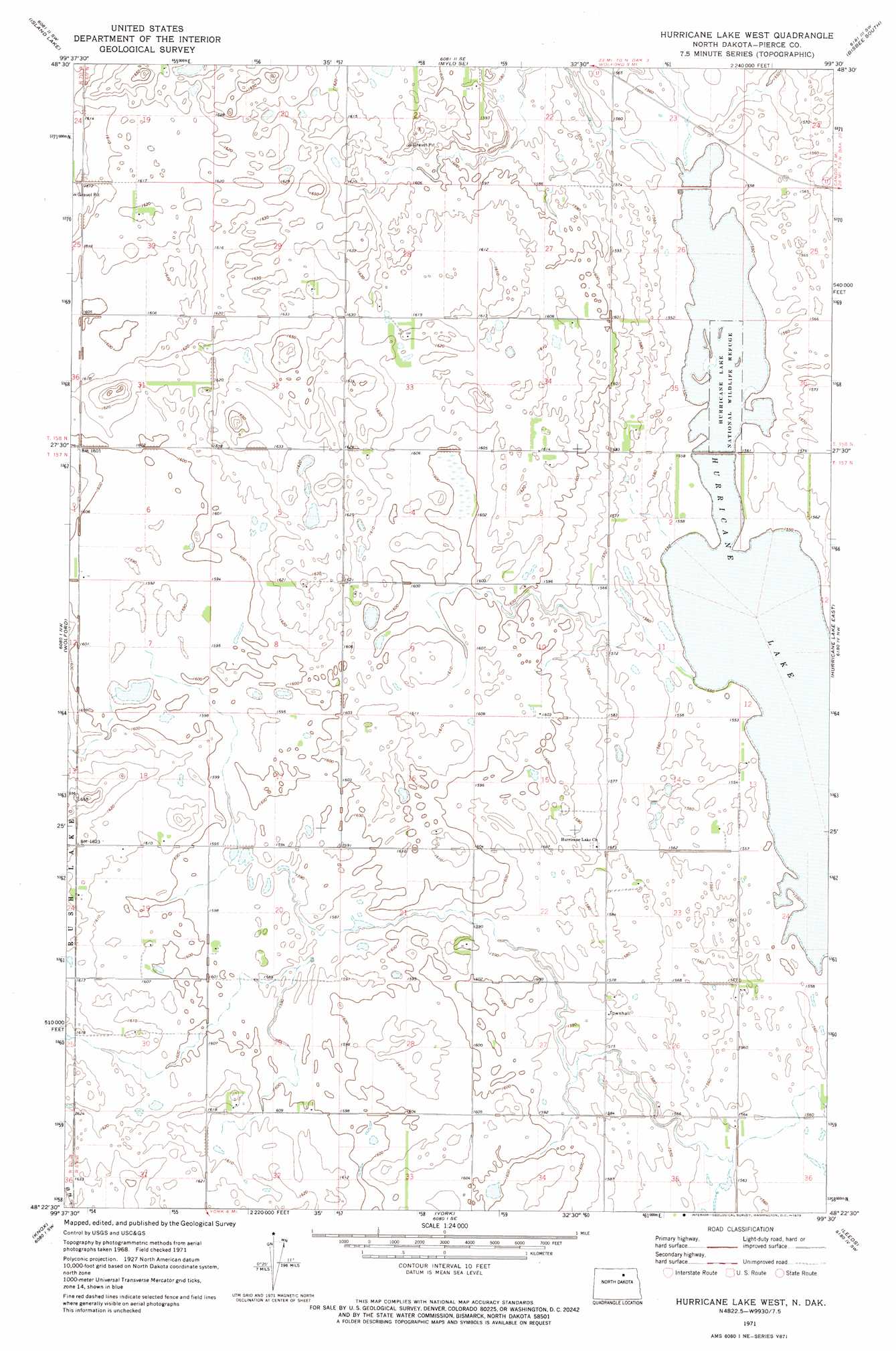
USGS Topo Quad 48099d5 - 1:24,000 scale
| Topo Map Name: | Hurricane Lake West |
| USGS Topo Quad ID: | 48099d5 |
| Print Size: | ca. 21 1/4" wide x 27" high |
| Southeast Coordinates: | 48.375° N latitude / 99.5° W longitude |
| Map Center Coordinates: | 48.4375° N latitude / 99.5625° W longitude |
| U.S. State: | ND |
| Filename: | O48099D5.jpg |
| Download Map JPG Image: | Hurricane Lake West topo map 1:24,000 scale |
| Map Type: | Topographic |
| Topo Series: | 7.5´ |
| Map Scale: | 1:24,000 |
| Source of Map Images: | United States Geological Survey (USGS) |
| Alternate Map Versions: |
Hurricane Lake West ND 1971, updated 1973 Download PDF Buy paper map Hurricane Lake West ND 2011 Download PDF Buy paper map Hurricane Lake West ND 2014 Download PDF Buy paper map |
1:24,000 Topo Quads surrounding Hurricane Lake West
Rolette |
Mylo Nw |
Mylo |
Bisbee North |
Big Coulee Dam |
Nanson |
Island Lake |
Mylo Se |
Bisbee South |
Considine |
Rugby Ne |
Wolford |
Hurricane Lake West |
Hurricane Lake East |
Leeds Ne |
Pleasant Lake |
Knox |
York |
Leeds |
Niles |
Fillmore |
Baker |
Harlow |
Comstock |
Brinsmade |
> Back to 48099a1 at 1:100,000 scale
> Back to 48098a1 at 1:250,000 scale
> Back to U.S. Topo Maps home
Hurricane Lake West topo map: Gazetteer
Hurricane Lake West: Lakes
Hurricane Lake elevation 471m 1545′Hurricane Lake West: Parks
Hurricane Lake National Wildlife Refuge elevation 472m 1548′Hurricane Lake West digital topo map on disk
Buy this Hurricane Lake West topo map showing relief, roads, GPS coordinates and other geographical features, as a high-resolution digital map file on DVD:
Eastern North Dakota & Eastern South Dakota
Buy digital topo maps: Eastern North Dakota & Eastern South Dakota